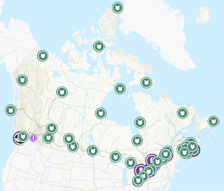
 Arctic SDI catalogue
Health
Type of resources
Available actions
Topics
Keywords
Contact for the resource
Provided by
Years
Formats
Representation types
Update frequencies
status
Scale
-
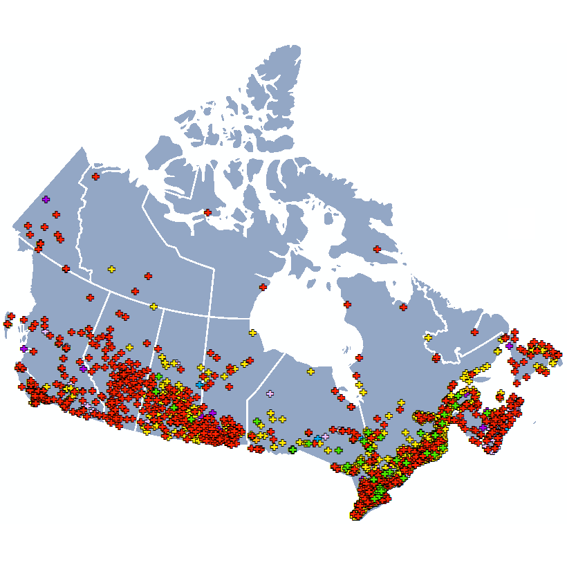
Health Canada routinely collects environmental samples for radioactivity analysis. The backbone of its monitoring comes from three separate networks: The Canadian Radiological Monitoring Network (CRMN), the Fixed Point Surveillance Network (FPS), and a Canadian contribution to the Comprehensive Nuclear-Test-Ban Treaty Organization (CTBTo). This dataset provides the approximate sampling location of the monitoring stations for each network. CRMN is a national network that routinely collects air particulate, precipitation, external gamma dose, drinking water, atmospheric water vapour, and milk samples for radioactivity analysis. The CRMN has been operating since 1959, and is used to establish long-term trends in naturally occurring environmental radioactivity, nuclear weapons fallout, as well as radioactivity generated by other human activities including nuclear power generation and medical isotope production. Full datasets for the Canadian Radiological Monitoring Network are available on the Open Government Portal. The Fixed Point Surveillance System (FPS) is an integrated network of radiation detectors providing terrestrial gamma radiation measurements in real time. The detectors are located in every province and territory of Canada with larger numbers in the vicinity of major Canadian nuclear facilities and ports where nuclear powered vessels sometimes harbour. Almost real time measurements are available on the EURDEP (EUropean Radiological Data Exchange Platform) website and monthly summaries are provided on the Health Canada website. The Comprehensive Nuclear-Test-Ban Treaty (CTBT) is a universal arms control treaty that bans all States from conducting nuclear explosions in any environment (atmosphere, underground, underwater). Canada is a signatory to the United Nations CTBT. The Radiation Protection Bureau of Health Canada is responsible for four certified radionuclide monitoring stations and a certified radionuclide laboratory. Additional information on the CTBT is available on the CTBTo website. The map shows the approximate sampling location for each monitoring station. Stations are found within the associated location range.
-

Geographic information on pharmacies in Ontario.
-
This geospatial dataset contains the geographic boundaries of the 34 Public Health Units (PHUs) in Ontario, based on Statistics Canada’s Health Region Boundary File (2018). A PHU is the area of jurisdiction of a board of health. PHUs in Ontario are defined in Regulation 553 (Revised Regulations of Ontario), pursuant to Health Protection and Promotion Act R.S.O. 1990, Amended to O. Reg. 64/05.
-

A List of all hospitals in New Brunswick operated by Horizon Health Network
-

Nova Scotia Community Community Health Networks are used for health service planning and research. Includes the following data fields: GIS_UID, GIS_SELECTED, GIS_HIDDEN, GIS_LENGTH, GIS_AREA, Network, NetworkID
-

Health regions are administrative areas defined by provincial ministries of health. These administrative areas represent geographic areas of responsibility for hospital boards or regional health authorities. Health regions, being provincial administrative areas, are subject to change. For complete Canadian coverage, each of the northern territories as well as the province of Prince Edward Island represents a single health region.
-
Geographic information on Independent Health Facility's (IHFs). An IHF, subject to certain exemptions, is a place in which one or more members of the public receives health services or a health facility or class of health facilities designated by the Minster of Health and Long-Term Care.
-
The Open Database of Healthcare Facilities (ODHF) is a collection of open data containing the names, types, and locations of health facilities across Canada. It is released under the Open Government License - Canada. The ODHF compiles open, publicly available, and directly-provided data on health facilities across Canada. Data sources include regional health authorities, provincial, territorial and municipal governments, and public health and professional healthcare bodies. This database aims to provide enhanced access to a harmonized listing of health facilities across Canada by making them available as open data. This database is a component of the Linkable Open Data Environment (LODE).
-
The geographic coverage of the 4 Nova Scotia Health Authority Management Zones.
-
A List of all hospitals in New Brunswick operated by Vitalité Health Network