 Arctic SDI catalogue
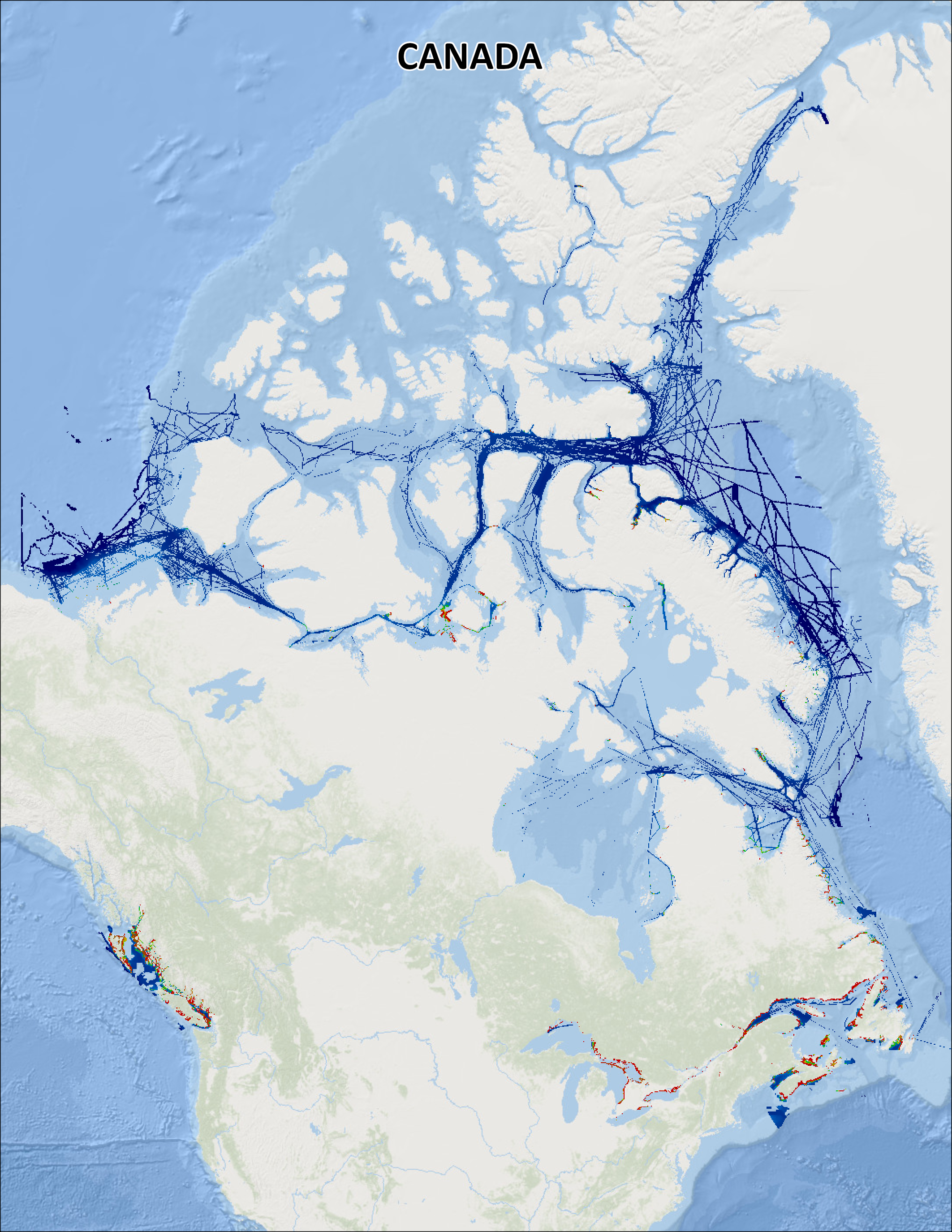
Canadian Hydrographic Service Non-Navigational (NONNA) Bathymetric Data
**CHS NONNA Data Portal was last updated: March 30, 2025 **
The Canadian Hydrographic Service (CHS) offers a complete inventory of bathymetric data free to the general public for non-navigational use called 'CHS NONNA' for the 'NON-NAvigational' purpose of the data. The product is available in a spatial resolution of 10 metres or 100 metres.
To directly access the CHS NONNA Data Portal please follow this link - https://data.chs-shc.ca/login
(Note: The data portal is NOT compatible with Internet Explorer browser).
Terms of Use
The Canadian Hydrographic Service (CHS) NONNA Data products are for NON-NAVIGATIONAL USE ONLY. Please see the Open Data Licence below and the CHS NONNA LICENCE viewable on https://data.chs-shc.ca/login and downloadable with the NONNA data, for the full terms and conditions governing the use of this data.
----- PRODUCT DESCRIPTION -----
The CHS NONNA-10 NONNA-100 and NONNA Package Bathymetric Data products represent a consolidation of digital bathymetric sources managed by the CHS in Canadian jurisdiction.
The « NONNA » refers to NON-NAvigational.
The « 10 » or « 100 » references the approximate resolution (in metres) of the data.
NONNA Packages
A NONNA Package is a ZIP file containing a collection of NONNAP datasets to ease the download of large amounts of high resolution data. Packages are currently available for data sources of approximately 10 metre resolution.
The «P10 » refers to the Packages and approximate resolution (in metres) of the data.
The CHS NONNA-10 individual product coverage (resolution) is as follows:
• South of 68°N the products = 0.1° latitude X 0.1° longitude (0.0001 degrees)
• 68°N-80°N the products = 0.1° latitude X 0.2° longitude (0.0002 degrees)
• 80°N and north the products = 0.1° latitude X 0.4° longitude (0.0004 degrees)
The CHS NONNA-100 individual product coverage (resolution) is as follows:
• South of 68°N the products = 1° latitude X 1° longitude (0.001 degrees)
• 68°N-80°N the products = 1° latitude X 2° longitude (0.002 degrees)
• 80°N and north the products = 1° latitude X 4° longitude (0.004 degrees)
The CHS NONNA-P10 Packages are ZIP files that contain product coverage (resolution) defined as:
• South of 68°N the products = 1° latitude X 1° longitude (0.0001 degrees)
• 68°N-80°N the products = 1° latitude X 2° longitude (0.0002 degrees)
• 80°N and north the products = 1° latitude X 4° longitude (0.0004 degrees)
----- DATUM -----
All CHS NONNA data sources are horizontally referenced to the World Geodetic System 1984 (WGS84) ESPG:4326 and vertically referenced to Chart Datum (CD), a tidal or water level datum that is locally derived and, of which, the depth of water should seldom fall below. For more information on vertical references visit:
https://tides.gc.ca/tides/en/vertical-datum-chart-references
----- DATA PRESENTATION -----
CHS NONNA products adhere to the following naming convention: NONNAXXX_SouthwestCorner Example: NONNAP10_4360N07940W
• NONNAP10 = the product NONNAP10
• 4360N07940W = the southwest corner of the NONNA cell.
These products are available to view, query and download via the CHS NONNA Data Portal. The following formats are available for download:
• 32-bit GeoTIFF
• ASCII++ (XYZ)
• CSAR
• BAG
These formats can be opened using various GIS applications.
Alternatively, the CHS NONNA products can be accessed via Web Map Service (WMS), Web Coverage Service (WCS) or Web Map Tile Service (WMTS) links:
WMS https://nonna-geoserver.data.chs-shc.ca/geoserver/wms?request=GetCapabilities
WMTS https://nonna-geoserver.data.chs-shc.ca/geoserver/gwc/service/wmts?request=GetCapabilities
WCS https://nonna-geoserver.data.chs-shc.ca/geoserver/wcs?request=GetCapabilities
*Note*
Gaps in the data may be visible where modern surveys have not yet been conducted, the data is not updated to Chart Datum (CD) or where legacy data has not yet been digitized. In addition, there may be data sources removed from the Data Portal for further processing in the CHS’ Bathymetric Database, and will not be available until such work is complete.
Data sources included in the NONNA products may not have been subjected to the same level of quality assurance as those in official navigational products.
*Help*
New users of the CHS NONNA Data Portal are encouraged to fully review the 'CHS NONNA Data Portal Guidance Document' (PDF) which is available below in the RESOURCES section of this page.
Simple
- Date ( RI_366 )
- 2018-10-01
- Date ( RI_367 )
- 2018-10-11
- Date ( RI_368 )
- 2025-03-30
- Presentation form
- imageDigital; imageNumérique RI_389
- Status
- onGoing; enContinue RI_596
- Maintenance and update frequency
- irregular; irrégulier RI_541
- Maintenance note
- CHS NONNA products last updated: March 2025
- Keywords ( RI_528 )
-
- Bathymetry
- Depth
- Government of Canada Core Subject Thesaurus Thésaurus des sujets de base du gouvernement du Canada ( RI_528 )
-
- Hydrography
- Classification
- unclassified; nonClassifié RI_484
- Use limitation
- Not to be used for navigation purposes. See the 5. CHS NONNA LICENCE in the resources section for the full terms and conditions governing the use of this data.
- Access constraints
- licenseUnrestricted; licenceSansRestriction RI_610
- Use constraints
- licenseEndUser; licenceUtilisateurFinal RI_611
- Use limitation
- Open Government Licence - Canada (http://open.canada.ca/en/open-government-licence-canada)
- Access constraints
- license; licence RI_606
- Use constraints
- license; licence RI_606
- Spatial representation type
- grid; grille RI_636
- Metadata language
- eng
- Metadata language
- fra
- Topic category
-
- Oceans
- Inland waters
- Description
- The CHS NONNA-10 NONNA-100 and NONNA Package Bathymetric Data products represent a consolidation of digital bathymetric sources managed by the CHS in Canadian jurisdiction.
))
- Begin date
- 2018-10-01
- Reference system identifier
- https://epsg.io / EPSG:4326 /
- Distribution format
-
-
GeoTIF
(
Unknown / Inconnu
)
-
TXT
(
The TXT file is in XYZ format / Le fichier TXT est au format XYZ
)
-
BAG
(
1.6.0
)
-
other
(
CSAR
)
-
WMS
(
1.1.1 and 1.3.0
)
-
WCS
(
1.0 and 1.1.1
)
-
WMTS
(
1.0
)
-
GeoTIF
(
Unknown / Inconnu
)
- OnLine resource
-
1. CHS NONNA Data Portal
(
HTTPS
)
Application;Web App;eng,fra
- OnLine resource
-
2. (a) - CHS NONNA Data Portal Guidance Document
(
HTTPS
)
Supporting Document;PDF;eng
- OnLine resource
-
2. (b) - CHS NONNA Data Portal Guidance Document
(
HTTPS
)
Supporting Document;PDF;fra
- OnLine resource
-
3. (a) - CHS NONNA Bathymetric Data
(
HTTPS
)
Web Service;WCS;eng,fra
- OnLine resource
-
3. (b) - CHS NONNA Bathymetric Data
(
HTTPS
)
Web Service;WMTS;eng,fra
- OnLine resource
-
3. (c) - CHS NONNA Bathymetric Data
(
HTTPS
)
Web Service;WMS;eng,fra
- OnLine resource
-
4. (a) - CHS NONNA Frequently Asked Questions
(
HTTPS
)
Supporting Document;PDF;eng
- OnLine resource
-
4. (b) - CHS NONNA Frequently Asked Questions
(
HTTPS
)
Supporting Document;PDF;fra
- OnLine resource
-
5. CHS NONNA Licence
(
HTTPS
)
Supporting Document;PDF;eng,fra
- OnLine resource
-
6. CHS NONNA 10 Index
(
HTTPS
)
Dataset;SHP;eng,fra
- OnLine resource
-
7. CHS NONNA 100 Index
(
HTTPS
)
Dataset;SHP;eng,fra
- OnLine resource
-
8. CHS NONNA Packages Index
(
HTTPS
)
Dataset;SHP;eng,fra
- OnLine resource
-
CHS NONNA Bathymetric Data
(
OGC:WMS
)
Web Service;WMS;eng
- OnLine resource
-
CHS NONNA Bathymetric Data
(
OGC:WMS
)
Web Service;WMS;fra
- File identifier
- d3881c4c-650d-4070-bf9b-1e00aabf0a1d XML
- Metadata language
- eng; CAN
- Character set
- utf8; utf8 RI_458
- Hierarchy level
- dataset; jeuDonnées RI_622
- Date stamp
- 2025-06-05T15:24:35.361Z
- Metadata standard name
- North American Profile of ISO 19115:2003 - Geographic information - Metadata
- Metadata standard version
- CAN/CGSB-171.100-2009
Overviews
Spatial extent
Provided by
