 Arctic SDI catalogue
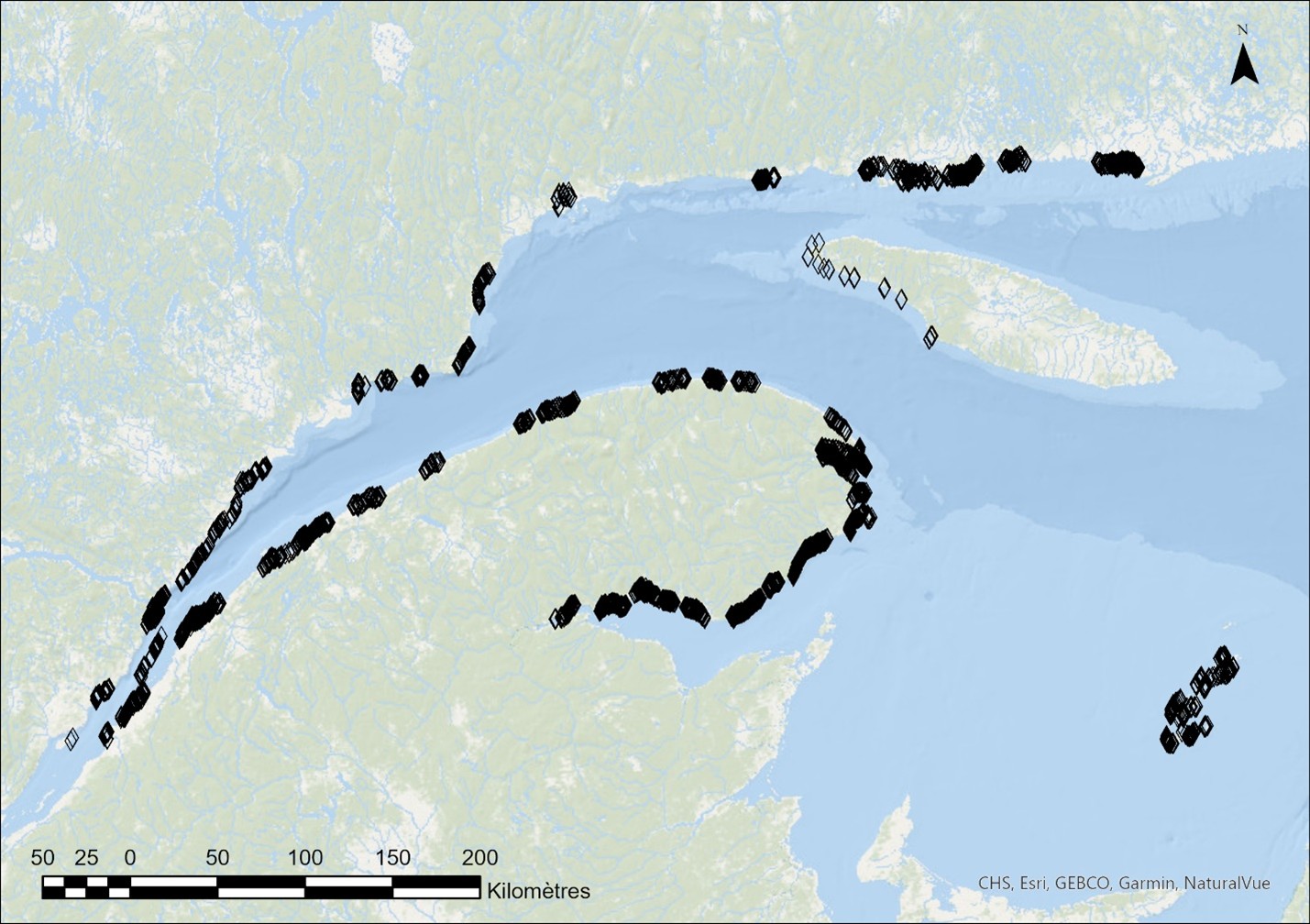
Underwater video analysis data of the coastal zone of maritime Quebec
Between 2017 and 2024, underwater imaging sampling campaigns were conducted by Fisheries and Oceans Canada across a broad area of the shallow coastal zone of the St. Lawrence Estuary and Gulf. The sampling targeted the lower intertidal and subtidal zones, to a maximum depth of approximately 10 m, with an emphasis on eelgrass beds and macroalgae. These targeted surveys were primarily intended to produce ground-truth data for the mapping of estuarine and marine macrophytes of the Québec maritime region (Provencher-Nolet et al., 2025), supporting oil spill preparedness and response activities.
This dataset summarizes information generated from the analysis of underwater video footage collected at 3,179 sampling stations using small boats equipped with a pole-mounted camera system, as described in Grégoire et al. (2025). The dataset documents multiple characteristics of coastal ecosystems, including the cover of erect vegetation, vegetation assemblages, dominant and minor vegetation, substrates, fauna, as well as the presence of encrusting algae, for each sampling station. The different attributes recorded during video analysis, along with certain identification criteria, are presented in the visual dictionary of Grégoire et al. (2022).
Simple
- Date ( RI_367 )
- 2026-04
- Date ( RI_366 )
- 2026-04
- Status
- completed; complété RI_593
- Maintenance and update frequency
- notPlanned; nonPlanifié RI_542
- Keywords
-
- Gulf of St. Lawrence
- Estuary of St. Lawrence
- Macroalgae
- Algae
- Seaweed
- Fucus
- Kelp
- Eelgrass
- Substrate
- Thésaurus des sujets de base du gouvernement du Canada Government of Canada Core Subject Thesaurus ( RI_528 )
-
- Aquatic plants
- Use limitation
- Open Government Licence - Canada (http://open.canada.ca/en/open-government-licence-canada)
- Access constraints
- license; licence RI_606
- Use constraints
- license; licence RI_606
- Classification
- unclassified; nonClassifié RI_484
- Spatial representation type
- vector; vecteur RI_635
- Metadata language
- fra; CAN
- Metadata language
- eng; CAN
- Topic category
-
- Biota
- Environment
- Begin date
- 2017
- End date
- 2024
))
- Reference system identifier
- https://epsg.io / EPSG:4326 /
- Distribution format
-
-
SHP
(
1
)
-
SHP
(
1
)
- OnLine resource
-
Data video analysis maritime Quebec
(
HTTPS
)
Dataset;SHP;eng,fra
- OnLine resource
-
Data dictionary video analysis maritime Quebec
(
HTTPS
)
Supporting Document;CSV;eng,fra
- OnLine resource
-
References
(
HTTPS
)
Supporting Document;PDF;eng,fra
- OnLine resource
-
Map service for underwater video analysis data
(
ESRI REST: Map Service
)
Web Service;ESRI REST;eng
- OnLine resource
-
Map service for underwater video analysis data
(
ESRI REST: Map Service
)
Web Service;ESRI REST;fra
- Hierarchy level
- dataset; jeuDonnées RI_622
- File identifier
- 044e733f-7560-422b-b8ab-046218f92160 XML
- Metadata language
- fra; CAN
- Character set
- utf8; utf8 RI_458
- Parent identifier
- Biological Sensitivity Mapping for Oil Spill Planning and Response, Quebec Region d8a6c6fd-76cc-4d68-a949-c4d80eb2f296
- Hierarchy level
- dataset; jeuDonnées RI_622
- Date stamp
- 2026-05-12T15:31:25.956293Z
- Metadata standard name
- North American Profile of ISO 19115:2003 - Geographic information - Metadata
- Metadata standard version
- CAN/CGSB-171.100-2009
Overviews
Spatial extent
Provided by
