 Arctic SDI catalogue
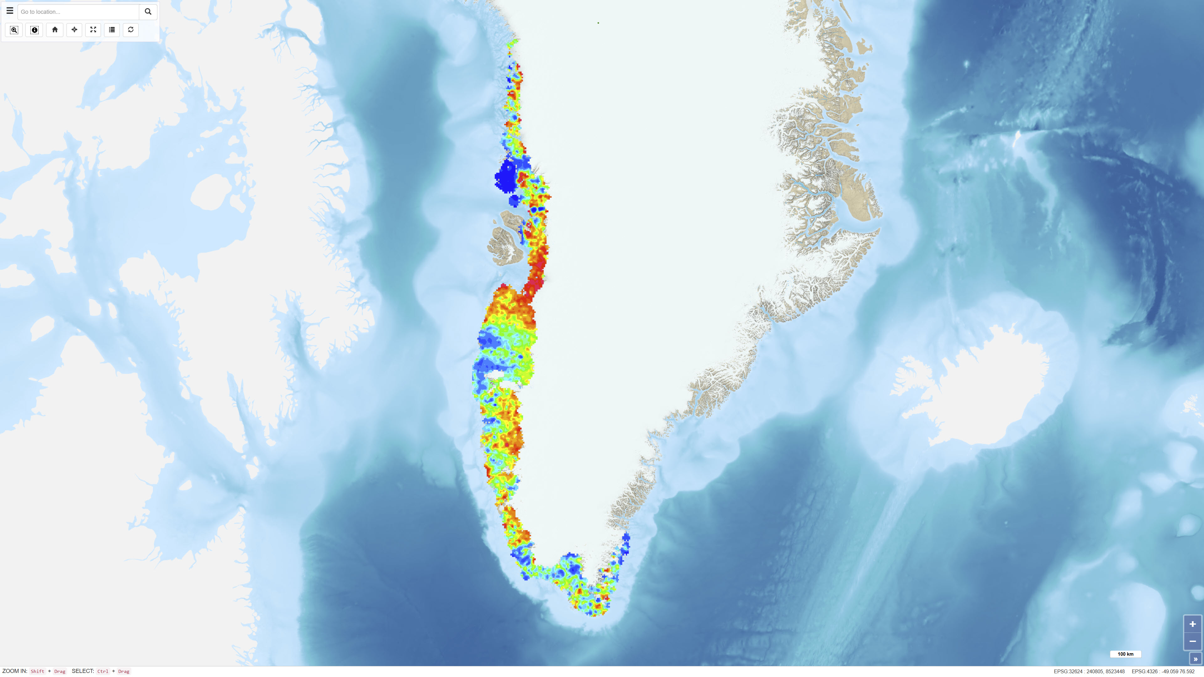
Element Distribution in Stream Sediments in West and South Greenland
Simple
- Date ( Publication )
- 2022-01-01
- Identifier
- dk.geus / grl_stream_sediment_elements_ws
- Presentation form
- Digital map
- Purpose
- The purpose of the dataset is to present regional geochemical patterns and variations in stream sediments to support geological mapping and mineral exploration.
- Status
- Completed
- Maintenance and update frequency
- As needed
- Keywords ( Theme )
-
- Dataset
- Geochemistry
- Stream Sediments
- Geochemical Atlas
- West Greenland
- South Greenland
- Forskningsemner Forskningsemner ( Theme )
- Geografisk Geografisk ( Place )
- Access constraints
- Other restrictions
- Use constraints
- Other restrictions
- Other constraints
- CC BY 4.0
- Other constraints
- The dataset is licensed under the Creative Commons Attribution 4.0 International (CC BY 4.0). Citation: Geological Survey of Denmark and Greenland (GEUS). Licence terms: https://creativecommons.org/licenses/by/4.0/
- Spatial representation type
- Grid
- Denominator
- 500000
- Metadata language
- en
- Character set
- UTF8
- Topic category
-
- Geoscientific information
- Begin date
- 1974-01-01
- End date
- 1979-12-31
))
- Supplemental Information
- The dataset represents interpolated element distribution maps and not individual point measurements. Interpretation should consider sampling density and analytical methods applied.
- Reference system identifier
- WGS 84 / UTM 24N (EPSG:32624)
- Distribution format
-
-
WMS
(
)
-
REST
(
)
-
WMS
(
)
- OnLine resource
-
Interactive webmap
(
WWW:LINK-1.0-http--link
)
Interactive map displaying the dataset.
- OnLine resource
-
Geochemical atlas of Greenland - West and South Greenland
(
DOI
)
Steenfelt, A. (2001). Geochemical atlas of Greenland - West and South Greenland. [2 versions: Printed maps included or 1 CD-Rom included]. GEUS. Danmarks og Grønlands Geologiske Undersøgelse Rapport Vol. 2001 No. 46 https://doi.org/10.22008/gpub/17839
- OnLine resource
-
ElementMaps2001R46
(
ESRI:REST
)
ArcGIS REST Service
- OnLine resource
-
Al2O3
(
OGC:WMS-1.3.0-http-get-capabilities
)
ArcGIS WMS Service
- Hierarchy level
- Dataset
- Statement
- Stream sediment samples were collected systematically in West and South Greenland and analysed for a range of elements. Samples were dried, sieved and analysed using laboratory methods applicable at the time. The digital maps were generated through interpolation of the analytical results and represent a regional generalisation of measured concentrations. Methodological details are described in the associated atlas publication.
- File identifier
- 05ba12b3-f40b-4832-9765-16d8ebb745c2 XML
- Metadata language
- Danskda
- Character set
- UTF8
- Hierarchy level
- Dataset
- Date stamp
- 2026-02-26T08:01:31.408232Z
- Metadata standard name
- ISO 19115:2003/19139
- Metadata standard version
- 1.0
Overviews
Spatial extent
Provided by
