 Arctic SDI catalogue
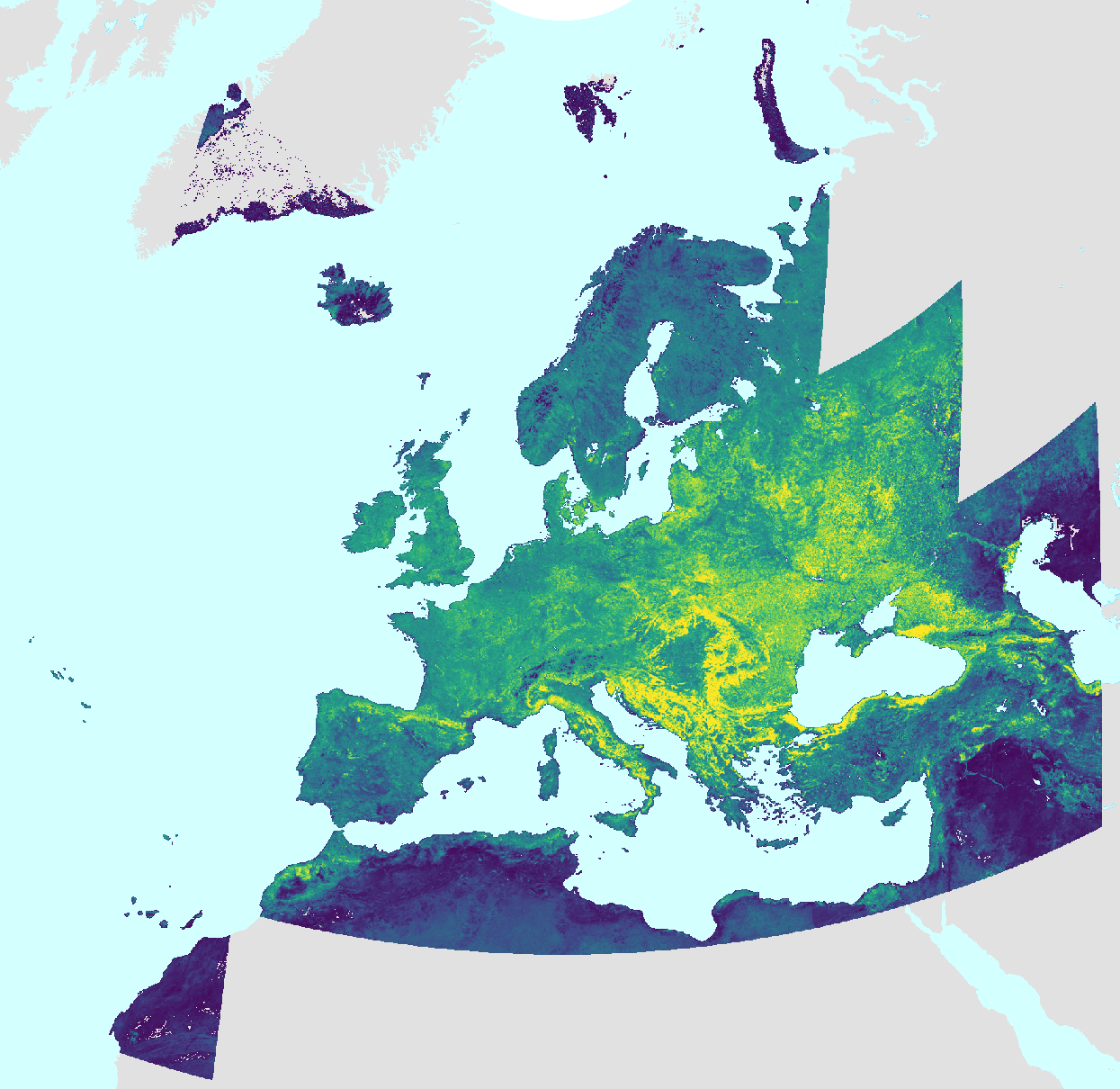
Medium Resolution Vegetation Phenology and Productivity: Slope of the green-up period 2000-2025 (raster 500m)
The slope of the green-up period (LSLOPE), one of the Vegetation Phenology and Productivity (VPP) parameters, is a product of the pan-European Medium Resolution Vegetation Phenology and Productivity (MR-VPP) component of the Copernicus Land Monitoring Service (CLMS).
The LSLOPE expresses the rate of change in the values of the Plant Phenology Index (PPI) at the day when the vegetation growing season starts.
The Plant Phenology Index (PPI) is a physically based vegetation index, developed for improving the monitoring of the vegetation growth cycle. The PPI index values, withwith daily inputs, are first used in a function fitting to derive the PPI Seasonal Trajectories. From these Seasonal Trajectories, a suite of 13 Vegetation Phenology and Productivity (VPP) parameters are then computed and provided, for up to two seasons each year. The LSLOPE is one of the 13 parameters.
The LSLOPE time series dataset is made available as raster files with 500x 500m resolution, in ETRS89-LAEA projection corresponding to the MCD43 tiling grid.
Simple
- Date ( Creation )
- 2026-04-28
- Date ( Publication )
- 2026-07-29
- Edition
- 01.00
- Identifier
- copernicus_r_3035_500_m_mrvpp-lslope_p_2000-2025_v05_r00
- Unique resource identifier
- 10.2909/080f0101-b60a-45c8-810f-90b21d36d64c
- Codespace
- doi.org
- Maintenance and update frequency
- Annually
- GEMET - INSPIRE themes, version 1.0 ( Theme )
- Keywords
-
- Keywords
-
- GEMET ( Theme )
- Spatial scope ( Theme )
- Temporal resolution ( Temporal )
- EEA topics ( Theme )
- Access constraints
- Other restrictions
- Other constraints
- no limitations to public access
- Use constraints
- Other restrictions
- Other constraints
-
The Copernicus component is governed by Regulation (EU) No 2021/696 of the European Parliament and of the Council of 28 April 2021 establishing the Union Space Programme and the European Union Agency for the Space Programme and repealing Regulations (EU) No 912/2010, (EU) No 1285/2013 and (EU) No 377/2014 and Decision No 541/2014/EU. Within the Copernicus component, a portfolio of land monitoring activities has been delegated by the European Union to the European Environment Agency (EEA) and the DG Joint Research Centre of the European Commission.
The Copernicus land monitoring products and services are made available on a principle of full, open and free access, as established by the Commission Delegated Regulation (EU) No 1159/2013 of 12 July 2013.
Free, full and open access to the products and services of the Copernicus Land Monitoring Service is made on the conditions that:
1. When distributing or communicating Copernicus Land Monitoring Service products and services (data, software scripts, web services, user and methodological documentation and similar) to the public, users shall inform the public of the source of these products and services.
2. Where the Copernicus Land Monitoring Service products and services have been adapted or modified by the user, the user shall clearly state this.
3. Users shall make sure not to convey the impression to the public that the user's activities are officially endorsed by the European Union.
- Unique resource identifier
- 09eac45f-6ce0-49de-bc24-4f7b48f8397a
- Association Type
- Part of seamless database
- Spatial representation type
- grid Grid
- Distance
- 500 m
- Metadata language
- en
- Character set
- utf8 UTF8
- Topic category
-
- Environment
- Imagery base maps earth cover
- Climatology, meteorology, atmosphere
))
- Begin date
- 2000-01-01
- End date
- 2025-12-31
- Unique resource identifier
- EPSG:3035
- Distribution format
-
-
GeoTIFF
(
)
-
GeoTIFF
(
)
OnLine resource
- OnLine resource
-
CLMS Website
(
WWW:DOWNLOAD:
)
Download (requires authentication)
- OnLine resource
- Product Information & Technical Documentation ( WWW:LINK )
- OnLine resource
- Digital Object Identifier (DOI) ( DOI )
- Hierarchy level
- Dataset
Conformance result
- Date ( Publication )
- 2010-12-08
- Explanation
- See the referenced specification
- Statement
- Vegetation Phenology and Productivity parameters (VPP) are based on Plant Phenology Index (PPI) seasonal trajectories and are yearly produced for two seasons using the Timesat 4 software. One of the parameters is the slope of the green-up period (LSLOPE) that expresses the rate of change in the values of the Plant Phenology Index (PPI) at the day when the vegetation growing season starts.
- File identifier
- 080f0101-b60a-45c8-810f-90b21d36d64c XML
- Metadata language
- en
- Character set
- UTF8
- Hierarchy level
- Dataset
- Date stamp
- 2026-07-29T12:58:24.061235Z
- Metadata standard name
- ISO 19115/19139
- Metadata standard version
- 1.0
Overviews
Spatial extent
Provided by
