 Arctic SDI catalogue
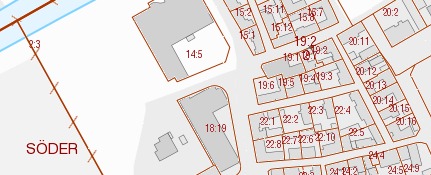
Fastighetsindelning Visning
Med våra visningstjänster kan du använda Lantmäteriets kartor i dina egna system eller applikationer. Visningstjänsterna går att kombinera med våra övriga geodatatjänster. Tjänsten ger tillgång till fastighetsinformation från Lantmäteriets grunddatalager. Kartinformationen är uppdelad i tio separata skikt. För vart och ett av skikten finns ett eller flera fördefinierade presentationssätt, så kallade ”stilar”.
Tjänsten uppfyller EU-direktivet Inspire för temat Fastighetsområden (Cadastral parcels). Inspireinformationen finns i skikten Cadastral parcels, Cadastral boundary och Cadastal zoning.
Simple
Identification info
- Alternate title
- Cadastral parcels View Service
- Date ( Publication )
- 2013-09-17
- Date ( Revision )
- 2018-04-25
- Date ( Revision )
- 2026-03-11
026-65 16 44
www.lantmateriet.se
- Maintenance and update frequency
- Continual
- Maintenance note
- Fastighetsindelningen ajourhålls kontinuerligt av lantmäterimyndigheterna i samband med fastighetsbildning. Inom vissa kommunala lantmäterimyndigheter sker ajourhållningen periodiskt, vilket innebär att de månadsvis skickar in de förändringar som skett.
- GEMET - INSPIRE themes, version 1.0 ( Theme )
- Initiativ ( Theme )
-
- Geodatasamverkan
- Inspire
- Use limitation
- no condition apply
- Access constraints
- Other restrictions
- Other constraints
- Inga begränsningar för allmänhetens tillgång
- Access constraints
- Other restrictions
- Other constraints
- Immateriella rättigheter - Upphovsrätt
- Use constraints
- Other restrictions
- Service Type
- view
- Description
- Fastighetsindelning Visning täcker hela Sverige.
- Geographic identifier
- Sverige
))
Vertical extent
Coupled Resource
- Operation Name
- GetCapabilities
- Identifier
- ac140515-99bf-46bc-8b43-97301463c6f3
Contains Operations
- Operates On
- Reference system identifier
- EPSG / http://www.opengis.net/def/crs/EPSG/0/4326
- Reference system identifier
- EPSG / http://www.opengis.net/def/crs/EPSG/0/3044
- Reference system identifier
- EPSG / http://www.opengis.net/def/crs/EPSG/0/3045
- Reference system identifier
- EPSG / http://www.opengis.net/def/crs/EPSG/0/4258
- Reference system identifier
- EPSG / http://www.opengis.net/def/crs/EPSG/0/4258
- Reference system identifier
- EPSG / http://www.opengis.net/def/crs/EPSG/0/4258
- Reference system identifier
- EPSG / http://www.opengis.net/def/crs/EPSG/0/32633
- Reference system identifier
- EPSG / http://www.opengis.net/def/crs/EPSG/0/4619
- Reference system identifier
- EPSG / http://www.opengis.net/def/crs/EPSG/0/3035
- Reference system identifier
- EPSG / http://www.opengis.net/def/crs/EPSG/0/3034
- Reference system identifier
- EPSG / http://www.opengis.net/def/crs/EPSG/0/3857
- Reference system identifier
- EPSG / http://www.opengis.net/def/crs/EPSG/0/3006
- Reference system identifier
- EPSG / http://www.opengis.net/def/crs/EPSG/0/3007
- Reference system identifier
- EPSG / http://www.opengis.net/def/crs/EPSG/0/3008
- Reference system identifier
- EPSG / http://www.opengis.net/def/crs/EPSG/0/3012
- Reference system identifier
- EPSG / http://www.opengis.net/def/crs/EPSG/0/3009
- Reference system identifier
- EPSG / http://www.opengis.net/def/crs/EPSG/0/3013
- Reference system identifier
- EPSG / http://www.opengis.net/def/crs/EPSG/0/3010
- Reference system identifier
- EPSG / http://www.opengis.net/def/crs/EPSG/0/3014
- Reference system identifier
- EPSG / http://www.opengis.net/def/crs/EPSG/0/3011
- Reference system identifier
- EPSG / http://www.opengis.net/def/crs/EPSG/0/3015
- Reference system identifier
- EPSG / http://www.opengis.net/def/crs/EPSG/0/3016
- Reference system identifier
- EPSG / http://www.opengis.net/def/crs/EPSG/0/3017
- Reference system identifier
- EPSG / http://www.opengis.net/def/crs/EPSG/0/3018
- Reference system identifier
- EPSG / http://www.opengis.net/def/crs/EPSG/0/3021
- Reference system identifier
- EPSG / http://www.opengis.net/def/crs/EPSG/0/25832
- Reference system identifier
- EPSG / http://www.opengis.net/def/crs/EPSG/0/25833
- Reference system identifier
- EPSG / http://www.opengis.net/def/crs/EPSG/0/25834
- Reference system identifier
- EPSG / http://www.opengis.net/def/crs/EPSG/0/25835
- Reference system identifier
- EPSG / http://www.opengis.net/def/crs/EPSG/0/32632
Distributor
- Name
- JPG
- Version
- okänt
- Name
- PGN
- Version
- okänt
- Name
- GIF
- Version
- okänt
- OnLine resource
-
Produktdokumentation för Fastighetsindelning Visning
(
HTTP:Information
)
Produktdokumentation för Fastighetsindelning Visning
- OnLine resource
-
Åtkomstpunkt till tjänsten Fastighetsindelning Visning (öppen capability-fil)
(
HTTP:OGC:WMS
)
Åtkomstpunkt till tjänsten Fastighetsindelning Visning (öppen capability-fil)
- OnLine resource
-
Åtkomstpunkt för tjänsten Fastighetsindelning Visning (ordinarie åtkomstpunkt)
(
HTTP:OGC:WMS
)
Åtkomstpunkt för tjänsten Fastighetsindelning Visning (ordinarie åtkomstpunkt)
- Hierarchy level
- Service
Conformance result
- Date ( Publication )
- 2014-04-17
- Pass
- Yes
Conformance result
- Date ( Publication )
- 2009-10-20
- Explanation
- Enligt ovanstående specifikation
- Pass
- Yes
Conformance result
- Date ( Publication )
- 2009-10-20
- Explanation
- Enligt ovanstående specifikation
- Pass
- Yes
- File identifier
- 099b8d93-c8c1-4a66-9eba-13d6db1085a7 XML
- Metadata language
- sv
- Hierarchy level
- Service
- Date stamp
- 2026-03-11T10:09:20.269Z
- Metadata standard name
- SS-EN-ISO-19115:2005-NMDP 4.0
- Metadata standard version
- 4.0
026-65 16 44
www.lantmateriet.se
Overviews
Spatial extent
Provided by
