 Arctic SDI catalogue
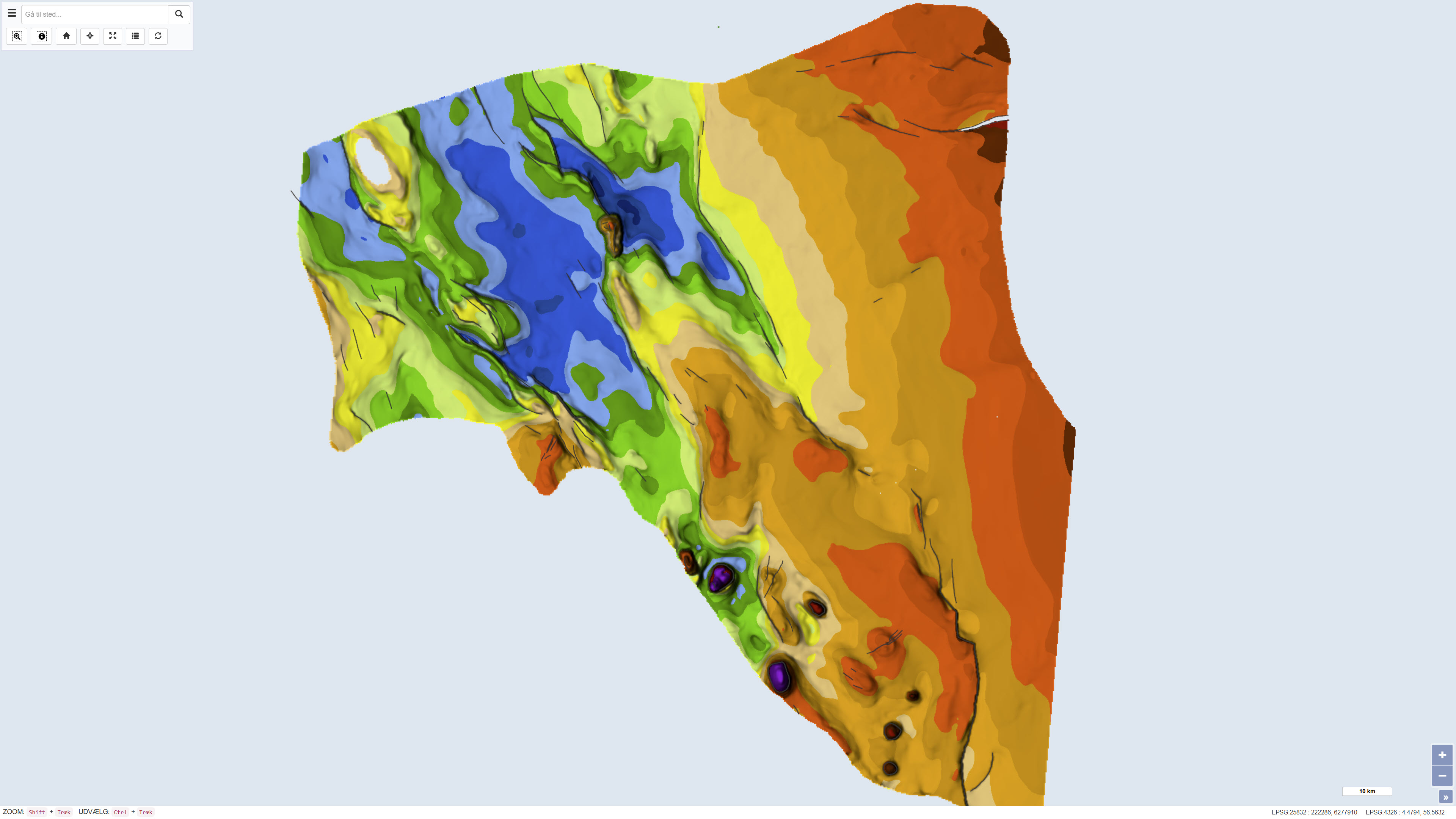
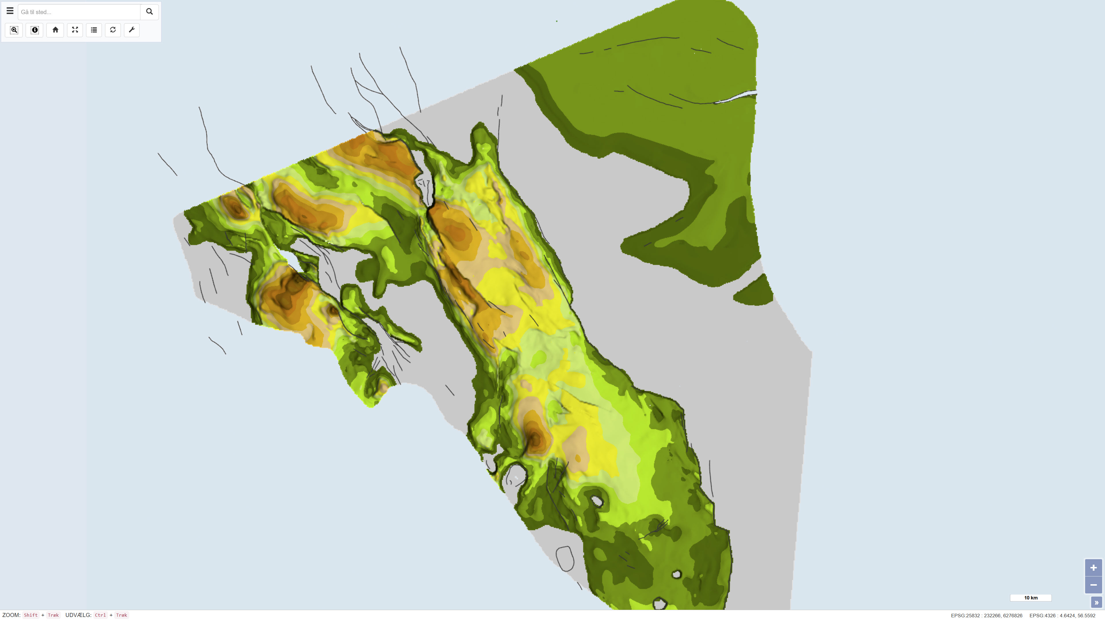
Geological map of Denmark, 1:200.000 - The Danish Central Graben: Base Cretaceous and the Cromer Knoll Group
Simple
- Date ( Publication )
- 1995-05-19
- Identifier
- dk.geus / dk_centralgraben_basecretaceous_cromerknoll_200k
- Presentation form
- Digital map
- Purpose
- The purpose of the dataset is to document the regional geometry and stratigraphic framework of the Base Cretaceous and the Cromer Knoll Group in the Danish Central Graben, thereby providing a basis for regional-scale stratigraphic and structural interpretation. The dataset is intended for use in geological and geophysical analyses as well as basin and resource studies.
- Status
- Completed
- Maintenance and update frequency
- As needed
- Keywords ( Theme )
-
- Dataset
- Geology
- Danish Central Graben
- Base Cretaceous
- Cromer Knoll Group
- Stratigraphy
- North Sea
- Denmark
- Forskningsemner Forskningsemner ( Theme )
- Geografisk Geografisk ( Place )
- Access constraints
- Other restrictions
- Use constraints
- Other restrictions
- Other constraints
- CC BY-SA 4.0
- Other constraints
- Use of the dataset requires acknowledgement of the Geological Survey of Denmark and Greenland (GEUS) as the data source.
- Spatial representation type
- Vector
- Spatial representation type
- Grid
- Denominator
- 200000
- Metadata language
- Da
- Character set
- UTF8
- Topic category
-
- Geoscientific information
- Elevation
- Begin date
- 1980-01-01
- End date
- 1995-05-19
))
- Supplemental Information
- The dataset is a map product at a scale of 1:200,000 and should be used with consideration of the map scale and level of generalisation. The map is part of the DGU map series and is based on the data coverage and interpretation available at the time of publication. The map sheet consists of several thematic sub-maps that together form the complete presentation.
- Reference system identifier
- ETRS 89 / UTM 32N (EPSG:25832)
- Distribution format
-
-
WMS
(
)
-
REST
(
)
-
WMS
(
)
- OnLine resource
-
Interactive webmap
(
WWW:LINK-1.0-http--link
)
Interactive map displaying the dataset.
- OnLine resource
-
Geological map of Denmark 1:200,000. The Danish Central Graben. ‘Base Cretaceous’ and the Cromer Knoll Group
(
DOI
)
The publication presents a geological map of the Danish Central Graben focusing on the structural and stratigraphic interpretation of the Base Cretaceous and the Cromer Knoll Group. The map is based on regional interpretation of seismic data supplemented by information from boreholes and is published as part of the DGU Map Series no. 49.
- OnLine resource
-
DenDanskeCentralgrav
(
ESRI:REST
)
ArcGIS REST Service
- OnLine resource
-
CG_CromerKnollGrp_iso
(
OGC:WMS-1.3.0-http-get-capabilities
)
ArcGIS WMS Service
- Hierarchy level
- Dataset
- Statement
- The map was published as DGU Map Series no. 49 in 1995 and was produced based on regional interpretation of seismic data supplemented by information from boreholes. The mapping work was initiated around 1980 and continued through the 1980s towards the time of publication. The seismic interpretations were used to compile regional structural maps of the Base Cretaceous as well as stratigraphic and structural maps of the Cromer Knoll Group. The dataset represents the geological and geophysical interpretation available at the time of publication.
- File identifier
- 1cf38de5-4aa7-452a-af31-e77be9245a4d XML
- Metadata language
- Danskda
- Character set
- UTF8
- Hierarchy level
- Dataset
- Date stamp
- 2026-03-20T11:15:26.293887Z
- Metadata standard name
- ISO 19115:2003/19139
- Metadata standard version
- 1.0
Overviews
Spatial extent
Provided by
