 Arctic SDI catalogue
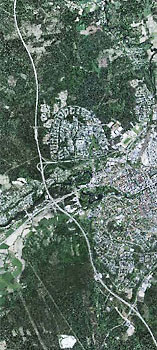
Ortofoto Visning
Simple
Identification info
- Alternate title
- Orthophoto View Service
- Date ( Publication )
- 2010
- Date ( Revision )
- 2025-02-07
- Maintenance and update frequency
- Continual
- Maintenance note
- Produkten uppdateras kontinuerligt med nya ortofoton allt eftersom nya flygbilder finns tillgängliga enligt det nationella bildförsörjningsprogrammet (nytt fönster). Det innebär att nya ortofoton tas fram över cirka 30% av landets yta årligen, med upplösning 0,4 m eller 0,16 m, med intervall 2 - 10 år, beroende på var i landet det är. Ortofoton över södra Sverige och över områden längs Norrlandskusten tas fram vartannat år, omväxlande före respektive efter lövsprickning, med 0,16 m upplösning. Ortofoton med den högre upplösningen tas även fram över vissa tätorter eller valda områden i övriga delar av landet.
- GEMET - INSPIRE themes, version 1.0 ( Theme )
- Ämnesområde ( Theme )
-
- Arealtäckande bilder och bakgrundskartor
- Initiativ ( Theme )
-
- Geodatasamverkan
- Inspire
- Use limitation
- no condition apply
- Access constraints
- Other restrictions
- Other constraints
- Immateriella rättigheter
- Use constraints
- Other restrictions
- Access constraints
- Other restrictions
- Other constraints
- Immateriella rättigheter - Upphovsrätt
- Service Type
- view
- Description
- Upplösning 0,16/0,25/0,4/0,5 m/pixel Tjänsten uppdateras kontinuerligt med nya ortofoton allt eftersom de framställs. Årtal för varje ortofoto redovisas i egna metadatalager. För ortofoto från 2010 och framåt redovisas även sömlinjer och flygfototidpunkter för ingående flygbilder i separata metadatalager.
- Geographic identifier
- Sverige
))
Vertical extent
Coupled Resource
- Operation Name
- GetCapabilities
- Identifier
- 223e1f42-2992-4ccb-9acb-aec9cd47deb2
Contains Operations
- Operates On
- Reference system identifier
- EPSG / http://www.opengis.net/def/crs/EPSG/0/4326
- Reference system identifier
- EPSG / http://www.opengis.net/def/crs/EPSG/0/3857
- Reference system identifier
- EPSG / http://www.opengis.net/def/crs/EPSG/0/3857
- Reference system identifier
- EPSG / http://www.opengis.net/def/crs/EPSG/0/3006
- Reference system identifier
- EPSG / http://www.opengis.net/def/crs/EPSG/0/4258
- Reference system identifier
- EPSG / http://www.opengis.net/def/crs/EPSG/0/4619
- Reference system identifier
- EPSG / http://www.opengis.net/def/crs/EPSG/0/3035
- Reference system identifier
- EPSG / http://www.opengis.net/def/crs/EPSG/0/3034
- Reference system identifier
- EPSG / http://www.opengis.net/def/crs/EPSG/0/3045
- Reference system identifier
- EPSG / http://www.opengis.net/def/crs/EPSG/0/3857
- Reference system identifier
- EPSG / http://www.opengis.net/def/crs/EPSG/0/3044
- Reference system identifier
- EPSG / http://www.opengis.net/def/crs/EPSG/0/3008
- Reference system identifier
- EPSG / http://www.opengis.net/def/crs/EPSG/0/3012
- Reference system identifier
- EPSG / http://www.opengis.net/def/crs/EPSG/0/3009
- Reference system identifier
- EPSG / http://www.opengis.net/def/crs/EPSG/0/3013
- Reference system identifier
- EPSG / http://www.opengis.net/def/crs/EPSG/0/3010
- Reference system identifier
- EPSG / http://www.opengis.net/def/crs/EPSG/0/3014
- Reference system identifier
- EPSG / http://www.opengis.net/def/crs/EPSG/0/3011
- Reference system identifier
- EPSG / http://www.opengis.net/def/crs/EPSG/0/3015
- Reference system identifier
- EPSG / http://www.opengis.net/def/crs/EPSG/0/3016
- Reference system identifier
- EPSG / http://www.opengis.net/def/crs/EPSG/0/3017
- Reference system identifier
- EPSG / http://www.opengis.net/def/crs/EPSG/0/3018
- Reference system identifier
- EPSG / http://www.opengis.net/def/crs/EPSG/0/25832
- Reference system identifier
- EPSG / http://www.opengis.net/def/crs/EPSG/0/25833
- Reference system identifier
- EPSG / http://www.opengis.net/def/crs/EPSG/0/25834
- Reference system identifier
- EPSG / http://www.opengis.net/def/crs/EPSG/0/25835
- Reference system identifier
- EPSG / http://www.opengis.net/def/crs/EPSG/0/32632
- Reference system identifier
- EPSG / http://www.opengis.net/def/crs/EPSG/0/32633
- Reference system identifier
- EPSG / http://www.opengis.net/def/crs/EPSG/0/32634
- Reference system identifier
- EPSG / http://www.opengis.net/def/crs/EPSG/0/32635
Distributor
- Name
- JPEG
- Version
- okänt
- OnLine resource
-
Produktdokumentation för Ortofoto Visning
(
HTTP:Information
)
Produktdokumentation för Ortofoto Visning
- OnLine resource
-
Åtkomstpunkt öppen capabilityfil
(
HTTP:OGC:WMS
)
Åtkomstpunkt till tjänsten Ortofoto Visning (Öppen capabilityfil)
- OnLine resource
-
Åtkomstpunkt till Ortofoto Visning
(
HTTP:OGC:WMS
)
Åtkomstpunkt till tjänsten Ortofoto Visning (ordinarie åtkomstpunkt)
- Hierarchy level
- Service
Conformance result
- Date ( Publication )
- 2013-12-10
- Pass
- Yes
Conformance result
- Date ( Publication )
- 2009-10-20
- Explanation
- Enligt ovanstående specifikation
- Pass
- Yes
Conformance result
- Date ( Publication )
- 2009-10-20
- Explanation
- Enligt ovanstående specifikation
- Pass
- Yes
- File identifier
- 23b71708-78f1-411c-84a6-a7af88bfbcf5 XML
- Metadata language
- sv
- Hierarchy level
- Service
- Date stamp
- 2026-06-15T16:15:50.491Z
- Metadata standard name
- SS-EN-ISO-19115:2005-NMDP 4.0
- Metadata standard version
- 4.0
www.lantmateriet.se
Overviews
Spatial extent
Provided by
