 Arctic SDI catalogue
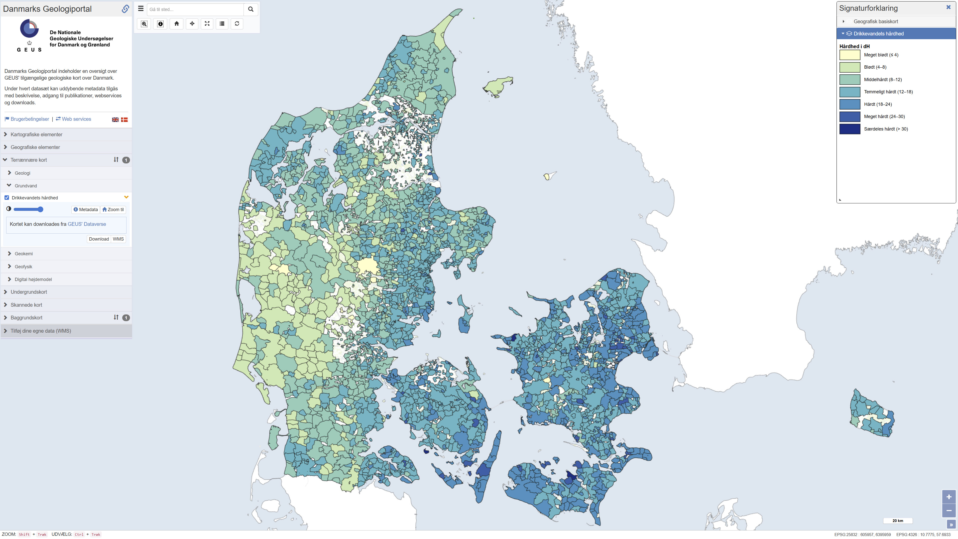
Hardness of Danish drinking water
Simple
- Date ( Publication )
- 2024-09-05
- Identifier
- dk.geus / drikkevands_haardhed
- Presentation form
- Digital map
- Purpose
- The purpose of this map is to show the variation of drinking water (DW) hardness in Denmark based on the data available in 2023. DW hardness is an important technical characteristic of tap water in relation to precipitation of carbonates in water pipes, boilers and other hot water household appliances, as well as in relation to increased soap use. The data have also potential relevance to different authorities and industries.
- Status
- Completed
- Maintenance and update frequency
- As needed
- Keywords ( Theme )
-
- Dataset
- Geology
- Drinking water
- ArcGIS
- QGIS
- Forskningsemner Forskningsemner ( Theme )
- Geografisk Geografisk ( Place )
- Access constraints
- Other restrictions
- Use constraints
- Other restrictions
- Other constraints
- CC BY 4.0
- Spatial representation type
- Vector
- Denominator
- 100000
- Metadata language
- Da
- Character set
- UTF8
- Topic category
-
- Geoscientific information
- Environment
))
- Supplemental Information
- None specified
- Reference system identifier
- ETRS 89 / UTM 32N (EPSG:25832)
- Distribution format
-
-
WMS
(
)
-
REST
(
)
-
WMTS
(
)
-
WMS
(
)
- OnLine resource
-
Download
(
DOI
)
Download dataset from GEUS' Dataverse
- OnLine resource
-
Interactive webmap
(
WWW:LINK-1.0-http--link
)
Viewing the dataset on the web portal
- OnLine resource
-
Drikkevandets_haardhed
(
OGC:WMS-1.3.0-http-get-capabilities
)
ArcGIS WMS Service
- OnLine resource
-
Drikkevandets_haardhed
(
ESRI:REST
)
ArcGIS REST Service
- OnLine resource
-
Denmark_Drikkevandets_haardhed
(
OGC:WMTS-1.0.0-http-get-capabilities
)
ArcGIS WMTS Service
- Hierarchy level
- Dataset
- Statement
- The map is based on the latest available hardness information at the water supply areas of public waterworks. The public waterworks metadata and drinking water analyses of Ca, Mg and total hardness were extracted from the Jupiter database on 6 September 2023. The water supply areas are from Schullehner (2022, https://doi.org/10.34194/geusb.v49.8319 ). Data were quality assured, filtered, aggregated and linked together.
- File identifier
- 27f53f24-c0b6-4c6a-8e1d-b53071461f74 XML
- Metadata language
- Danskda
- Character set
- UTF8
- Hierarchy level
- Dataset
- Date stamp
- 2026-02-05T09:17:42.494688Z
- Metadata standard name
- ISO 19115:2003/19139
- Metadata standard version
- 1.0
Overviews
Spatial extent
Provided by
