 Arctic SDI catalogue
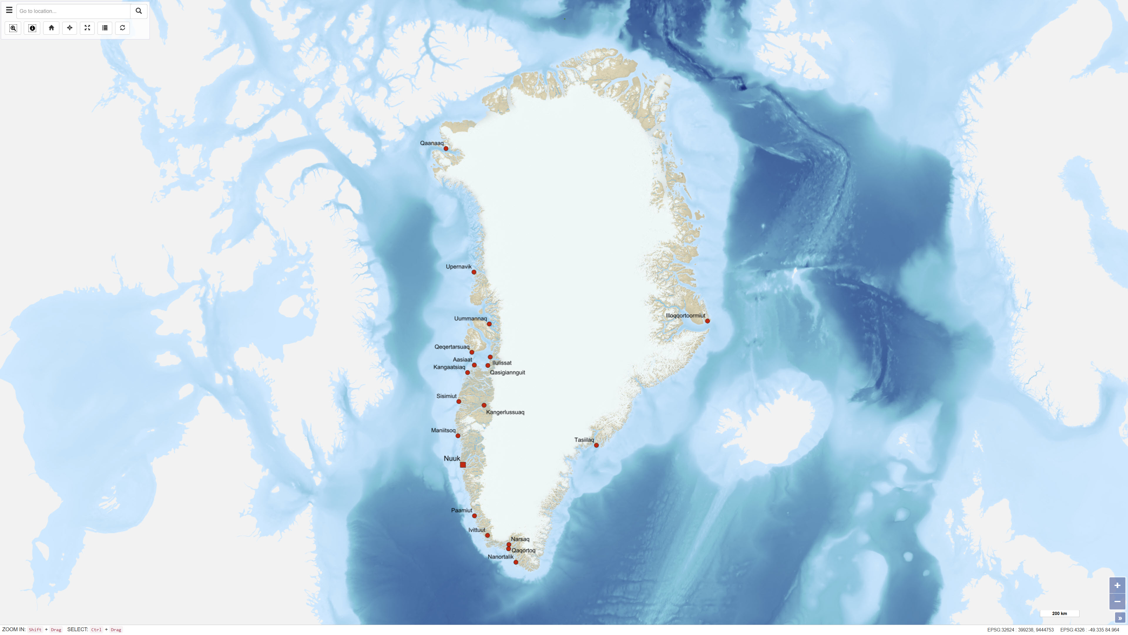
Towns, Settlements and Airfields in Greenland
Simple
- Date ( Publication )
- 2018-04-09
- Identifier
- dk.geus / grl_towns_settlements_airfields
- Presentation form
- Digital map
- Purpose
- The purpose of the dataset is to support landslide-related analyses and assessments by providing detailed terrain models and infrastructure data for towns and settlements in Greenland.
- Status
- Completed
- Maintenance and update frequency
- As needed
- Keywords ( Theme )
-
- Dataset
- Towns
- Settlements
- Airfields
- Greenland
- Forskningsemner Forskningsemner ( Theme )
- Geografisk Geografisk ( Place )
- Access constraints
- Other restrictions
- Use constraints
- Other restrictions
- Other constraints
- CC BY 4.0
- Other constraints
- This dataset is subject to usage restrictions and may not be redistributed or published in any form without prior approval from Asiaq. For access to the original data or further information, please contact the data provider directly.
- Spatial representation type
- Vector
- Denominator
- 100
- Metadata language
- Da
- Character set
- UTF8
- Topic category
-
- Geoscientific information
- Location
- Society
))
- Supplemental Information
- The dataset was produced for a specific project purpose and is not a general public dataset. Use and further distribution are subject to approval by the data owner.
- Reference system identifier
- WGS 84 / UTM 24N (EPSG:32624)
- Distribution format
-
-
WMS
(
)
-
WFS
(
)
-
SHP
(
)
-
GeoJSON
(
)
-
WMS
(
)
- OnLine resource
-
Interactive webmap
(
WWW:LINK-1.0-http--link
)
Interactive map displaying the dataset.
- OnLine resource
-
byer_og_bygder
(
OGC:WMS-1.3.0-http-get-capabilities
)
WMS for Towns, settlements & airfields
- OnLine resource
-
ms:byer_og_bygder
(
OGC:WFS-1.0.0-http-get-capabilities
)
WFS for Towns, settlements & airfields
- OnLine resource
-
Download
Download dataset as shapefile
- OnLine resource
-
Download
Download dataset as GeoJSON
- Hierarchy level
- Dataset
- Statement
- The dataset was delivered by Asiaq and prepared as part of the Landslide Project 2022. It consists of terrain models and associated infrastructure data compiled for towns and settlements across Greenland.
- File identifier
- 2f291d00-f88e-4b21-ba62-9f9de0d00a2b XML
- Metadata language
- Danskda
- Character set
- UTF8
- Hierarchy level
- Dataset
- Date stamp
- 2026-03-02T12:01:43.870186Z
- Metadata standard name
- ISO 19115:2003/19139
- Metadata standard version
- 1.0
Overviews

Spatial extent
Provided by
