 Arctic SDI catalogue
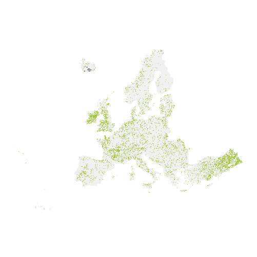
Grassland 2015 (raster 20 m), Europe, 3-yearly, Apr. 2018
The main high resolution grassland product is the Grassland layer, a grassland/non-grassland mask for the EEA39. This grassy and non-woody vegetation baseline product includes all kinds of grasslands: managed grassland, semi-natural grassland and natural grassy vegetation. It is a binary status layer for the 2015 reference year mapping grassland and all non-grassland areas in 20m and (aggregated) 100m pixel size and for the 2018 reference year - in 10m and (aggregated) 100m pixel size.
The production of the high resolution grassland layers was coordinated by the European Environment Agency (EEA) in the frame of the EU Copernicus programme.
Simple
- Date ( Creation )
- 2018-04-09
- Date ( Publication )
- 2018-04-09
- Identifier
- copernicus_r_3035_20_m_gra-2015_p_2014-2016_v01_r00
- Unique resource identifier
- 10.2909/35a036bb-c027-401c-8625-2ecf722e8461
- Maintenance and update frequency
- Continual
- GEMET - INSPIRE themes, version 1.0 ( Theme )
-
- Land cover
- Keywords
-
- Continents, countries, sea regions of the world. ( Place )
-
- EEA39
- Keywords
-
- GEMET ( Theme )
-
- forest management
- land cover
- landscape alteration
- land use
- grassland
- Spatial scope ( Theme )
- EEA topics ( Theme )
-
- Land use
- Access constraints
- Other restrictions
- Other constraints
- no limitations to public access
- Use constraints
- Other restrictions
- Other constraints
-
The Copernicus component is governed by Regulation (EU) No 2021/696 of the European Parliament and of the Council of 28 April 2021 establishing the Union Space Programme and the European Union Agency for the Space Programme and repealing Regulations (EU) No 912/2010, (EU) No 1285/2013 and (EU) No 377/2014 and Decision No 541/2014/EU. Within the Copernicus component, a portfolio of land monitoring activities has been delegated by the European Union to the European Environment Agency (EEA) and the DG Joint Research Centre of the European Commission.
The Copernicus land monitoring products and services are made available on a principle of full, open and free access, as established by the Commission Delegated Regulation (EU) No 1159/2013 of 12 July 2013.
Free, full and open access to the products and services of the Copernicus Land Monitoring Service is made on the conditions that:
1. When distributing or communicating Copernicus Land Monitoring Service products and services (data, software scripts, web services, user and methodological documentation and similar) to the public, users shall inform the public of the source of these products and services.
2. Where the Copernicus Land Monitoring Service products and services have been adapted or modified by the user, the user shall clearly state this.
3. Users shall make sure not to convey the impression to the public that the user's activities are officially endorsed by the European Union.
- Spatial representation type
- grid Grid
- Distance
- 20 m
- Metadata language
- en
- Character set
- utf8 UTF8
- Topic category
-
- Environment
- Imagery base maps earth cover
- Begin date
- 2014-01-01
- End date
- 2016-12-31
))
))
- Unique resource identifier
- EPSG:3035
- Distribution format
-
-
GeoTIFF
(
1.0
)
-
GeoTIFF
(
1.0
)
- OnLine resource
-
0
(
OGC:WMS
)
HRL_Grassland_2015
- OnLine resource
- Product Information & Technical Documentation ( WWW:LINK )
- OnLine resource
- https://doi.org/10.2909/35a036bb-c027-401c-8625-2ecf722e8461 ( DOI )
- OnLine resource
- https://image.discomap.eea.europa.eu/arcgis/rest/services/GioLandPublic/HRL_Grassland_2015/MapServer ( ESRI:REST )
- OnLine resource
-
CLMS Website
(
WWW:DOWNLOAD
)
Download (requires authentication)
- Hierarchy level
- Dataset
Conformance result
- Date ( Publication )
- 2010-12-08
- Explanation
- See the referenced specification
- Statement
- Thematic accuracy: The thematic accuracy assessment will be made on the primary layer, the grassland mask. The target will be set at 85 % to be achieved within each biogeographic region. A quantitative approach will be used based on a set of stratified random point samples compared to external datasets (e.g. GoogleEarth, national orthophotos or national grassland datasets). Achieved overall accuracy: 96.66%. Geometric accuracy (positioning accuracy): Less than half a pixel. According to ortho-rectified satellite image base delivered by ESA.
- File identifier
- 35a036bb-c027-401c-8625-2ecf722e8461 XML
- Metadata language
- en
- Character set
- UTF8
- Hierarchy level
- Dataset
- Date stamp
- 2025-10-09T10:44:49.208093Z
- Metadata standard name
- ISO 19115/19139
- Metadata standard version
- 1.0
Overviews
Spatial extent
Provided by
