 Arctic SDI catalogue
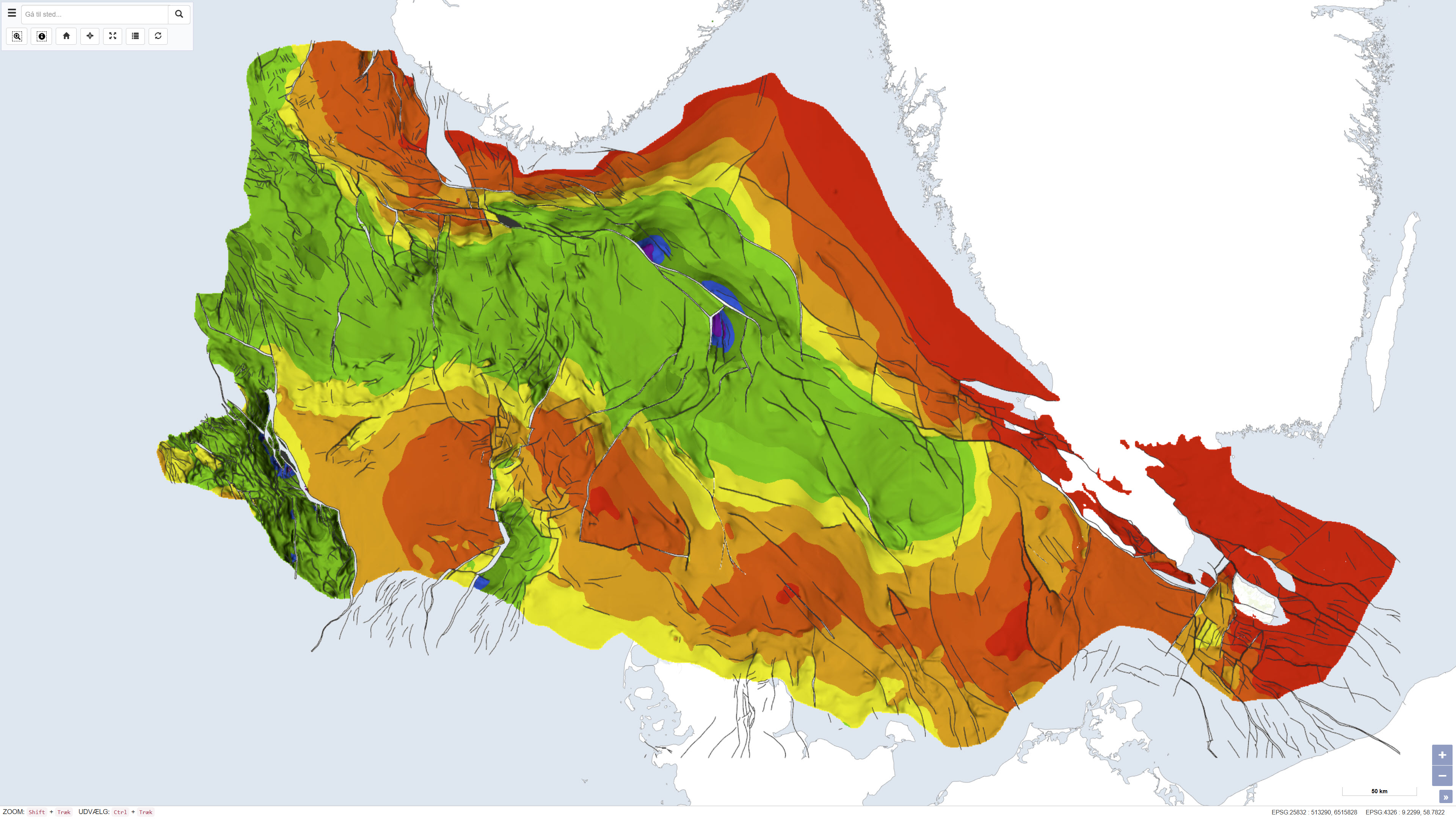
Top pre-Zechstein - Geological structures in the Danish subsurface 1:750.000
Simple
- Date ( Publication )
- 1994-12-01
- Identifier
- dk.geus / top_pre-zechstein
- Presentation form
- Digital map
- Purpose
- The purpose of the dataset is to describe the regional structure of the pre-Zechstein surface in the Danish subsurface. The dataset is used as a basis for geological and geophysical analyses, including structural studies, resource assessments and construction of regional subsurface models.
- Status
- Completed
- Maintenance and update frequency
- As needed
- Keywords ( Theme )
-
- Dataset
- Geology
- Geological structures
- Pre-Zechstein
- Subsurface
- Denmark
- Forskningsemner Forskningsemner ( Theme )
- Geografisk Geografisk ( Place )
- Access constraints
- Other restrictions
- Use constraints
- Other restrictions
- Other constraints
- CC BY-SA 4.0
- Other constraints
- Use of the dataset requires acknowledgement of the Geological Survey of Denmark and Greenland (GEUS) as the data source.
- Spatial representation type
- Grid
- Denominator
- 750000
- Metadata language
- Da
- Character set
- UTF8
- Topic category
-
- Geoscientific information
- Begin date
- 1970-01-01
- End date
- 1994-12-01
))
- Supplemental Information
- The dataset represents a historical map product and is not subject to ongoing updates. Later seismic surveys and newly drilled boreholes are not included. The dataset is primarily intended for regional analysis and should not be used for detailed local interpretations without supplementary data.
- Reference system identifier
- ETRS 89 / UTM 32N (EPSG:25832)
- Distribution format
-
-
WMS
(
)
-
REST
(
)
-
WMS
(
)
- OnLine resource
-
Interactive webmap
(
WWW:LINK-1.0-http--link
)
Interactive map displaying the dataset.
- OnLine resource
-
Geological map of Denmark 1:750.000. Top pre-Zechstein (two-way traveltime and depth)
(
DOI
)
Ole Valdemar Vejbæk, Peter Britze
- OnLine resource
-
TopPreZechstein_depth
(
OGC:WMS-1.3.0-http-get-capabilities
)
ArcGIS WMS Service
- OnLine resource
-
DetDanskeOmraade
(
ESRI:REST
)
ArcGIS REST Service
- Hierarchy level
- Dataset
- Statement
- The dataset was produced by the Geological Survey of Denmark as part of DGU map series no. 45 and is based on compilation and interpretation of seismic profiles, deep boreholes and existing geological models. The map reflects the interpretation level at the time of publication and was produced in the early 1990s. The production was carried out under the auspices of the Geological Survey of Denmark within the Ministry of Environment and Energy and reflects the contemporary understanding of subsurface structural geology.
- File identifier
- 4442fdc1-5b22-43ed-b054-bff1954945fa XML
- Metadata language
- Danskda
- Character set
- UTF8
- Hierarchy level
- Dataset
- Date stamp
- 2026-03-20T11:02:58.853068Z
- Metadata standard name
- ISO 19115:2003/19139
- Metadata standard version
- 1.0
Overviews
Spatial extent
Provided by
