 Arctic SDI catalogue
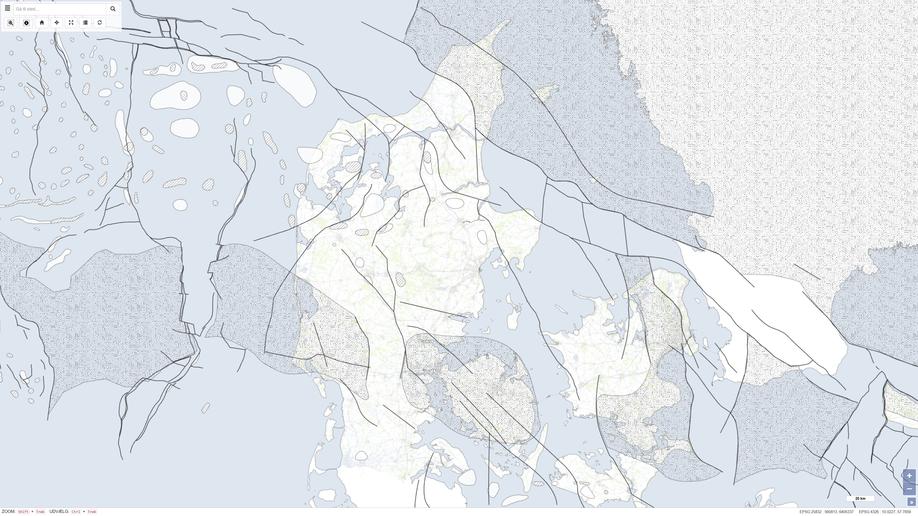
Structural features in the Danish area
Simple
- Date ( Publication )
- 1994-01-01
- Identifier
- dk.geus / structural_elements_dk
- Presentation form
- Digital map
- Purpose
- The purpose of the dataset is to provide a compiled geological map framework for use in research, planning, resource management, and dissemination of geological knowledge. The dataset serves as a reference for regional geological conditions and supports both scientific analysis and general cartographic presentation.
- Status
- Completed
- Maintenance and update frequency
- As needed
- Keywords ( Theme )
-
- Dataset
- Geology
- Subsurface
- Denmark
- Structures
- Forskningsemner Forskningsemner ( Theme )
- Geografisk Geografisk ( Place )
- Access constraints
- Other restrictions
- Use constraints
- Other restrictions
- Other constraints
- CC BY 4.0
- Spatial representation type
- Vector
- Denominator
- 750000
- Metadata language
- Da
- Character set
- UTF8
- Topic category
-
- Geoscientific information
- Begin date
- 1970-01-01
- End date
- 1994-01-01
))
- Supplemental Information
- The dataset represents a historical map product and is not subject to ongoing updates. Subsequent geological interpretations and datasets are not included.
- Reference system identifier
- ETRS 89 / UTM 32N (EPSG:25832)
- Distribution format
-
-
WMS
(
)
-
REST
(
)
-
WMS
(
)
- OnLine resource
-
Interactive webmap
(
WWW:LINK-1.0-http--link
)
Interactive map displaying the dataset.
- OnLine resource
-
Report
(
DOI
)
Geological map of Denmark. Geological map of Denmark 1:750 000. Top pre-Zechstein (two-way traveltime and depth). Top pre-Zechstein (two-way traveltime and depth)
- OnLine resource
-
Strukturelle_elementer
(
ESRI:REST
)
ArcGIS REST Service
- OnLine resource
-
Hovedforkastninger
(
OGC:WMS-1.3.0-http-get-capabilities
)
ArcGIS WMS Service
- Hierarchy level
- Dataset
- Statement
- The dataset was produced by the Geological Survey of Denmark as part of map series no. 45 and is based on compilation and interpretation of existing geological maps, seismic data, and previous investigations. The map was produced in the early 1990s and reflects the data availability and interpretation level at the time of publication. The production was carried out under the auspices of the Geological Survey of Denmark within the Ministry of Environment and Energy.
- File identifier
- 4617ed73-8a21-4f7c-816d-48307fea7e55 XML
- Metadata language
- Danskda
- Character set
- UTF8
- Hierarchy level
- Dataset
- Date stamp
- 2026-02-05T09:14:48.011493Z
- Metadata standard name
- ISO 19115:2003/19139
- Metadata standard version
- 1.0
Overviews
Spatial extent
Provided by
