 Arctic SDI catalogue
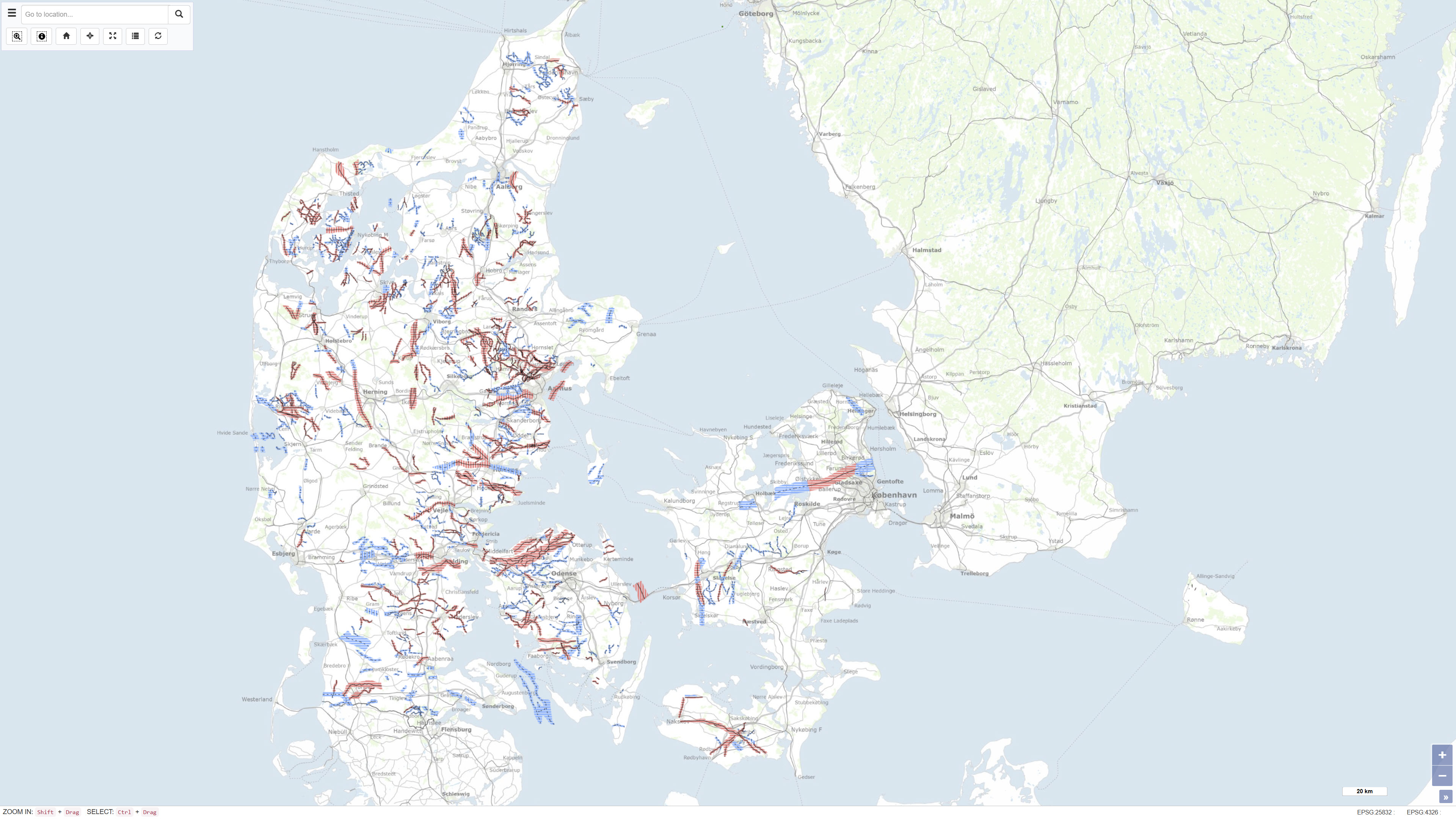
Buried valleys in Denmark
Simple
- Date ( Publication )
- 2016-11-01
- Identifier
- dk.geus / begravede_dale
- Presentation form
- Digital map
- Purpose
- The purpose of the dataset is to provide a comprehensive nationwide mapping of buried valleys as a basis for hydrogeological analyses, groundwater management, resource assessment and geological interpretation. The dataset is particularly used in the evaluation of groundwater reservoirs and the geological framework of the subsurface.
- Status
- Completed
- Maintenance and update frequency
- As needed
- Keywords ( Theme )
-
- Dataset
- Quaternary geology
- Subsurface
- Groundwater
- Forskningsemner Forskningsemner ( Theme )
- Geografisk Geografisk ( Place )
- Access constraints
- Other restrictions
- Use constraints
- Other restrictions
- Other constraints
- CC BY 4.0
- Spatial representation type
- Vector
- Denominator
- 200000
- Metadata language
- Da
- Character set
- UTF8
- Topic category
-
- Geoscientific information
- Begin date
- 2010-01-01
- End date
- 2015-01-01
))
- Supplemental Information
- The dataset is an interpretation-based national map product reflecting the data coverage and level of knowledge at the time of compilation. The mapping is not subject to continuous updates, and local variations in data density may result in differences in level of detail and interpretational confidence. The dataset should be used in conjunction with local geophysical data and borehole information where detailed hydrogeological assessments are required.
- Reference system identifier
- ETRS 89 / UTM 32N (EPSG:25832)
- Distribution format
-
-
WMS
(
)
-
REST
(
)
-
WMTS
(
1.0
)
-
WMS
(
)
- OnLine resource
-
Download
(
WWW:DOWNLOAD-1.0-http--download
)
Data can be downloaded from the official page 'Mapping of buried valleys in Denmark'
- OnLine resource
-
Interactive webmap
(
WWW:LINK-1.0-http--link
)
Interactive map displaying the dataset.
- OnLine resource
-
Mapping of buried valleys in Denmark – Update 2010–2015
(
WWW:LINK-1.0-http--link
)
GEUS publication documenting the nationwide mapping and update of buried valleys in Denmark based on geophysical and geological data.
- OnLine resource
-
Mapping of buried valleys in Denmark – Volume 1
(
WWW:LINK-1.0-http--link
)
Technical report describing the data basis, methods and results of the mapping of buried valleys in Denmark.
- OnLine resource
-
Begravede_dale
(
ESRI:REST
)
ArcGIS REST Service
- OnLine resource
-
Centerlinje_svagt_dokumenteret_45788
(
OGC:WMS-1.3.0-http-get-capabilities
)
ArcGIS WMS Service
- OnLine resource
-
Denmark_Begravede_dale
(
OGC:WMTS-1.0.0-http-get-capabilities
)
ArcGIS WMTS Service
- Hierarchy level
- Dataset
- Statement
- The dataset was compiled by the Geological Survey of Denmark and Greenland (GEUS) and is based on systematic interpretation of geophysical data collected through national and regional mapping programmes. The mapping was updated and compiled during the period 2010–2015 and is based on TEM and SkyTEM surveys, borehole data from the Jupiter database, and existing geological maps and investigations. The results are documented in the report series Mapping of buried valleys in Denmark, and the present dataset represents the consolidated nationwide interpretation.
- File identifier
- 4aaf72e6-b4eb-4c4f-a472-d8639f60710f XML
- Metadata language
- Danskda
- Character set
- UTF8
- Hierarchy level
- Dataset
- Date stamp
- 2026-04-10T11:53:01.292098Z
- Metadata standard name
- ISO 19115:2003/19139
- Metadata standard version
- 1.0
Overviews
Spatial extent
Provided by
