 Arctic SDI catalogue
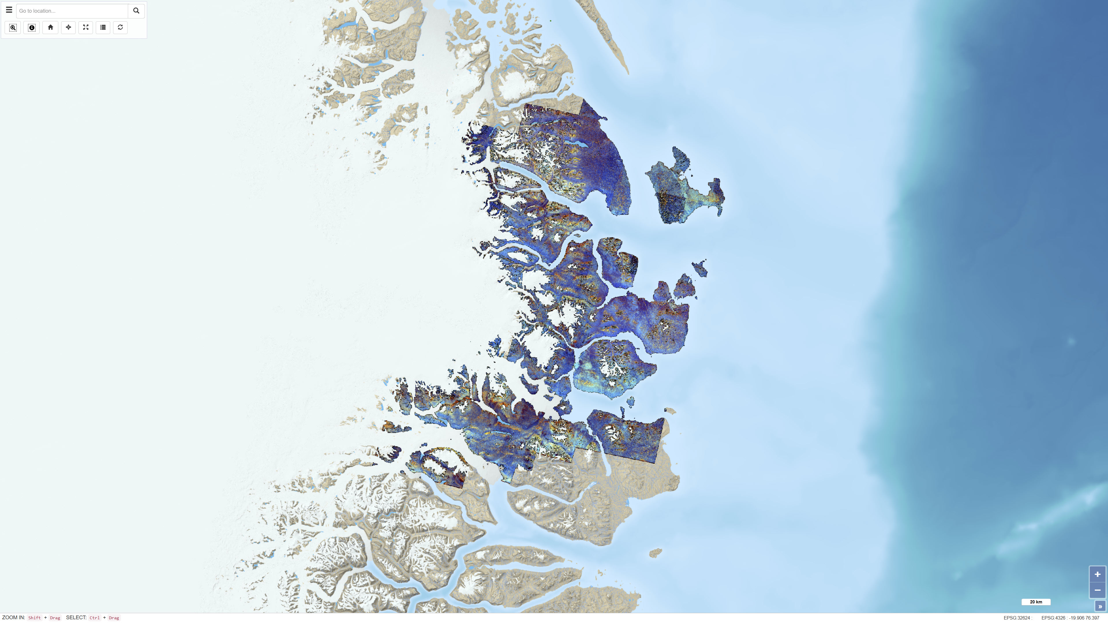
ASTER band ratio data for Northeast Greenland
Simple
- Date ( Publication )
- 2019-05-02
- Identifier
- dk.geus / grl_northeast_greenland_aster_band_ratios
- Presentation form
- Digital map
- Purpose
- The purpose of the dataset is to support regional mineral exploration and geological mapping by enhancing spectral variations related to mineralogy and lithology in Northeast Greenland.
- Status
- Completed
- Maintenance and update frequency
- As needed
- Keywords ( Theme )
-
- Dataset
- ASTER
- Remote sensing
- Band ratios
- Mineral exploration
- Northeast Greenland
- Forskningsemner Forskningsemner ( Theme )
- Geografisk Geografisk ( Place )
- Access constraints
- Other restrictions
- Use constraints
- Other restrictions
- Other constraints
- CC BY 4.0
- Other constraints
- The dataset is a derived product based on ASTER satellite data. It was developed for regional mineralogical analysis and should not be interpreted as fully radiometrically calibrated surface reflectance data. Use must consider the methodological limitations described in the accompanying report.
- Spatial representation type
- Grid
- Denominator
- 1000000
- Metadata language
- en
- Character set
- UTF8
- Topic category
-
- Geoscientific information
- Begin date
- 2000-01-01
- End date
- 2007-12-31
))
- Supplemental Information
-
The methodological background, including band ratio selection, data coverage and processing parameters, is described in GEUS Report 2019/7.
The original ASTER Level 1T data can be accessed via the USGS EarthExplorer portal (https://earthexplorer.usgs.gov/).
- Reference system identifier
- WGS 84 / UTM 24N (EPSG:32624)
- Distribution format
-
-
WMS
(
)
-
REST
(
)
-
WMS
(
)
- OnLine resource
-
Download
(
WWW:DOWNLOAD-1.0-http--download
)
USGS Earth Explorer download page
- OnLine resource
-
Interactive webmap
(
WWW:LINK-1.0-http--link
)
Interactive map displaying the dataset.
- OnLine resource
-
ASTER data analysis applied to mineral and geological mapping in North East Greenland. Documentation of the NEG ASTER Project
(
DOI
)
Salehi, S., Olsen, S. D., Pedersen, C. B., & Thorning, L. (2019). ASTER data analysis applied to mineral and geological mapping in North East Greenland. Documentation of the NEG ASTER Project. GEUS. Danmarks og Grønlands Geologiske Undersøgelse Rapport Vol. 2019 No. 7 https://doi.org/10.22008/gpub/32607
- OnLine resource
-
neg_aster_data_grl
(
ESRI:REST
)
ArcGIS REST Service
- OnLine resource
-
AST_L1T_Carbonate_chlorite_epidote
(
OGC:WMS-1.3.0-http-get-capabilities
)
ArcGIS WMS Service
- Hierarchy level
- Dataset
- Statement
-
The dataset is based on ASTER satellite data that were preprocessed using atmospheric, radiometric and topographic corrections. The corrections were performed using ATCOR-3 in rugged terrain mode, applying a digital elevation model to adjust illumination conditions in rugged terrain. The corrected radiance data were converted to apparent surface reflectance. Further calibration against ground-based reflectance measurements was not feasible due to the lack of field data. After correction, non-outcrop pixels were masked and individual scenes were mosaicked. The dataset consists of derived band ratio products and is not identical to the original ASTER Level-1 data.
The source data consist of ASTER Level 1 Precision Terrain Corrected Registered At-Sensor Radiance (AST_L1T) scenes obtained from the USGS EarthExplorer portal. The scenes cover the period 2000–2007 and were limited to summer acquisitions captured during daytime.
- File identifier
- 53661d2a-6cd7-4f72-82d7-a01db028bf04 XML
- Metadata language
- Danskda
- Character set
- UTF8
- Hierarchy level
- Dataset
- Date stamp
- 2026-02-27T10:22:48.851467Z
- Metadata standard name
- ISO 19115:2003/19139
- Metadata standard version
- 1.0
Overviews
Spatial extent
Provided by
