 Arctic SDI catalogue
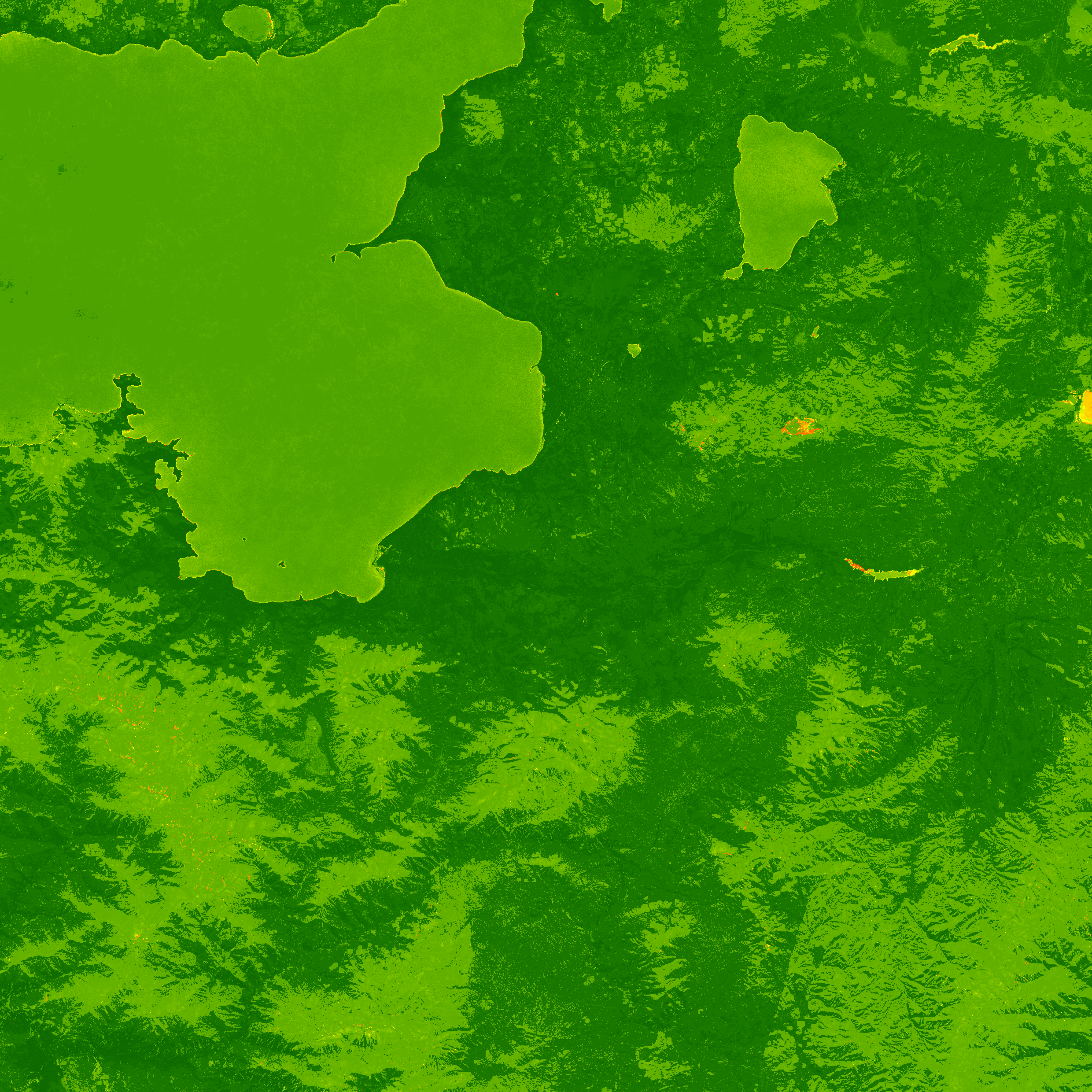
Water Confidence Layer 2021 (raster 10 m), Europe, 3-yearly
The Confidence Layer (WCL) is one of the products of the pan-European High-Resolution Water Snow & Ice portfolio (HR-WSI), which are provided at high spatial resolution from the Sentinel-2 and Sentinel-1 constellations data from September 1, 2016 onwards.
The WCL is displaying a measure of confidence between 0 and 100%. It identifies the likelihood of (in)correctness on pixel level based on information gained during production for the WL for the 2021 reference year.
It is also generated in different spatial resolutions (10m and 100m) and projections (LAEA & WGS84/UTM).
The High Resolution Water Layer portfolio consists of the WL, the Water Presence Index (WPI), the Water confidence layer (WCL) and the Rolling archive (WLRA).
Simple
- Date ( Publication )
- 2025-03-25
- Edition
- 01.00
- Identifier
- copernicus_r_3035_10_m_wcl_p_2016-2021_v01_r00
- Identifier
- a67c24d-a8b3-4b43-a321-aedf9e5f0c83
- Unique resource identifier
- 10.2909/5838901a-1fab-4123-823e-426e1b4963eb
Point of contact
- Maintenance and update frequency
- threeYears
- GEMET - INSPIRE themes, version 1.0 ( Theme )
- Keywords
-
- Continents, countries, sea regions of the world. ( Place )
-
- United Kingdom
- EEA38 (from 2020)
- Keywords
-
- GEMET ( Theme )
- Spatial scope ( Theme )
- EEA topics ( Theme )
- Temporal resolution ( Temporal )
-
- As needed
- Access constraints
- Other restrictions
- Other constraints
- no limitations to public access
- Use constraints
- Other restrictions
- Other constraints
-
The Copernicus component is governed by Regulation (EU) No 2021/696 of the European Parliament and of the Council of 28 April 2021 establishing the Union Space Programme and the European Union Agency for the Space Programme and repealing Regulations (EU) No 912/2010, (EU) No 1285/2013 and (EU) No 377/2014 and Decision No 541/2014/EU. Within the Copernicus component, a portfolio of land monitoring activities has been delegated by the European Union to the European Environment Agency (EEA) and the DG Joint Research Centre of the European Commission.
The Copernicus land monitoring products and services are made available on a principle of full, open and free access, as established by the Commission Delegated Regulation (EU) No 1159/2013 of 12 July 2013.
Free, full and open access to the products and services of the Copernicus Land Monitoring Service is made on the conditions that:
1. When distributing or communicating Copernicus Land Monitoring Service products and services (data, software scripts, web services, user and methodological documentation and similar) to the public, users shall inform the public of the source of these products and services.
2. Where the Copernicus Land Monitoring Service products and services have been adapted or modified by the user, the user shall clearly state this.
3. Users shall make sure not to convey the impression to the public that the user's activities are officially endorsed by the European Union.
- Spatial representation type
- grid Grid
- Distance
- 10 m
- Metadata language
- en
- Character set
- utf8 UTF8
- Topic category
-
- Environment
- Begin date
- 2016-09-01
- End date
- 2021-12-31 Now
))
- Unique resource identifier
- EPSG:3035
- Distribution format
-
-
GeoTIFF
(
1.0
)
-
GeoTIFF
(
1.0
)
OnLine resource
- OnLine resource
- https://doi.org/10.2909/5838901a-1fab-4123-823e-426e1b4963eb ( DOI )
- Hierarchy level
- Dataset
Domain consistency
Domain consistency
Conformance result
- Date ( Publication )
- 2010-12-08
- Explanation
- See the referenced specification
- Statement
- The confidence layer combines multiple quality and processing-based parameters. For the calculation, the water and probabilities from September 2016 to December 2021 were used. This results in merged probabilities for 64 months.
- File identifier
- 5838901a-1fab-4123-823e-426e1b4963eb XML
- Metadata language
- en
- Character set
- UTF8
- Hierarchy level
- Dataset
- Date stamp
- 2025-10-09T10:51:47.581944Z
- Metadata standard name
- ISO 19115/19139
- Metadata standard version
- 1.0
Overviews
Spatial extent
Provided by
