 Arctic SDI catalogue
Canadian Anchorages and Anchorage Areas
Simple
- Date ( RI_367 )
- 2020-02-26
- Date ( RI_366 )
- 2019-12-05
- Status
- onGoing; enContinue RI_596
- Maintenance and update frequency
- asNeeded; auBesoin RI_540
- Government of Canada Core Subject Thesaurus Thésaurus des sujets de base du gouvernement du Canada ( RI_528 )
-
- Coastal waters
- Geographic data
- Geographic information systems
- Geography
- Government information
- Maps
- Marine safety
- Navigation
- Oceans
- Transportation safety
- Water transport
- Classification
- unclassified; nonClassifié RI_484
- Use limitation
- Open Government Licence - Canada (http://open.canada.ca/en/open-government-licence-canada)
- Access constraints
- license; licence RI_606
- Use constraints
- license; licence RI_606
- Spatial representation type
- vector; vecteur RI_635
- Metadata language
- eng; CAN
- Character set
- utf8; utf8 RI_458
- Topic category
-
- Oceans
- Inland waters
- Transportation
- Begin date
- 2019-12-05
))
- Reference system identifier
- http://www.epsg-registry.org / EPSG:4326 /
- Distribution format
-
-
SHP
(
unknown
)
-
ESRI REST
(
unknown
)
-
SHP
(
unknown
)
- OnLine resource
-
Chart 1 : Symbols, Abbreviations and Terms
(
HTTPS
)
Supporting Document;HTML;eng
- OnLine resource
-
Canadian Chart 1 Symbols, Abbreviations and Terms
(
HTTPS
)
Supporting Document;HTML;fra
- OnLine resource
-
Chart 1 : Symbols, Abbreviations and Terms
(
HTTPS
)
Supporting Document;HTML;fra
- OnLine resource
-
Canadian Chart 1 Symbols, Abbreviations and Terms
(
HTTPS
)
Supporting Document;HTML;eng
- OnLine resource
-
Canadian Anchorages and Anchorage Areas
(
ESRI REST: Map Server
)
Web Service;ESRI REST;eng
- OnLine resource
-
Canadian Anchorages and Anchorage Areas
(
HTTPS
)
Dataset;SHP;eng,fra
- OnLine resource
-
Canadian Anchorages and Anchorage Areas
(
ESRI REST: Map Server
)
Web Service;ESRI REST;fra
- File identifier
- 622a7f72-4a00-4f9e-b04f-af6551c77db3 XML
- Metadata language
- eng; CAN
- Character set
- utf8; utf8 RI_458
- Hierarchy level
- dataset; jeuDonnées RI_622
- Date stamp
- 2025-02-06T00:22:39.923Z
- Metadata standard name
- North American Profile of ISO 19115:2003 - Geographic information - Metadata
- Metadata standard version
- CAN/CGSB-171.100-2009
Overviews


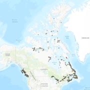
Spatial extent
Provided by
