 Arctic SDI catalogue
DTU gravity compilation
Simple
- Date ( Publication )
- 2022-01-01
- Identifier
- dk.geus / grl_gravity_compilation_dtu
- Presentation form
- Digital map
- Purpose
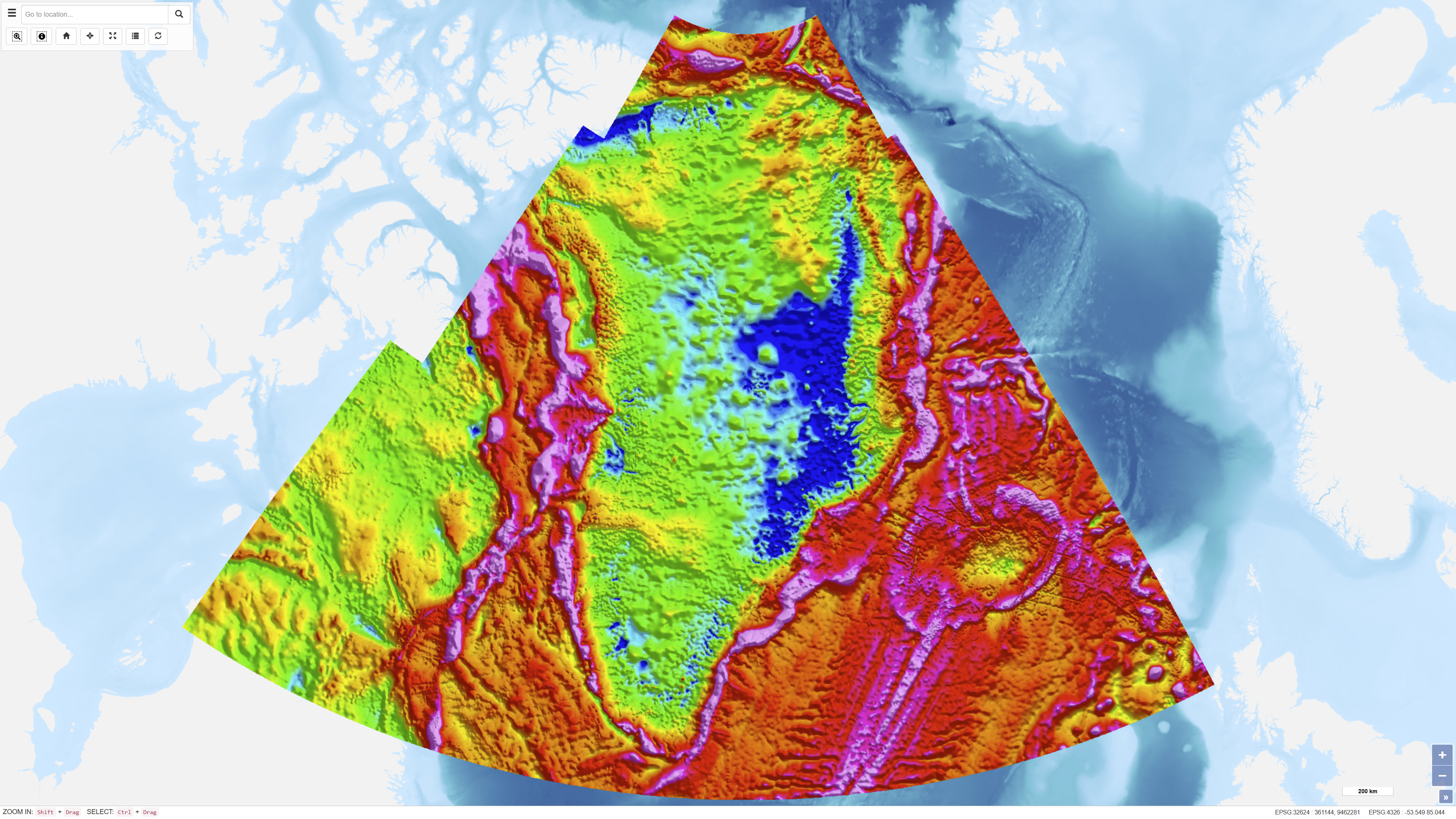
- The purpose of the dataset is to provide a consistent, regionally complete gravity framework for Greenland to support geological mapping, tectonic analysis and resource assessment. The compilation integrates multiple data sources into a unified model.
- Status
- Completed
- Maintenance and update frequency
- As needed
- Keywords ( Theme )
-
- Dataset
- Geophysics
- Gravity
- Bouguer Anomaly
- Free-air Anomaly
- DTU Space
- Greenland
- Forskningsemner Forskningsemner ( Theme )
- Geografisk Geografisk ( Place )
- Access constraints
- Other restrictions
- Use constraints
- Other restrictions
- Other constraints
- The dataset is based on gravity data managed by DTU Space. Rights and terms of use follow DTU Space's current terms and conditions. Users should ensure correct source attribution.
- Spatial representation type
- Grid
- Denominator
- 500000
- Metadata language
- en
- Character set
- UTF8
- Topic category
-
- Geoscientific information
))
- Supplemental Information
- The dataset represents a regional compilation rather than original individual observations. Data coverage and resolution vary depending on the underlying data sources. Use for detailed local analysis should consider variations in data density and origin.
- Reference system identifier
- WGS 84 / UTM 24N (EPSG:32624)
- Distribution format
-
-
WMS
(
)
-
REST
(
)
-
WMS
(
)
- OnLine resource
-
Interactive webmap
(
WWW:LINK-1.0-http--link
)
Interactive map displaying the dataset.
- OnLine resource
-
A new bed elevation dataset for Greenland
(
DOI
)
Bamber, J. L., Griggs, J. A., Hurkmans, R. T. W. L., Dowdeswell, J. A., Gogineni, S. P., Howat, I., Mouginot, J., Paden, J., Palmer, S., Rignot, E., and Steinhage, D.: A new bed elevation dataset for Greenland, The Cryosphere, 7, 499–510, https://doi.org/10.5194/tc-7-499-2013, 2013.
- OnLine resource
-
dtu_bouguer_anomaly
(
ESRI:REST
)
ArcGIS REST Service
- OnLine resource
-
bouguer_anomaly
(
OGC:WMS-1.3.0-http-get-capabilities
)
ArcGIS WMS Service
- OnLine resource
-
Global gravity field from recent satellites (DTU15) - Arctic improvements
(
DOI
)
Andersen, O.B., P. Knudsen, S. Kenyon, J.K. Factor and S. Holmes: Global gravity field from recent satellites (DTU15) - Arctic improvements. First Break, Volume 35, Issue 12, Dec 2017
- Hierarchy level
- Dataset
- Statement
- The dataset has been established as a compilation of terrestrial, marine, airborne and satellite-derived gravity observations maintained by DTU Space. Data have been homogenised and adjusted to a common reference framework prior to calculation of free-air and Bouguer anomalies. Terrain corrections are based on digital elevation models. Over the Greenland Ice Sheet, ice thickness information is derived from the model presented by Bamber et al. (2013), which integrates radar and satellite data to determine ice thickness and bed topography. In areas without direct gravity observations, satellite-derived gravity models are used as supplementary input.
- File identifier
- 6d9f5c54-527e-4dee-ab49-4016d4810fc8 XML
- Metadata language
- Danskda
- Character set
- UTF8
- Hierarchy level
- Dataset
- Date stamp
- 2026-02-25T16:10:21.634003Z
- Metadata standard name
- ISO 19115:2003/19139
- Metadata standard version
- 1.0
Overviews
Spatial extent
Provided by
