 Arctic SDI catalogue
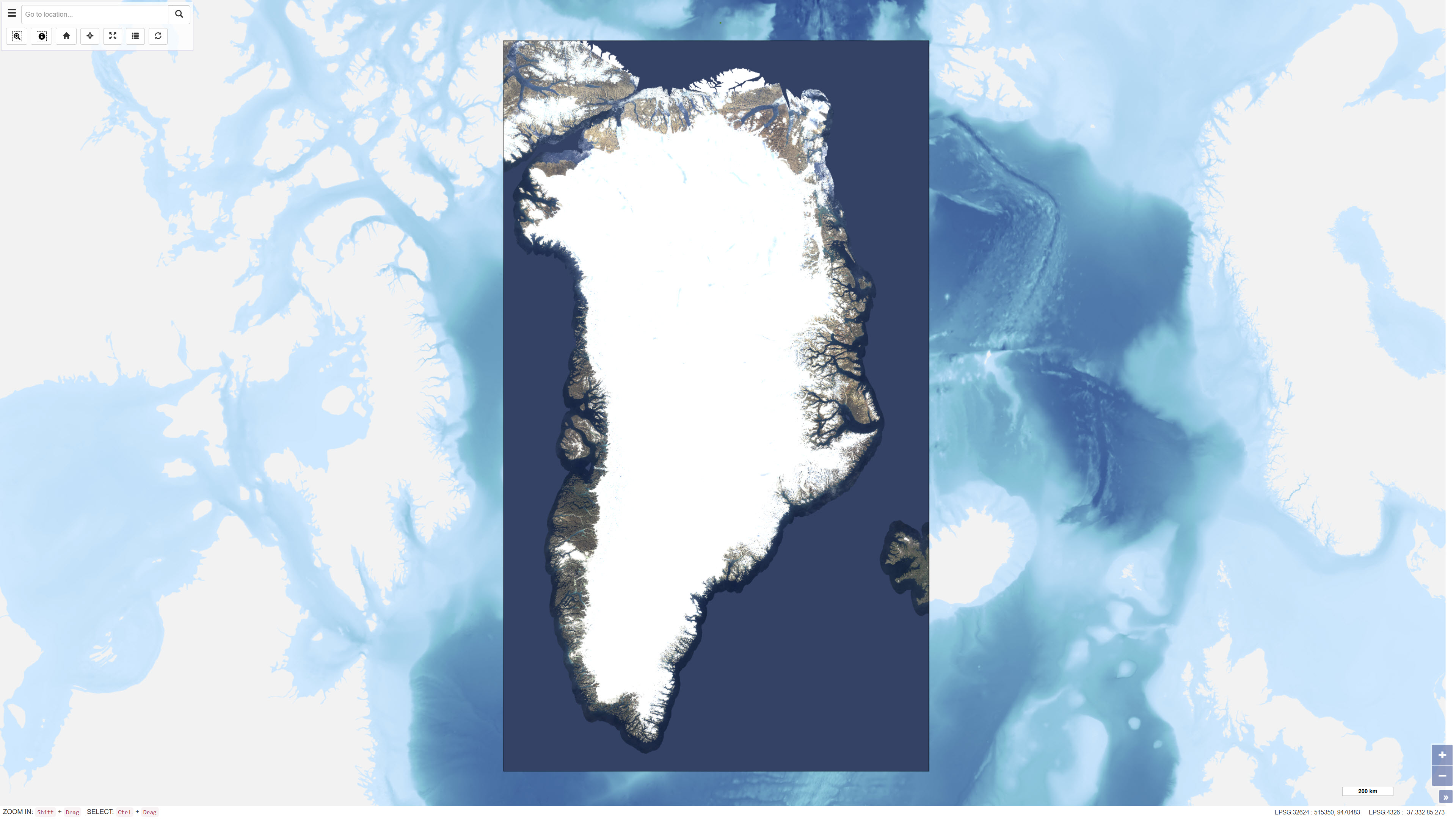
EOX Sentinel-2 Cloudless satellite images of Greenland
EOxCloudless is a global satellite imagery dataset consisting of near-cloudless mosaics derived from Copernicus Sentinel-2 multispectral satellite data. The dataset is produced by EOX IT Services GmbH and is designed to provide consistent, high-resolution surface imagery for mapping, analysis, and visualization purposes.
The mosaics are generated by combining a large number of Sentinel-2 Level-1C observations acquired over defined time periods. Advanced pixel selection algorithms and thematic masks (including clouds, cloud shadows, and water) are applied to reduce cloud contamination. For each pixel location, the most representative observation is selected based on statistical criteria and temporal analysis, resulting in near-cloudless composite images.
The dataset provides global land coverage and is typically delivered at a spatial resolution of 10 metres for the utilised spectral bands (blue, green, red, and near-infrared). EOxCloudless is suitable for use as a basemap as well as for environmental monitoring, land analysis, spatial planning, and other geoscientific applications.
Simple
- Date ( Publication )
- 2018-08-01
- Identifier
- dk.geus / eox_s2cloudless
- Presentation form
- Digital map
- Purpose
- The dataset has been adapted and created specifically for display on the Greenland Portal.
- Status
- Completed
- Maintenance and update frequency
- As needed
- Keywords ( Theme )
-
- Dataset
- Satellite
- Greenland
- Sentinel-2
- Forskningsemner Forskningsemner ( Theme )
- Geografisk Geografisk ( Place )
- Access constraints
- Other restrictions
- Use constraints
- Other restrictions
- Other constraints
- CC BY 4.0
- Spatial representation type
- Grid
- Denominator
- 50000
- Metadata language
- Da
- Character set
- UTF8
- Topic category
-
- Geoscientific information
- Imagery base maps earth cover
- Begin date
- 2017-01-01
- End date
- 2018-12-31
))
- Supplemental Information
-
Sentinel-2 cloudless [1] by EOX IT Services GmbH [2] is licensed under a Creative Commons Attribution 4.0 International License [3].
You are free to use Sentinel-2 cloudless for commercial and non-commercial purposes, as long as you provide proper attribution. It shall be displayed legibly and in proximity to the usage and read "Sentinel-2 cloudless - https://s2maps.eu by EOX IT Services GmbH (Contains modified Copernicus Sentinel data 2016 & 2017)". It shall include the links [1] and [2] in on-line usage.
- Reference system identifier
- WGS 84 / UTM 24N (EPSG:32624)
- Distribution format
-
-
WMTS
(
)
-
REST
(
)
-
WMTS
(
)
- OnLine resource
-
Sentinel-2 cloudless by EOX
(
WWW:LINK-1.0-http--link
)
The global Sentinel-2 map, crafted by EOX.
- OnLine resource
-
EOxCloudless
(
WWW:LINK-1.0-http--link
)
EOxCloudless official website
- OnLine resource
-
SatelliteImagery_EOX_s2cloudless_UTM24N
(
OGC:WMTS-1.0.0-http-get-capabilities
)
ArcGIS WMTS Service
- OnLine resource
-
EOX_s2cloudless_UTM24N
(
ESRI:REST
)
ArcGIS REST Service
- OnLine resource
-
Interactive webmap
(
WWW:LINK-1.0-http--link
)
Viewing the dataset on the web portal
- Hierarchy level
- Dataset
- Statement
- EOX Sentinel-2 cloudless is a purchased dataset from the company EOX that contains a mosaic of cloudless satellite imagery worldwide on a scale of 1:20.000. The original dataset consists of a GeoPackage with tiles of 512 x 512 pixels with LZW (lossless) compression where the individual tiles are stored as GeoTIFFs with 8-bit RGB bands, each in a non-projected geographical coordinate system (WGS 84, EPSG: 4326). The data set is cut to Greenland only and projected from WGS 84 to projected coordinate system WGS 84 / UTM 24N (EPSG: 32624).
- File identifier
- 6db5d3d9-0b37-4ef7-bae8-aee1c57bcb3d XML
- Metadata language
- Danskda
- Character set
- UTF8
- Hierarchy level
- Dataset
- Date stamp
- 2026-03-01T13:24:03.175651Z
- Metadata standard name
- ISO 19115:2003/19139
- Metadata standard version
- 1.0
Overviews
Spatial extent
Provided by
