 Arctic SDI catalogue
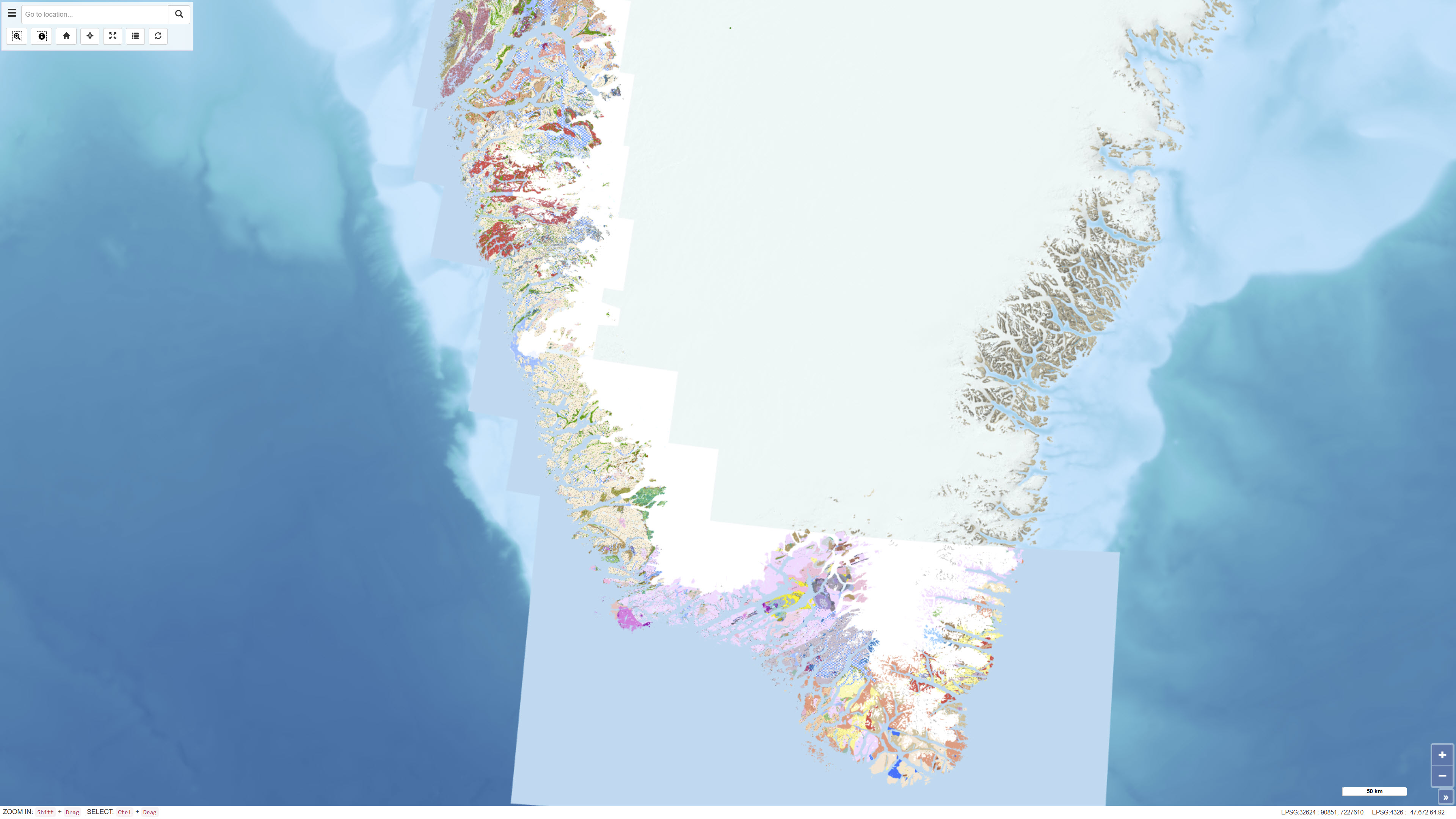
Geological map of South and South-West Greenland 1:100.000
Simple
- Date ( Publication )
- 2025-11-18
- Identifier
- dk.geus / geological_map_100k_ssw
- Presentation form
- Digital map
- Purpose
- The purpose of the seamless digital geological map is to provide a consistent and integrated geological reference framework for South and South-West Greenland, based on harmonised 1:100,000 scale mapping. The dataset is optimised for digital visualisation and analysis and integrates existing geological mapping with supplementary information in areas with limited coverage.
- Status
- Completed
- Maintenance and update frequency
- As needed
- Keywords ( Theme )
-
- Dataset
- Geology
- Greenland
- Mapping
- Stratigraphy
- Geodata
- ArcGIS
- QGIS
- Forskningsemner Forskningsemner ( Theme )
- Geografisk Geografisk ( Place )
- Access constraints
- Other restrictions
- Use constraints
- Other restrictions
- Other constraints
- CC BY 4.0
- Spatial representation type
- Vector
- Denominator
- 100000
- Metadata language
- en
- Character set
- UTF8
- Topic category
-
- Geoscientific information
- Imagery base maps earth cover
- Begin date
- 1966
- End date
- 2005
))
- Supplemental Information
- Recommended citation: Kokfelt, T.F., Keulen, N.T., Tandrup, K. & Willerslev, E. 2025. "Geological map of South and South-West Greenland 1:100 000", https://doi.org/10.22008/FK2/C45WZU, GEUS Dataverse, V3.
- Reference system identifier
- WGS 84 / UTM 24N (EPSG:32624)
- Distribution format
-
-
WMS
(
)
-
WMTS
(
)
-
REST
(
)
-
WMS
(
)
- OnLine resource
-
Download
(
WWW:DOWNLOAD-1.0-http--download
)
Download dataset from GEUS' Dataverse
- OnLine resource
-
Interactive webmap
(
WWW:LINK-1.0-http--link
)
Viewing the dataset on the web portal
- OnLine resource
-
SSW_Greenland
(
ESRI:REST
)
ArcGIS REST Service
- OnLine resource
-
Greenland_SSW_Greenland
(
OGC:WMTS-1.0.0-http-get-capabilities
)
ArcGIS WMTS Service
- OnLine resource
-
g100_geology
(
OGC:WMS-1.3.0-http-get-capabilities
)
ArcGIS WMS Service
- Hierarchy level
- Dataset
- Statement
- The dataset is the result of a continued effort to digitize and homogenize map sheets dating from the sixties to the nineties, made by different geologists.
- File identifier
- 730a2662-e422-4f7a-9666-22938e9dca9a XML
- Metadata language
- Danskda
- Character set
- UTF8
- Hierarchy level
- Dataset
- Date stamp
- 2026-02-11T13:29:29.503985Z
- Metadata standard name
- ISO 19115:2003/19139
- Metadata standard version
- 1.0
Overviews
Spatial extent
Provided by
