 Arctic SDI catalogue
High-Resolution Imagery, Banff National Park and Ya Ha Tinda Ranch, 2025
Simple
- Date ( RI_366 )
- 2025-08-21
- Date ( RI_367 )
- 2026-01-22
- Status
- completed; complété RI_593
- Maintenance and update frequency
- notPlanned; nonPlanifié RI_542
- Government of Canada Core Subject Thesaurus Thésaurus des sujets de base du gouvernement du Canada ( RI_528 )
-
- Aerial photography
- Open data
- Geographic data
- Open government
- Use limitation
- Open Government Licence - Canada (http://open.canada.ca/en/open-government-licence-canada)
- Access constraints
- license; licence RI_606
- Use constraints
- license; licence RI_606
- Spatial representation type
- grid; grille RI_636
- Metadata language
- eng; CAN
- Metadata language
- fre; CAN
- Character set
- utf8; utf8 RI_458
- Topic category
-
- Imagery base maps earth cover
- Begin date
- 2025-08-21
- End date
- 2025-08-23
))
- Reference system identifier
- EPSG / EPSG:26911 / 1.0
- Distribution format
-
-
COG
(
1.0
)
-
COG
(
1.0
)
- OnLine resource
-
Banff National Park and Ya Ha Tinda Ranch 2025 - Cloud Optimised GeoTIFF (COG)
(
HTTPS
)
Dataset;COG;zxx
- OnLine resource
-
Banff National Park and Ya Ha Tinda Ranch 2025 - Virtual raster file (VRT)
(
HTTPS
)
Dataset;other;zxx
- OnLine resource
-
SpatioTemporal Asset Catalog (STAC) browser
(
HTTPS
)
Dataset;COG;eng,fra
- OnLine resource
-
SpatioTemporal Asset Catalog (STAC) Application Programming Interface (API)
(
HTTPS
)
API;JSON;eng,fra
- File identifier
- 79bd1269-5bce-4cd7-b8d3-7da75b3e777a XML
- Metadata language
- eng; CAN
- Character set
- utf8; utf8 RI_458
- Hierarchy level
- dataset; jeuDonnées RI_622
- Date stamp
- 2026-09-24T12:00:41
- Metadata standard name
- North American Profile of ISO 19115:2003 - Geographic information - Metadata
- Metadata standard version
- CAN/CGSB-171.100-2009
Overviews
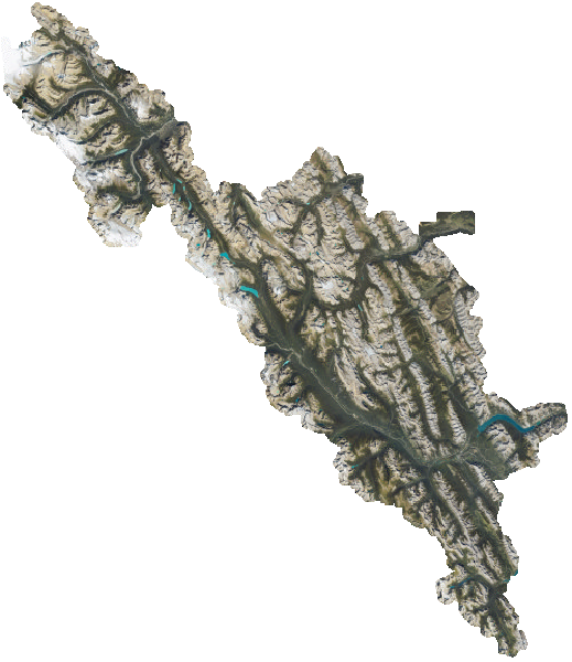
Spatial extent
Provided by
