 Arctic SDI catalogue
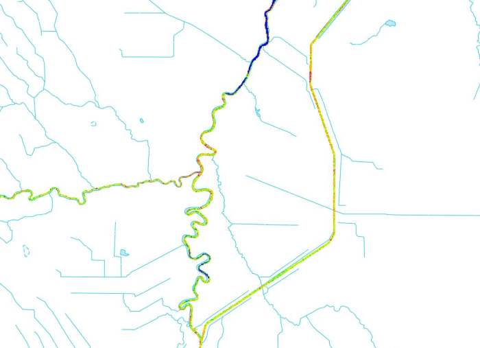
Active Monitoring of River Ice in Canada
River ice roughness products from the last three days in selected Canadian regions that have been designated for observation, monitored by Natural Resources Canada using satellite imagery for emergency response. Coverage is not comprehensive nationwide.
In order to mitigate ice jam induced flood risks, Natural Resources Canada emergency geomatics service (EGS) may be activated by Canada’s emergency management authorities. As new satellite imagery becomes available, NRCan will produce river ice roughness maps and update the dataset in near real time (4 hours). This item contains the latest river ice roughness products generated in the past three days. For any data older than 72 hours, please refer to the [River Ice in Canada - Current Year](https://open.canada.ca/data/en/dataset/8ca6f047-ddef-43d7-81c2-47654f4c69bd) entry.
The river ice product is generated and validated on a best effort basis. Various factors may affect the quality of the river ice roughness maps. Those factors include but are not limited to: environmental condition at the time of acquisition, image resolution or the limitations of the methodology used.
To view a specific product in Web Services, filter the data by date (UTC Date) and area of interest (AOI). A link to download specific EGS products is available in the Resources section.
Disclaimer:
Emergency response authorities are the primary users of these satellite-derived river ice roughness map products. These products are generated to provide analysis and emergency response situational awareness and to facilitate decision-making during major flood events. The river ice roughness products are generated rapidly and limited time is available for editing and validation. The river ice roughness products reflect the river ice surface roughness conditions at the date/time of acquisition. While efforts are made to produce high quality products, near-real time products may contain errors due to the limited time available for validation and the limited availability of ground truthing data.
Limitation of Liability:
Accordingly, the information contained on this website is provided on an “as is” basis and Natural Resources Canada makes no representations or warranties respecting the information, either expressed or implied, arising by law or otherwise, including but not limited to, effectiveness, completeness, accuracy or fitness for a particular purpose. Natural Resources Canada does not assume any liability in respect of any damage or loss based on the use of this website. In no event shall Natural Resources Canada be liable in any way for any direct, indirect, special, incidental, consequential, or other damages based on any use of this website or any other website to which this site is linked, including, without limitation, any lost profits or revenue or business interruption.
Parent Collection:
- **[River Ice State in Canada - Cartographic Product Collection](https://open.canada.ca/data/en/dataset/d1fcb44f-5f86-4957-bdb4-e6fd1aa69283)**
Simple
- Date ( RI_366 )
- 2018-10-12
- Date ( RI_367 )
- 2019-03-01
- Date ( RI_368 )
- 2022-12-08
- Status
- onGoing; enContinue RI_596
- Maintenance and update frequency
- irregular; irrégulier RI_541
- Government of Canada Core Subject Thesaurus Thésaurus des sujets de base du gouvernement du Canada ( RI_528 )
-
- Emergency services
- Ice
- Natural disasters
- Use limitation
- Open Government Licence - Canada (http://open.canada.ca/en/open-government-licence-canada)
- Access constraints
- license; licence RI_606
- Use constraints
- license; licence RI_606
- Spatial representation type
- grid; grille RI_636
- Metadata language
- eng
- Metadata language
- fra
- Character set
- utf8; utf8 RI_458
- Topic category
-
- Inland waters
- Begin date
- 2025-01-01
))
- Reference system identifier
- http://www.epsg-registry.org / EPSG:4326 /
- Distribution format
-
-
FGDB/GDB
(
10.3.1
)
- File decompression technique
- ZIP
-
TIFF
(
6.0
)
- File decompression technique
- ZIP
-
KMZ
(
2.2
)
- File decompression technique
- ZIP
-
WMS
(
1.3.0
)
-
ESRI REST
(
10.7.1
)
-
FGDB/GDB
(
10.3.1
)
- OnLine resource
-
River Ice In Canada - Active
(
ESRI REST: Tiled Map Service
)
Web Service;ESRI REST;eng
- OnLine resource
-
Prepackaged files sorted by year (download directory)
(
HTTPS
)
Dataset;TIFF;eng,fra
- OnLine resource
-
River Ice In Canada - Active - Footprints
(
ESRI REST: Map Server
)
Web Service;ESRI REST;fra
- OnLine resource
-
River Ice In Canada - Active - Footprints
(
OGC:WMS
)
Web Service;WMS;eng
- OnLine resource
-
River Ice In Canada - Active - Footprints
(
OGC:WMS
)
Web Service;WMS;fra
- OnLine resource
-
River Ice In Canada - Active and Footprints
(
HTTPS
)
Dataset;FGDB/GDB;eng,fra
- OnLine resource
-
River Ice In Canada - Guide
(
HTTPS
)
Supporting Document;PDF;eng
- OnLine resource
-
River Ice In Canada - Guide
(
HTTPS
)
Supporting Document;PDF;fra
- OnLine resource
-
River Ice In Canada - RFT
(
HTTPS
)
Supporting Document;XML;eng,fra
- OnLine resource
-
River Ice In Canada - RFT - English
(
HTTPS
)
Supporting Document;XML;eng
- OnLine resource
-
River Ice In Canada - RFT - French
(
HTTPS
)
Supporting Document;XML;fra
- OnLine resource
-
River Ice In Canada - Active - Footprints
(
ESRI REST: Map Server
)
Web Service;ESRI REST;eng
- OnLine resource
-
River Ice In Canada - Active
(
ESRI REST: Tiled Map Service
)
Web Service;ESRI REST;fra
- File identifier
- 7b210c58-2fc7-47c5-8b8a-2605c77d725c XML
- Metadata language
- fra; CAN
- Character set
- utf8; utf8 RI_458
- Parent identifier
- River Ice State in Canada - Cartographic Product Collection d1fcb44f-5f86-4957-bdb4-e6fd1aa69283
- Hierarchy level
- dataset; jeuDonnées RI_622
- Date stamp
- 2025-05-01T07:45:03
- Metadata standard name
- North American Profile of ISO 19115:2003 - Geographic information - Metadata
- Metadata standard version
- CAN/CGSB-171.100-2009
Overviews

Spatial extent
Provided by
