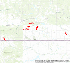
AAFC Infrastructure Flood Mapping in Saskatchewan
Simple
- Date ( RI_367 )
- 2014-04-24
- Date ( RI_366 )
- 2014-04-24
- Presentation form
- mapDigital;carteNumérique RI_391
- Status
- completed; complété RI_593
- Maintenance and update frequency
- notPlanned; nonPlanifié RI_542
- Government of Canada Core Subject Thesaurus Thésaurus des sujets de base du gouvernement du Canada ( RI_528 )
- 
                            - Earth sciences
- Topography
- Aerial photography
 
- Use limitation
- Open Government Licence - Canada (http://open.canada.ca/en/open-government-licence-canada)
- Access constraints
- license; licence RI_606
- Use constraints
- license; licence RI_606
- Spatial representation type
- vector; vecteur RI_635
- Spatial representation type
- grid; grille RI_636
- Spatial representation type
- textTable; texteTable RI_637
- Metadata language
- eng; CAN
- Topic category
- 
                            - Elevation
- Imagery base maps earth cover
 
- Begin date
- 2009-01-01
- End date
- 2013-01-01
)) 
                        - Reference system identifier
- http://www.epsg-registry.org/ / EPSG:3857 / 8.3.4
- OnLine resource
- 


                                Data Product Specification  (French)
                              
                            
                            (


                                HTTP
                              
                            
                            )
                            Supporting Document;PDF;fra 
- OnLine resource
- 


                                Data Product Specification  (English)
                              
                            
                            (


                                HTTP
                              
                            
                            )
                            Supporting Document;PDF;eng 
- OnLine resource
- 


                                AAFC - Multiple Sites - Saskatchewan LiDAR Survey  Report
                              
                            
                            (


                                HTTP
                              
                            
                            )
                            Supporting Document;PDF;eng 
- OnLine resource
- 


                                AAFC - Multiple Sites - Saskatchewan  Spring 2012 Collection LiDAR Survey Report
                              
                            
                            (


                                HTTP
                              
                            
                            )
                            Supporting Document;PDF;eng 
- OnLine resource
- 


                                Pre-packaged FGDB files
                              
                            
                            (


                                HTTP
                              
                            
                            )
                            Dataset;FGDB/GDB;eng,fra 
- OnLine resource
- 


                                Pre-packaged GeoJSON  files
                              
                            
                            (


                                HTTP
                              
                            
                            )
                            Dataset;GEOJSON;eng,fra 
- OnLine resource
- 


                                Pre-packaged GeoTIF  files
                              
                            
                            (


                                HTTP
                              
                            
                            )
                            Dataset;GeoTIF;zxx 
- OnLine resource
- 


                                Pre-packaged LASer  files
                              
                            
                            (


                                HTTP
                              
                            
                            )
                            Dataset;LAS;eng,fra 
- OnLine resource
- 


                                Sask Dams-LiDAR
                              
                            
                            (


                                HTTP
                              
                            
                            )
                            Supporting Document;TXT;eng 
- OnLine resource
- 


                                2013-1820-1741-Sask Dams-Air-Photo
                              
                            
                            (


                                HTTP
                              
                            
                            )
                            Supporting Document;TXT;eng 
- File identifier
- 7ca9fbd2-f3b9-4589-b3ed-0aac545b54bd XML
- Metadata language
- eng; CAN
- Character set
- utf8; utf8 RI_458
- Hierarchy level
- series; série RI_623
- Date stamp
- 2023-02-07T12:03:02
- Metadata standard name
- North American Profile of ISO 19115:2003 - Geographic information - Metadata
- Metadata standard version
- CAN/CGSB-171.100-2009
Overviews
 
                  Spatial extent
)) 
                  Provided by
 
                 Arctic SDI catalogue
                  Arctic SDI catalogue