 Arctic SDI catalogue
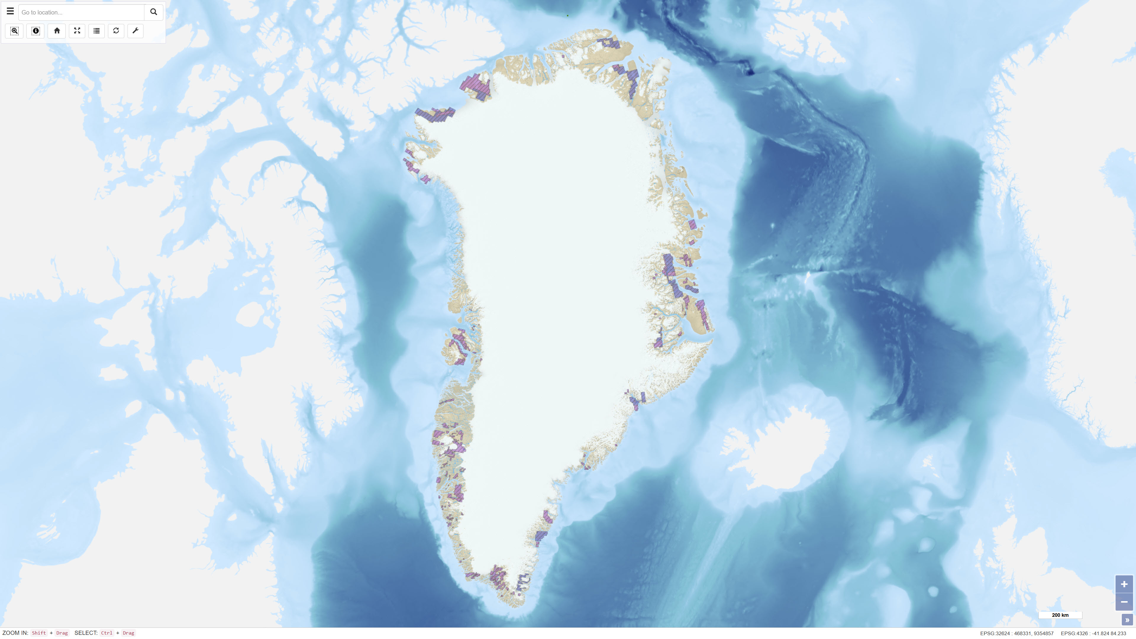
Historical Mineral Exploration and Exploitation Licences in Greenland
Simple
- Date ( Publication )
- 2022-01-01
- Identifier
- dk.geus / grl_historical_mineral_licences
- Presentation form
- Digital map
- Purpose
- The purpose of the dataset is to provide a geographic overview of former mineral licences in Greenland to support analysis, planning and historical documentation. The dataset may serve as a reference layer in the assessment of mineral activities and land management processes.
- Status
- On going
- Maintenance and update frequency
- As needed
- Keywords ( Theme )
-
- Dataset
- Mineral Licences
- Historical Licences
- Exploration
- Exploitation
- Administrative Boundaries
- Greenland
- Forskningsemner Forskningsemner ( Theme )
- Geografisk Geografisk ( Place )
- Access constraints
- Other restrictions
- Use constraints
- Other restrictions
- Other constraints
- The dataset is based on data provided by the Ministry of Mineral Resources in Greenland and is distributed by GEUS as reference data. The dataset does not constitute legally binding information and should be verified against official sources. Proper source citation is required.
- Spatial representation type
- Vector
- Denominator
- 500000
- Metadata language
- en
- Character set
- UTF8
- Topic category
-
- Economy
- Planning cadastre
))
- Supplemental Information
- The dataset functions as an administrative reference layer and does not constitute legally binding documentation of former licence conditions. Boundaries and licence status should be verified against official registers and applicable legislation maintained by the Ministry of Mineral Resources in Greenland. The dataset is primarily suitable for overview and screening purposes.
- Reference system identifier
- WGS 84 / UTM 24N (EPSG:32624)
- Distribution format
-
-
WFS
(
)
-
WMS
(
)
-
WFS
(
)
- OnLine resource
-
Interactive webmap
(
WWW:LINK-1.0-http--link
)
Interactive map displaying the dataset.
- OnLine resource
-
MLSA:mcas_mlsa_public_historic
(
OGC:WFS-1.0.0-http-get-capabilities
)
WFS Service from https://gis.govmin.gl/geoserver/web/?0
- OnLine resource
-
grl_lic_minerals_historical
(
OGC:WMS-1.1.1-http-get-capabilities
)
WMS for Greenland licenses licenses - Historical
- Hierarchy level
- Dataset
- Statement
- The dataset is based on geographic data provided via WFS by the Ministry of Mineral Resources in Greenland. The data are retrieved and converted into GEUS’ internal data structure and redistributed through GEUS’ MapServer setup without modification of the original polygon boundaries. Classification and attribute information follow the structure defined in the source service. The dataset is updated in accordance with changes in the official source service.
- File identifier
- 7e2e5437-9945-4bfe-b4ea-72a1e42f464d XML
- Metadata language
- Danskda
- Character set
- UTF8
- Hierarchy level
- Dataset
- Date stamp
- 2026-03-03T15:56:06.843354Z
- Metadata standard name
- ISO 19115:2003/19139
- Metadata standard version
- 1.0
Overviews
Spatial extent
Provided by
