 Arctic SDI catalogue
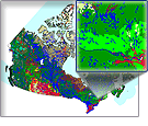
Prince Edward Island Detailed Soil Survey
Simple
- Date ( RI_367 )
- 2013-10-31
- Date ( RI_366 )
- 2013-10-31
- Presentation form
- mapDigital;carteNumérique RI_391
- Status
- completed; complété RI_593
- Maintenance and update frequency
- notPlanned; nonPlanifié RI_542
- Government of Canada Core Subject Thesaurus Thésaurus des sujets de base du gouvernement du Canada ( RI_528 )
-
- Soil
- Agriculture
- Temperature
- Farmlands
- Precipitation
- Crops
- Use limitation
- Open Government Licence - Canada (http://open.canada.ca/en/open-government-licence-canada)
- Access constraints
- license; licence RI_606
- Use constraints
- license; licence RI_606
- Spatial representation type
- vector; vecteur RI_635
- Spatial representation type
- textTable; texteTable RI_637
- Metadata language
- eng; CAN
- Topic category
-
- Geoscientific information
- Begin date
- 2013-01-01
))
- Reference system identifier
- http://www.epsg.org / EPSG: 3857 / 8.3.4
- OnLine resource
-
Pre-packaged FGDB files
(
HTTPS
)
Dataset;FGDB/GDB;eng,fra
- OnLine resource
-
Pre-packaged GeoPackage (GPKG) files
(
HTTPS
)
Dataset;GPKG;eng,fra
- OnLine resource
-
Pre-packaged CSV files
(
HTTPS
)
Dataset;CSV;eng,fra
- OnLine resource
-
Data Product Specification (English)
(
HTTPS
)
Supporting Document;PDF;eng
- OnLine resource
-
Data Product Specification (French)
(
HTTPS
)
Supporting Document;PDF;fra
- File identifier
- 7fa18ce7-6c14-438a-95c6-bb0906ddfb30 XML
- Metadata language
- eng; CAN
- Character set
- utf8; utf8 RI_458
- Parent identifier
- Detailed Soil Survey 7ed13bbe-fbac-417c-a942-ea2b3add1748
- Hierarchy level
- dataset; jeuDonnées RI_622
- Date stamp
- 2026-01-06T11:54:13
- Metadata standard name
- North American Profile of ISO 19115:2003 - Geographic information - Metadata
- Metadata standard version
- CAN/CGSB-171.100-2009
Overviews
Spatial extent
Provided by
