 Arctic SDI catalogue
Vertical aerial photographs of Greenland 1:150.000
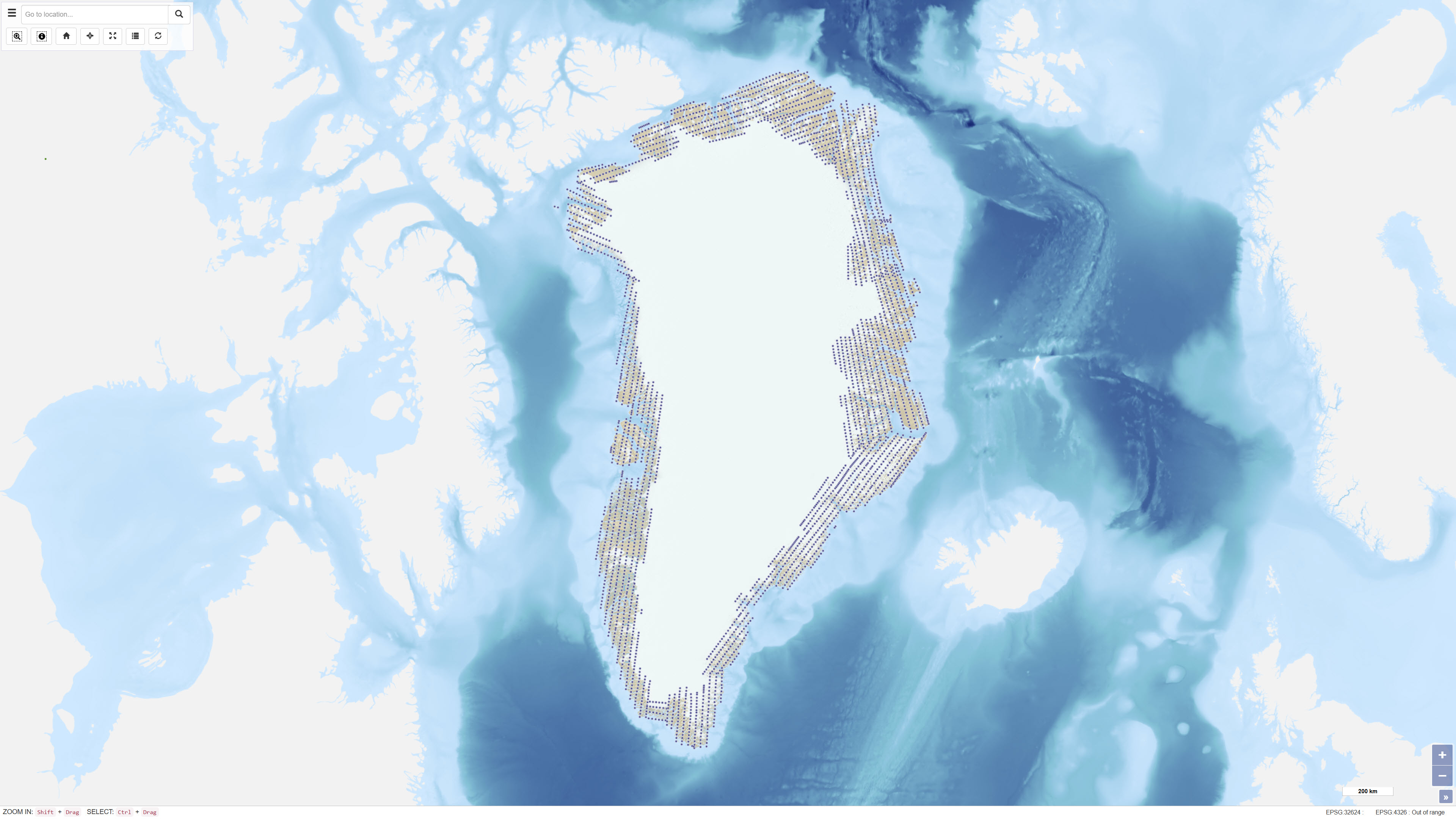
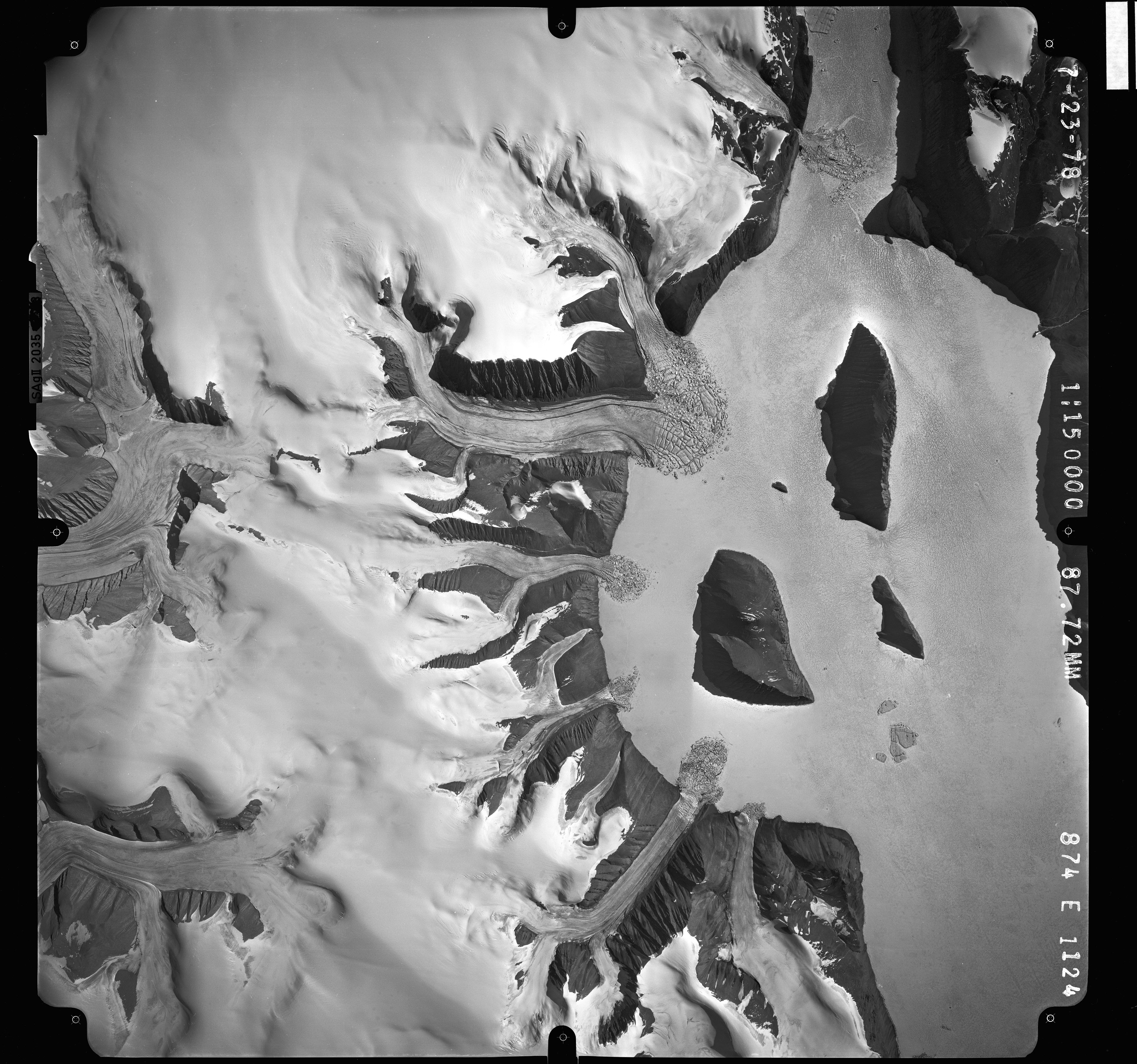
Uniform vertical aerial photographic coverage of Greenland was achieved between 1978 and 1987 at a scale of 1:150.000 by Mark Hurd Aerial Surveys, Inc., Minneapolis, Minnesota, U.S.A., on behalf of the Danish Geodetic Institute. The photography provided systematic nationwide coverage and formed a fundamental reference dataset for mapping and geodetic purposes.
The black-and-white photographs were acquired using a Wild RC-10 camera equipped with a super wide-angle lens (focal length 88 mm). The aircraft used was a Gates Learjet 25C, flying at approximately 14 km altitude to achieve the image scale of 1:150.000. To minimise blind areas caused by steep mountain slopes in combination with the wide-angle lens, photographs were acquired with 80% forward overlap and 40% side overlap.
Photo centre coordinates were established through aerotriangulation performed by the Danish Geodata Agency. The dataset has subsequently been used for mapping, aerotriangulation and scanning applications.
Simple
- Date ( Publication )
- 2023-12-03
- Identifier
- dk.geus / grl_vertical_aerial_photos_150k
- Presentation form
- Digital map
- Purpose
- The purpose of the dataset is to provide uniform national aerial photographic coverage of Greenland to support mapping, geodetic control and geological interpretation.
- Status
- Completed
- Maintenance and update frequency
- As needed
- Keywords ( Theme )
-
- Dataset
- Vertical aerial photographs
- Aerial photography
- Photogrammetry
- Greenland
- Forskningsemner Forskningsemner ( Theme )
- Geografisk Geografisk ( Place )
- Access constraints
- Other restrictions
- Use constraints
- Other restrictions
- Other constraints
- The original aerial photographs are the property of the Danish Geodata Agency. GEUS publishes the photographs online in a low-resolution version with permission from the rights holder. Reuse or redistribution may be subject to restrictions imposed by the Danish Geodata Agency.
- Spatial representation type
- Vector
- Denominator
- 150000
- Metadata language
- Da
- Character set
- UTF8
- Topic category
-
- Geoscientific information
- Begin date
- 1978-01-01
- End date
- 1987-12-31
))
- Supplemental Information
- The dataset represents the first uniform nationwide vertical aerial photographic coverage of Greenland and has served as a basis for subsequent mapping and elevation modelling.
- Reference system identifier
- WGS 84 / UTM 24N (EPSG:32624)
- Distribution format
-
-
KML
(
)
-
KML
(
)
- OnLine resource
-
Download
(
GLG:KML-2.0-http-get-map
)
Download Google KML service file.
- OnLine resource
-
Interactive webmap
(
WWW:LINK-1.0-http--link
)
Interactive map displaying the dataset.
- Hierarchy level
- Dataset
- Statement
-
The aerial photographs were acquired between 1978 and 1987 by Mark Hurd Aerial Surveys, Inc. for the Danish Geodetic Institute as part of a national aerial photography programme. The survey was designed to provide complete photographic coverage of Greenland at a uniform scale of 1:150,000.
The photographs were acquired with systematic forward and side overlap to ensure stereoscopic coverage and minimise blind areas. Subsequent aerotriangulation was performed by the Danish Geodata Agency to establish accurate photo centre coordinates. The dataset has since been used as a basis for mapping, geodetic and geoscientific applications.
- File identifier
- 7fc152da-aec8-49a5-9eb0-64f8bb981128 XML
- Metadata language
- Danskda
- Character set
- UTF8
- Hierarchy level
- Dataset
- Date stamp
- 2026-04-09T07:37:59.106833Z
- Metadata standard name
- ISO 19115:2003/19139
- Metadata standard version
- 1.0
Overviews
Spatial extent
Provided by
