 Arctic SDI catalogue
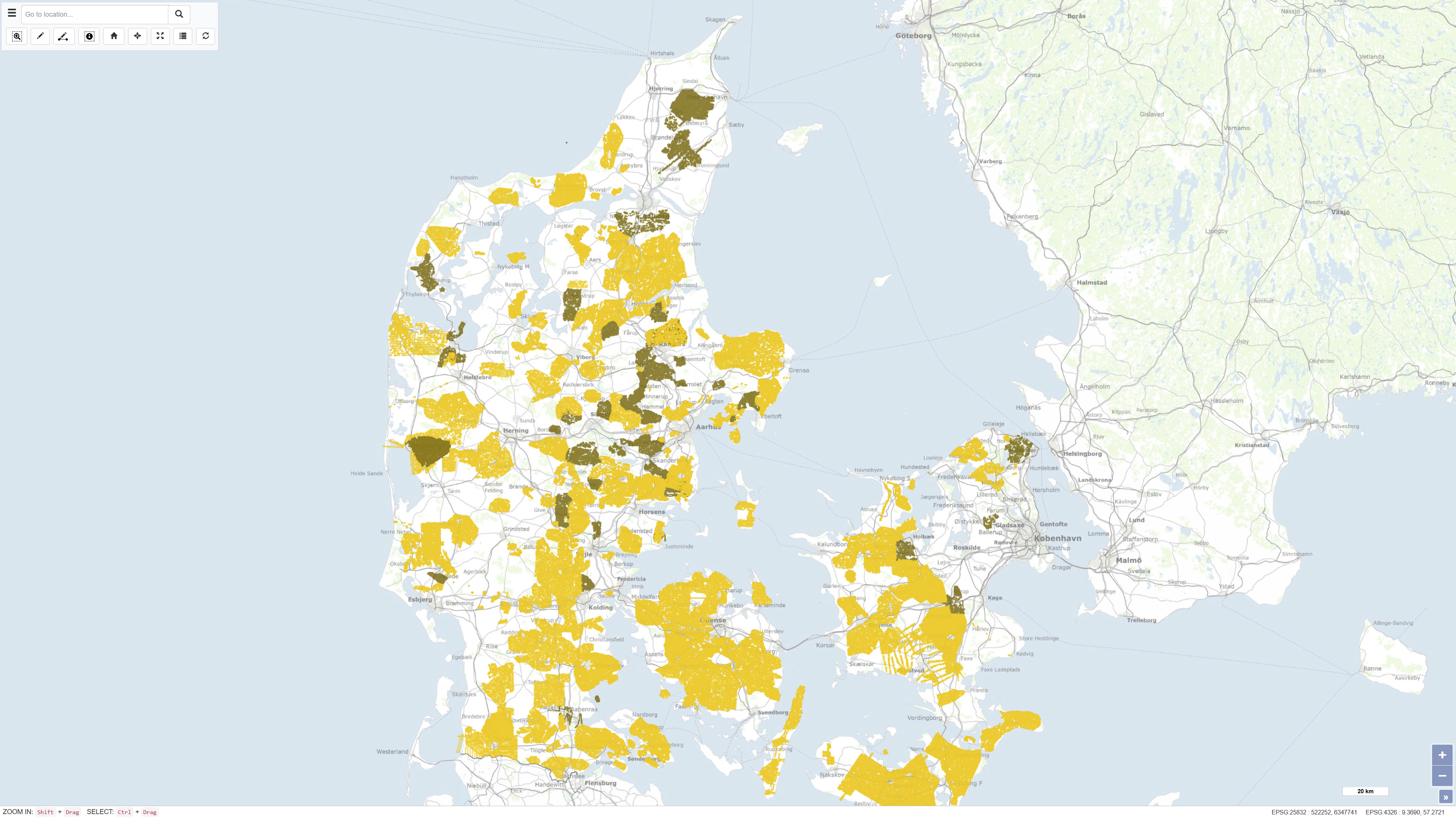
Surface-near geophysics in Denmark, Gerda
Nationwide geophysical database for environmental and raw material data, also known as GERDA (GEophysical Relational DAtabase).
The database contains various types of geophysics, including geoelectrics, electromagnetics, borehole logs and seismic. All data is freely available for download on the GEUS website.
The database is updated continuously.
Simple
- Date ( Publication )
- 2023-01-01
- Identifier
- dk.geus / dk_gerda
- Presentation form
- Digital table
- Purpose
- None specified
- Status
- On going
- Maintenance and update frequency
- As needed
- Keywords ( Theme )
-
- Dataset
- Geophysics
- Forskningsemner Forskningsemner ( Theme )
- Geografisk Geografisk ( Place )
- Access constraints
- Other restrictions
- Use constraints
- Other restrictions
- Other constraints
- CC BY 4.0
- Spatial representation type
- Vector
- Denominator
- 100
- Metadata language
- Da
- Character set
- UTF8
- Topic category
-
- Geoscientific information
))
- Supplemental Information
- None specified
- Reference system identifier
- ETRS 89 / UTM 32N (EPSG:25832)
- Distribution format
-
-
WMS
(
)
-
WFS
(
)
-
SHP
(
)
-
GeoJSON
(
)
-
WMS
(
)
- OnLine resource
-
Download
(
WWW:DOWNLOAD-1.0-http--download
)
Download dataset from GEUS' Products and services
- OnLine resource
-
Interactive webmap
(
WWW:LINK-1.0-http--link
)
Interactive map displaying the dataset.
- OnLine resource
-
National geophysical database (GERDA)
(
WWW:LINK-1.0-http--link
)
Here you find information about data in the national database for surface-near geophysics – GERDA. You also find information about exchange formats and data download and upload possibilities.
- OnLine resource
-
gerda_lines
(
OGC:WMS-1.3.0-http-get-capabilities
)
WMS for Lokationer for geofysiske data
- OnLine resource
-
ms:gerda_lines
(
OGC:WFS-1.0.0-http-get-capabilities
)
WFS for Lokationer for geofysiske data
- OnLine resource
-
Download
Download dataset as shapefile
- OnLine resource
-
Download
Download dataset as shapefile
- Hierarchy level
- Dataset
- Statement
- In cooperation with the then Danish Forest and Nature Agency, the Department Groundwater and Rawmaterials at the then Århus Amt (county), the Geological Institute at Aarhus University and GEUS, a pilot project was carried out in the period 1996 to 1997. The aim of the project was to prepare the establishment of a national database for geophysical data regarding raw material and environment. In 1998, this work resulted in the establishment of a database and an associated website. The database has since been developed to include more geophysical methods, just as data is continuously reported in connection with new studies. The data is quality assured by GEUS.
- File identifier
- 87a6e70c-b9aa-45f9-b96f-4a18c2f299ce XML
- Metadata language
- Danskda
- Character set
- UTF8
- Hierarchy level
- Dataset
- Date stamp
- 2026-03-02T11:49:32.404299Z
- Metadata standard name
- ISO 19115:2003/19139
- Metadata standard version
- 1.0
Overviews
Spatial extent
Provided by
