 Arctic SDI catalogue
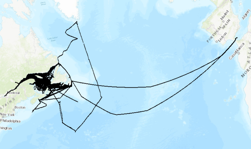
Surface temperature and salinity - Shipboard Thermosalinographs
1999 to 2023 surface temperature and salinity measured along the track of commercial ships, mostly between Montreal (Quebec) and St. John's (Newfoundland).
Monitoring of surface water conditions in the Estuary and Gulf of St. Lawrence is carried out with different complementary methods such as thermosalinographs (TSG) installed on commercial ships. These ships are sailing all year long from Montreal to St. John’s, one round trip per week, and are sampling water near the surface (3 to 8 meters deep) to determine the temperature and salinity all along the route.
Purpose
The recorded data are used as input to numerical forecasting models for sea ice conditions and as a monitoring tool for the Gulf of St. Lawrence.
Annual reports are available at the Canadian Science Advisory Secretariat (CSAS), (http://www.dfo-mpo.gc.ca/csas-sccs/index-eng.htm). Galbraith, P.S., Chassé, J., Caverhill, C., Nicot, P., Gilbert, D., Lefaivre, D. and Lafleur, C. 2018. Physical Oceanographic Conditions in the Gulf of St. Lawrence during 2017. DFO Can. Sci. Advis. Sec. Res. Doc. 2018/050. v + 79 p.
Simple
- Date ( RI_367 )
- 2019
- Date ( RI_366 )
- 2018
- Date ( RI_368 )
- 2023
- Status
- onGoing; enContinue RI_596
- Maintenance and update frequency
- annually; annuel RI_539
- Keywords ( RI_530 )
-
- Ocean Temperature
- Water Temperature
- Sea Surface Temperature
- Salinity
- Keywords ( RI_525 )
-
- St. Lawrence Estuary
- Gulf of St. Lawrence
- St. Lawrence River
- Cabot Strait
- Strait of Belle Isle
- Atlantic Ocean
- Thésaurus des sujets de base du gouvernement du Canada Government of Canada Core Subject Thesaurus ( RI_528 )
-
- Earth sciences
- Oceanography
- Physics
- Temperature
- Oceans
- Salt water
- Surface water
- Classification
- unclassified; nonClassifié RI_484
- Use limitation
- Open Government Licence - Canada (http://open.canada.ca/en/open-government-licence-canada)
- Access constraints
- license; licence RI_606
- Use constraints
- license; licence RI_606
- Spatial representation type
- vector; vecteur RI_635
- Metadata language
- fra; CAN
- Metadata language
- eng; CAN
- Character set
- utf8; utf8 RI_458
- Topic category
-
- Oceans
- Environment
- Begin date
- 1999
- End date
- 2023
))
- Reference system identifier
- EPSG / EPSG: 32198 / 7.4.1
- Distribution format
-
-
ESRI REST
(
10.3.1
)
-
CSV
(
Inconnue
)
-
ESRI REST
(
10.3.1
)
- OnLine resource
-
Map of surface temperature and salinity - Shipboard Thermosalinographs
(
ESRI REST: Map Server
)
Web Service;ESRI REST;eng
- OnLine resource
-
Map of surface temperature and salinity - Shipboard Thermosalinographs
(
ESRI REST: Map Server
)
Web Service;ESRI REST;fra
- OnLine resource
-
Data of surface temperature and salinity - Shipboard Thermosalinographs
(
HTTPS
)
Dataset;CSV;eng,fra
- OnLine resource
-
Data dictionary
(
HTTPS
)
Supporting Document;CSV;eng,fra
- File identifier
- 8a3dc9e5-f3af-4270-8c09-43fa2c25848b XML
- Metadata language
- fra; CAN
- Character set
- utf8; utf8 RI_458
- Hierarchy level
- dataset; jeuDonnées RI_622
- Date stamp
- 2025-02-04T20:44:56.674Z
- Metadata standard name
- North American Profile of ISO 19115:2003 - Geographic information - Metadata
- Metadata standard version
- CAN/CGSB-171.100-2009
Overviews
Spatial extent
Provided by
