 Arctic SDI catalogue
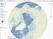
The Arctic SDI Topographic Basemap
The Arctic SDI Topographic Basemap is a WMTS service provided by Arctic SDI - a cooperation between the national mapping agencies in Canada, Denmark, Finland, Iceland, Norway, Russia, Sweden and US. It contains basic topographic information coming from these authoritative data sources:: Canada Centre for Mapping and Earth Observation - National Resources Canada, Danish Agency for Data Supply and Efficiency, National Land Survey of Finland, National Land Survey of Iceland, Norwegian Mapping Authority, Norwegian Polar Institute, Russian Federal Service for State Registration, Cadastre and Mapping, Swedish Mapping, Cadastre and Land Registration Authority and United States Geological Survey.
Simple
Identification info
- Date ( Creation )
- 2018-10-26
- Date ( Publication )
- 2018-10-26
- Date ( Revision )
- 2019-01-18
- Purpose
- The purpose of the Basemap for the Arctic is to provide a service sharing basic topographic information from authoritative data sources for the Arctic. To make the service widely usable the ASDI cooperation is applying international standards and a mainstream cooperation approach.
- Maintenance and update frequency
- As needed
- Keywords ( Place )
-
- The Arctic region and adjacent areas as defined by the countries themselves.
- Keywords ( Theme )
-
- Placenames
- Transport
- Landcover
- Hydrography
- Bathymetri(small scales)
- ISO 19119:2016 Geographic information -- Services
-
- infoMapAccessService
- Keywords
-
- Arctic
- Basemap
- Referencemap
- Panarctic
- Specific usage
- This Arctic Basemap is meant for use in the scale range 1:10.000.000 to 1:100.000. The Basemap covers the Arctic regions of the involved participating countries, as defined by the countries themselves. The Arctic can be identified and defined in many different ways depending on the parameters used (tree line, climate, Arctic Circle, temperature, flora, fauna, jurisdiction). Thus for some parts, the Basemap covers the entire territory of a country including areas normally considered outside of the Arctic region.
- Use limitation
- Open
- Access constraints
- Other restrictions
- Use constraints
- License
- Other constraints
- Creative Commons CC0
- Other constraints
- no restrictions
- Service Type
- view
N
S
E
W
))
- Coupling Type
- Tight
Contains Operations
No information provided.
- Reference system identifier
- / http://www.opengis.net/def/crs/EPSG/0/3572
- Reference system identifier
- / http://www.opengis.net/def/crs/EPSG/0/3574
- Reference system identifier
- / http://www.opengis.net/def/crs/EPSG/0/3571
- Reference system identifier
- / http://www.opengis.net/def/crs/EPSG/0/3576
- Reference system identifier
- / http://www.opengis.net/def/crs/EPSG/0/3575
- Reference system identifier
- / http://www.opengis.net/def/crs/EPSG/0/3573
- Distribution format
-
-
png
()
-
png
()
- OnLine resource
- http://basemap.arctic-sdi.org/mapcache/wmts/?service=wmts&version=1.1.0&request=getcapabilities ( OGC:WMTS )
- Hierarchy level
- Service
- File identifier
- 8b4f2b34-2d0d-4744-ae0f-d7989b9f7a02 XML
- Metadata language
- nor
- Hierarchy level
- Service
- Date stamp
- 2018-11-07
- Metadata standard name
- ISO19115
- Metadata standard version
- 2003
Overviews

original
miniatyrbilde

medium
Spatial extent
N
S
E
W
Provided by

Associated resources
Not available