 Arctic SDI catalogue
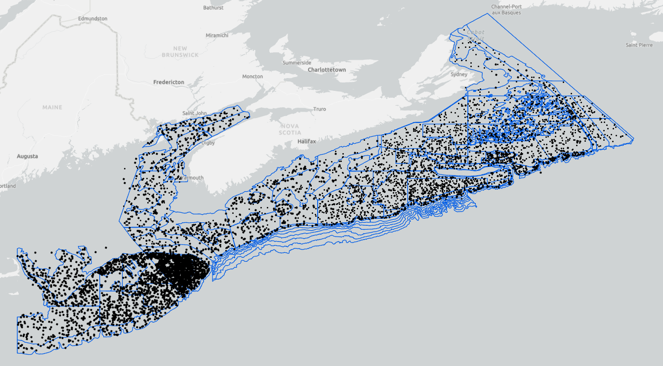
MARITIMES RESEARCH VESSEL SURVEYS
The Fisheries and Oceans Canada ecosystem surveys are conducted annually and are a source of integrated ecosystem monitoring data. These survey data are the primary data source for monitoring trends in species distribution, abundance, and biological condition within the region, and also provide data to the Atlantic Zonal Monitoring Program (AZMP) for monitoring hydrographic conditions, along with zooplankton and phytoplankton. The surveys follow a stratified random sampling design, and include sampling using a bottom otter trawl, CTD rosette and vertical plankton tows. Data from the bottom trawl catch are used to monitor the distribution and abundance of fish and invertebrates throughout the Scotian Shelf, Bay of Fundy and Georges Bank.
Cite this data as: Clark, D., Emberley, J. Data of MARITIMES RESEARCH VESSEL SURVEYS. Published January 2021. Population Ecology Division, Fisheries and Oceans Canada, Dartmouth, N.S. https://open.canada.ca/data/en/dataset/8ddcaeea-b806-4958-a79f-ba9ab645f53b
Simple
- Date ( RI_367 )
- 2021-01-14
- Date ( RI_366 )
- 1970
- Status
- onGoing; enContinue RI_596
- Maintenance and update frequency
- asNeeded; auBesoin RI_540
- Keywords ( RI_528 )
-
- Agricultural Aquatic Sciences
- Agriculture
- Animals/Vertebrates
- Aquatic Sciences
- Biological Classification
- Biosphere
- Earth Science
- Ecological Dynamics
- Fish
- Fisheries
- Oceans
- Species/Population Interactions
- Keywords ( RI_525 )
-
- Gulf of Maine and Bay of Fundy
- North Atlantic Ocean
- North Atlantic
- Scotian Shelf
- Government of Canada Core Subject Thesaurus Thésaurus des sujets de base du gouvernement du Canada ( RI_528 )
-
- Oceans
- Classification
- unclassified; nonClassifié RI_484
- Use limitation
- Open Government Licence - Canada (http://open.canada.ca/en/open-government-licence-canada)
- Access constraints
- license; licence RI_606
- Use constraints
- license; licence RI_606
- Spatial representation type
- vector; vecteur RI_635
- Metadata language
- eng; CAN
- Character set
- utf8; utf8 RI_458
- Topic category
-
- Oceans
- Biota
- Environment
- Begin date
- 1970
))
- Reference system identifier
- http://www.epsg-registry.org / EPSG:4326 / 8.2.6
- Distribution format
-
-
ESRI REST
(
10.6.1
)
-
CSV
(
1
)
-
WMS
(
1.1.1
)
-
WFS
(
1.1.0
)
-
ESRI REST
(
10.6.1
)
- OnLine resource
-
MARITIMES 4VSW RESEARCH VESSEL SURVEY
(
HTTPS
)
Supporting Document;HTML;eng,fra
- OnLine resource
-
MARITIMES FALL RESEARCH VESSEL SURVEY
(
HTTPS
)
Supporting Document;HTML;eng,fra
- OnLine resource
-
MARITIMES SPRING RESEARCH VESSEL SURVEY
(
HTTPS
)
Supporting Document;HTML;eng,fra
- OnLine resource
-
MARITIMES SUMMER RESEARCH VESSEL SURVEY
(
HTTPS
)
Supporting Document;HTML;eng,fra
- File identifier
- 8ddcaeea-b806-4958-a79f-ba9ab645f53b XML
- Metadata language
- eng; CAN
- Character set
- utf8; utf8 RI_458
- Hierarchy level
- series; série RI_623
- Date stamp
- 2026-04-24T14:21:23.320186Z
- Metadata standard name
- North American Profile of ISO 19115:2003 - Geographic information - Metadata
- Metadata standard version
- CAN/CGSB-171.100-2009
Overviews
Spatial extent
Provided by
