 Arctic SDI catalogue
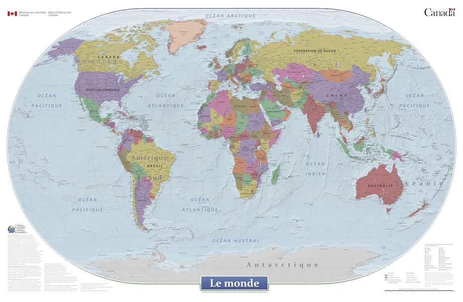
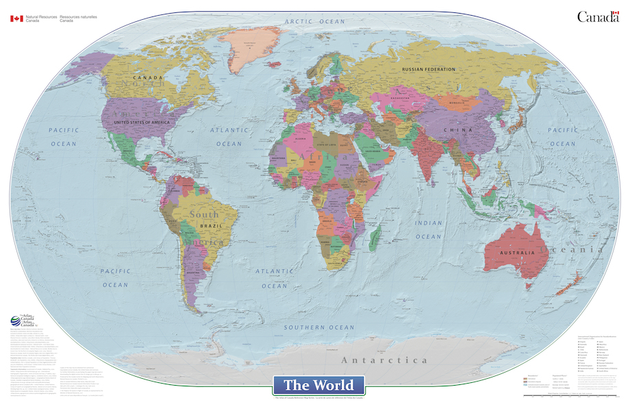
The World
This cartographic digital product is derived from the Atlas of Canada's wall map "The World" (MCR 0046) and "Le monde" (MCR 0046F) published in 2021.
The World is a general reference political map focused on the names and international boundaries of sovereign and non-sovereign countries. The information is portrayed using the Winkel II projection at a scale of 1:29 000 000. The dataset includes international boundaries, populated places, and labelled major hydrographic and physical features.
In the geodatabase the representation of political boundaries do not necessarily reflect the position of the Government of Canada on all international issues of recognition, sovereignty or jurisdiction; some of the populated places have seasonal populations, while others are research or military bases with no permanent populations; and, there are no attribute information in the geodatabase for the labelled hydrographic and physical features.
Simple
- Date ( RI_366 )
- 2019
- Date ( RI_367 )
- 2021-11-30
- Status
- completed; complété RI_593
- Maintenance and update frequency
- unknown; inconnu RI_543
- Keywords ( RI_528 )
-
- World
- World political map
- Government of Canada Core Subject Thesaurus Thésaurus des sujets de base du gouvernement du Canada ( RI_528 )
-
- Geographic data
- Geography
- Geographical maps
- Use limitation
- Open Government Licence - Canada (http://open.canada.ca/en/open-government-licence-canada)
- Access constraints
- license; licence RI_606
- Use constraints
- otherRestrictions; autresRestrictions RI_609
- Other constraints
-
This map is for informational purposes and has not been prepared for, or would not be suitable for, legal, engineering, or surveying purposes. The geographic data layers are provided as a public resource. Natural Resources Canada makes no warranties, expressed or implied, concerning the accuracy, completeness, or suitability of its data, and it should not be construed or used as a legal description. Every reasonable effort has been made to ensure the accuracy and completeness of the data.
Users of this information should review or consult the primary data and information sources to ascertain the usability of the information. Natural Resources Canada provides these data in good faith and shall in no event be liable for any incorrect results, any lost profits and special, indirect or consequential damages to any party, arising out of or in connection with the use or the inability to use the data herein or the services provided. Natural Resources Canada shall not be held liable for any third party’s interpretation of the data. Natural Resources Canada reserves the right to change or revise published data and/or these services at any time.
- Spatial representation type
- vector; vecteur RI_635
- Metadata language
- eng; CAN
- Metadata language
- fra
- Character set
- utf8; utf8 RI_458
- Topic category
-
- Boundaries
- Location
- Begin date
- 2002
- End date
- 2019
))
- Reference system identifier
- http://www.epsg-registry.org / unknown
- Distribution format
-
-
FGDB/GDB
(
10.6.1
)
-
FGDB/GDB
(
10.6.1
)
- OnLine resource
-
The World (mxd, mpk)
(
HTTPS
)
Dataset;MXD;fra
- OnLine resource
-
The World (mxd, mpk)
(
HTTPS
)
Dataset;MXD;eng
- OnLine resource
-
The World (300 dpi: pdf, jpg)
(
HTTPS
)
Supporting Document;PDF;eng
- OnLine resource
-
The World (300 dpi: pdf, jpg)
(
HTTPS
)
Supporting Document;PDF;fra
- OnLine resource
-
The World (2021) wall map
(
HTTPS
)
Supporting Document;HTML;eng
- OnLine resource
-
The World (2021) wall map
(
HTTPS
)
Supporting Document;HTML;fra
- OnLine resource
-
The World (150 dpi jpg)
(
HTTPS
)
Supporting Document;JPG;fra
- OnLine resource
-
The World (150 dpi pdf)
(
HTTPS
)
Supporting Document;PDF;fra
- OnLine resource
-
The World (150 dpi jpg)
(
HTTPS
)
Supporting Document;JPG;eng
- OnLine resource
-
The World (150 dpi pdf)
(
HTTPS
)
Supporting Document;PDF;eng
- File identifier
- 8f1749a5-ac67-467a-9c01-752b375127c3 XML
- Metadata language
- eng; CAN
- Character set
- utf8; utf8 RI_458
- Hierarchy level
- dataset; jeuDonnées RI_622
- Date stamp
- 2022-02-09T13:30:58
- Metadata standard name
- North American Profile of ISO 19115:2003 - Geographic information - Metadata
- Metadata standard version
- CAN/CGSB-171.100-2009
Overviews
Spatial extent
Provided by
