 Arctic SDI catalogue
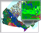
Alberta Detailed Soil Survey
The Agricultural Region of Alberta Soil Inventory Database (AGRASID3.0) Detailed Soil Survey dataset series at a scale of 1:100 000 consists of geo-referenced soil polygons with linkages to attribute data found in the associated Component File (CMP), Soil Names File (SNF) and Soil Layer File (SLF).
Together, these datasets describe the spatial distribution of soils and associated landscapes within the agricultural region of Alberta (an area of approximately 26M ha.)
Simple
- Date ( RI_367 )
- 2013-06-25
- Date ( RI_368 )
- 2015-02-12
- Date ( RI_366 )
- 2013-06-25
- Presentation form
- mapDigital;carteNumérique RI_391
- Status
- completed; complété RI_593
- Maintenance and update frequency
- unknown; inconnu RI_543
- Government of Canada Core Subject Thesaurus Thésaurus des sujets de base du gouvernement du Canada ( RI_528 )
-
- Soil taxonomy
- Use limitation
- Open Government Licence - Canada (http://open.canada.ca/en/open-government-licence-canada)
- Access constraints
- license; licence RI_606
- Use constraints
- license; licence RI_606
- Spatial representation type
- vector; vecteur RI_635
- Spatial representation type
- textTable; texteTable RI_637
- Metadata language
- eng; CAN
- Topic category
-
- Geoscientific information
- Begin date
- 2013-01-01
))
- Reference system identifier
- http://www.epsg.org / EPSG: 3857 / 8.3.4
- OnLine resource
-
Pre-packaged FGDB files (Bilingual)
(
HTTPS
)
Dataset;FGDB/GDB;eng,fra
- OnLine resource
-
Pre-packaged GeoPackage (GPKG) files (Bilingual)
(
HTTPS
)
Dataset;GPKG;eng,fra
- OnLine resource
-
Pre-packaged CSV files (Bilingual)
(
HTTPS
)
Dataset;CSV;eng,fra
- OnLine resource
-
Data Product Specification (English)
(
HTTPS
)
Supporting Document;PDF;eng
- OnLine resource
-
Data Product Specification (French)
(
HTTPS
)
Supporting Document;PDF;fra
- File identifier
- 9150ad66-73f7-444f-a67c-4be5cf676453 XML
- Metadata language
- eng; CAN
- Character set
- utf8; utf8 RI_458
- Parent identifier
- Detailed Soil Survey 7ed13bbe-fbac-417c-a942-ea2b3add1748
- Hierarchy level
- dataset; jeuDonnées RI_622
- Date stamp
- 2026-01-06T11:38:19
- Metadata standard name
- North American Profile of ISO 19115:2003 - Geographic information - Metadata
- Metadata standard version
- CAN/CGSB-171.100-2009
Overviews
Spatial extent
Provided by
