 Arctic SDI catalogue
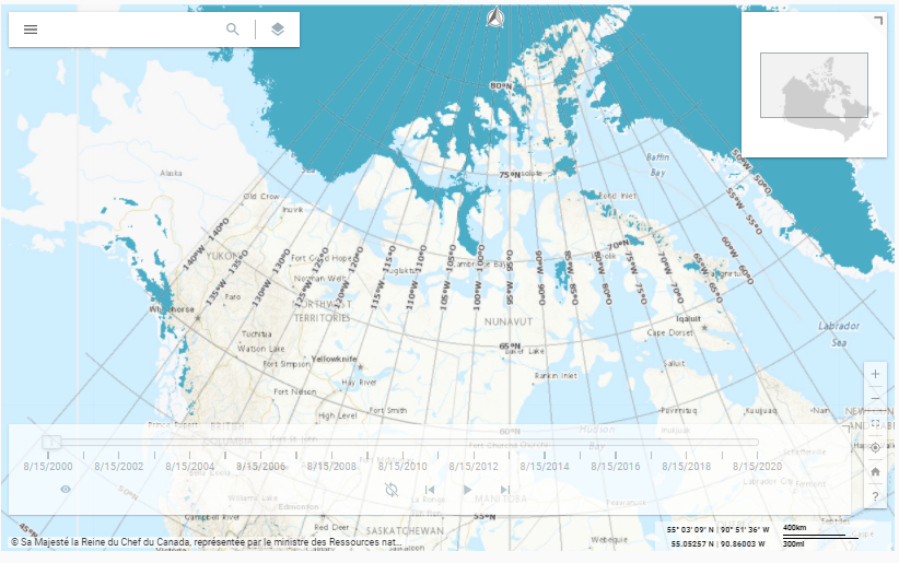
Atlas of Canada National Scale Data – Annual Minimum Snow and Ice (MSI) Extent Time Series
The Annual Minimum Snow and Ice (MSI) Extent of the Atlas of Canada National Scale Data, are data sets compiled containing annual data from 2000 to present. The data sets were derived from research published by the Canada Centre for Remote Sensing which classified satellite imagery over Canada and neighbouring regions for the continued presence or absence of snow and ice from April 1 to September 20 each year. The Atlas of Canada MSI products consist of a vector dataset and a raster time-series animation application.
VECTOR DATASET
The vector dataset has been generalized to display at the scale of 1:1,000,000.
TIME-SERIES ANIMATION APPLICATION
The time-series animation application has not been generalized from its original scale (250 m pixels).
The application is disseminated through the Data Cube Platform, implemented by the Canada Centre for Mapping and Earth Observation, Natural Resources Canada using geospatial big data management techniques. These technologies enable the rapid and efficient visualization of high-resolution geospatial data and allow for the rapid generation of dynamically derived products. The time-series is also available as a Web Map Service (WMS) and Web Coverage Service (WCS).
CREDIT
Source data provided by Alexander P. Trishchenko, Canada Centre for Remote Sensing, Natural Resources Canada
Metadata record: https://open.canada.ca/data/en/dataset/808b84a1-6356-4103-a8e9-db46d5c20fcf
Simple
- Date ( RI_367 )
- 2021-05
- Date ( RI_366 )
- 2021-02
- Date ( RI_368 )
- 2024-03
- Purpose
- The Atlas of Canada National Scale Data 1:1,000,000 Series was compiled to be used for atlas large scale (1:1,000,000 to 1:4,000,000) mapping. The MSI vectors were originally created to validate glacier layers at 1:1,000,000 based on Randolph Glacier Inventory 5.0 (https://www.glims.org/RGI/) . The processing power of the data cube was used to create a time-series animation based on the original raster files.
- Credit
-
Source data provided by Alexander P. Trishchenko, Canada Centre for Remote Sensing, Natural Resources Canada
Metadata record: https://open.canada.ca/data/en/dataset/808b84a1-6356-4103-a8e9-db46d5c20fcf
- Status
- onGoing; enContinue RI_596
- Maintenance and update frequency
- annually; annuel RI_539
- Keywords ( RI_528 )
-
- snow cover
- ice cover
- Government of Canada Core Subject Thesaurus Thésaurus des sujets de base du gouvernement du Canada ( RI_528 )
-
- Climate change
- Ice
- Snow
- Ice caps
- Glaciers
- Use limitation
- Open Government Licence - Canada (http://open.canada.ca/en/open-government-licence-canada)
- Access constraints
- license; licence RI_606
- Use constraints
- license; licence RI_606
- Spatial representation type
- vector; vecteur RI_635
- Metadata language
- eng; CAN
- Metadata language
- fra
- Topic category
-
- Climatology, meteorology, atmosphere
- Begin date
- 2000-04
- End date
- 2023-08
))
- Reference system identifier
- http://www.epsg-registry.org / EPSG:3978 /
- Distribution format
-
-
SHP
(
Unknown
)
-
FGDB/GDB
(
10
)
-
WMS
(
1.3.0
)
-
WCS
(
1.1.1
)
-
Web App
(
unknown
)
-
SHP
(
Unknown
)
- OnLine resource
-
MSI Time Series Application 2000 - 2023
(
HTTPS
)
Application;Web App;eng
- OnLine resource
-
MSI Time Series Application 2000 - 2023
(
HTTPS
)
Application;Web App;fra
- OnLine resource
-
WMS - MSI Time Series 2000 - 2023
(
HTTPS
)
Web Service;WMS;eng,fra
- OnLine resource
-
WCS - MSI Time Series 2000 - 2023
(
HTTPS
)
Web Service;WCS;eng,fra
- OnLine resource
-
MSI vectors 2000-2019 Download ZIP (gdb, shp) through HTTP
(
HTTP
)
Dataset;ZIP;eng,fra
- OnLine resource
-
Initial validation of Randolph Glacier inventory: version 5.0 data over Canada using 250 m MODIS-derived annual minimum snow/ice extent (English only)
(
HTTP
)
Supporting Document;PDF;eng
- OnLine resource
-
SpatioTemporal Asset Catalog (STAC) Application Programming Interface (API)
(
HTTPS
)
API;JSON;zxx
- OnLine resource
-
Probability of permanent snow and ice (94% or more)
(
OGC:WMS
)
Web Service;WMS;eng
- OnLine resource
-
Probability of permanent snow and ice (94% or more)
(
OGC:WMS
)
Web Service;WMS;fra
Data quality info
- Hierarchy level
- service; service RI_631
- Description
-
Time Series
The web application and the WMS, WCS services present the MSI V4 data from the Trishchenko et al. research (see credits). For the layer Permanent snow/ice (prob. 94% or more), a threshold of 94% is dynamically applied to the original image. Probability equal to 94% (i.e., 16 or 17 points of snow/ice) was originally chosen as the threshold value for "permanent" snow/ice cover in Trishchenko et al. (2016).
- Hierarchy level
- dataset; jeuDonnées RI_622
- Description
-
Vector Dataset
The 1:1 million Annual Minimum Snow and Ice (MSI) layers were produced from the MSI raster data (see credits).
The raster cells for each year that met the threshold (greater or equal to 194) were selected and converted into vectors. This threshold represents a 94% probability of the consistent presence of snow or ice over a particular pixel location. Once the selected raster cells were converted into a vector layer, polygons were generated for all holes within each polygon and attributes were assigned to identify MSI and hole features. The area for each polygon was also assigned to a new field so it could be used for selection purposes. Once this initial layer was generated, MSI polygons (500,000 m2) and holes polygons (100,000 m2) were selected based on a size threshold. Polygons below the threshold were removed and holes below the threshold were dissolved and merged with the MSI polygons. These features were then smoothed using the PAEK (Polynomial Approximation with Exponential Kernel) algorithm and simplified (removes extra vertices). The polygon layer was then dissolved to remove any overlap and erroneous small polygons were removed creating the final MSI layer.
For the period 2000-2016 the data used is from MSI V3 derived from MODIS/Terra Collection 5 surface level data. For the period 2017-2019 the data used is from MSI V4 top-of-atmosphere (TOA) clear-sky composites generated from MODIS Collection 6. Since there is no significant statistical difference between V3 and V4, the vector data for the period 2000-2016 was not reprocessed for V4. August 15th is used as the approximate average date for MSI for each year.
- File identifier
- 93d94cac-05d2-4ea0-82e1-3ff8500ebf93 XML
- Metadata language
- eng; CAN
- Character set
- utf8; utf8 RI_458
- Parent identifier
- Probability of the annual minimum snow and ice (MSI) presence over Canada 808b84a1-6356-4103-a8e9-db46d5c20fcf
- Hierarchy level
- dataset; jeuDonnées RI_622
- Date stamp
- 2024-03-19T09:24:01
- Metadata standard name
- North American Profile of ISO 19115:2003 - Geographic information - Metadata
- Metadata standard version
- CAN/CGSB-171.100-2009
Overviews
Spatial extent
Provided by
