 Arctic SDI catalogue
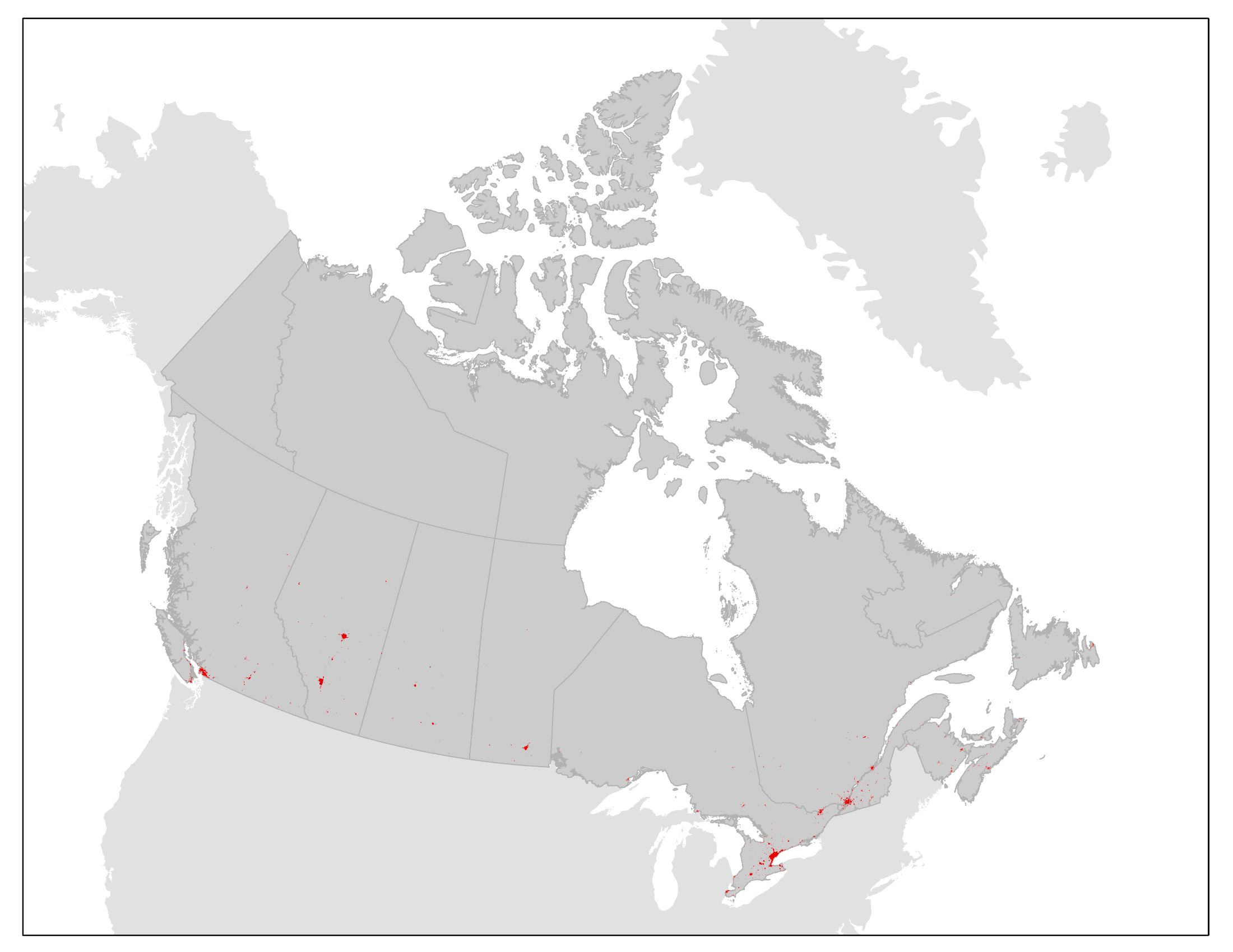
Contiguously Settled Areas: Settlement footprints, 2010 and 2020
This product contains contiguously settled area (CSA) boundaries for a subset of Canadian population centres for 2010 and 2020.
The CSA boundaries are derived from land cover data and represent the geographic extent of settled areas based on their physical footprint on the landscape. The boundaries can be used for reference, mapping and spatial analysis of settled areas and urban ecosystems.
The CSA boundaries are created and maintained under the umbrella of the Census of Environment, and will support Statistics Canada’s ecosystem accounting efforts following the System of Environmental-Economic Accounting — Ecosystem Accounting (SEEA EA) framework. The primary purpose of the CSA boundaries is to represent the extent of the contiguous urban footprint and allow for the measurement of settled area expansion over time. They will also contribute to the urban and industrial ecosystem class in Statistics Canada’s ecosystem accounting efforts. The boundaries will be used for other types of urban ecosystem analyses, including measures of urban ecosystem condition and services. The CSA boundaries may also be used for urban thematic accounts or to inform where users of ecosystem services are located.
Moving forward, CSA boundaries will be updated on an ongoing basis.
Simple
- Date ( RI_367 )
- 2023-10-27
- Date ( RI_366 )
- 2023-10-27
- Status
- completed; complété RI_593
- Maintenance and update frequency
- asNeeded; auBesoin RI_540
- Keywords ( RI_528 )
-
- Environment
- Contiguously settled area
- Boundaries
- Location
- Society
- Urban areas
- Settlements
- Government of Canada Core Subject Thesaurus Thésaurus des sujets de base du gouvernement du Canada ( RI_528 )
-
- Environment
- Use limitation
- Open Government Licence - Canada (http://open.canada.ca/en/open-government-licence-canada)
- Access constraints
- license; licence RI_606
- Use constraints
- license; licence RI_606
- Spatial representation type
- vector; vecteur RI_635
- Metadata language
- eng; CAN
- Metadata language
- fra;CAN
- Character set
- utf8; utf8 RI_458
- Topic category
-
- Environment
- Boundaries
- Begin date
- 2010-01
- End date
- 2020-12
))
- Supplemental Information
-
Contiguously settled areas (CSAs) are boundaries representing the spatial extent of settled areas based on their physical footprint on the landscape. They are derived from Agriculture and Agri-Food Canada's 30 m spatial resolution Semi-decadal Land Use Time Series.
For each CSA year, the land use product for the corresponding year was used as the base data. Settled areas were identified by extracting pixels from the Semi-decadal Land Use Time Series classified as one of the following classes: settlement, high reflectance settlement, settlement forest, roads, vegetated settlement or very high reflectance settlement. The population centre served as the starting point for identifying the core area of the contiguously settled area. For each population centre, the settled area intersecting its boundaries was selected and this area was edited according to a set of guidelines to create a boundary for the contiguously settled area. In general, pixels classified as settlement that are not contiguous with the core settled area are removed. Land covers other than built-up, such as forest, water, cropland and grassland, are included within CSA boundaries when enclosed by settled areas. If the contiguously settled areas of two or more population centres are attached, one CSA is created for the entire area and these areas are termed “agglomerated CSAs.”
CSA boundaries were produced for Statistics Canada population centres with a 2021 population greater than 5,000 persons or those within a census metropolitan area or census agglomeration, and do not include settled areas that are non-contiguous with these areas.
CSAs associated with a population centre that crosses provincial boundaries have been split into provincial portions. These include the CSAs of Ottawa-Gatineau, Hawkesbury and Lloydminster. Contiguously settled area boundaries were not created for the population centres of Iqaluit, Whitehorse and Yellowknife since the Semi-decadal Land Use Time Series does not have coverage for areas north of 60° N.
For more details of the CSA methodology, please see Contiguously Settled Areas: Boundaries and User Documentation.
- Reference system identifier
- http://www.epsg-registry.org / EPSG:3978 /
- Distribution format
-
-
SHP
(
10.8.1
)
-
ESRI REST
(
10.8.1
)
-
WMS
(
1.3.0
)
-
SHP
(
10.8.1
)
- OnLine resource
-
Contiguously Settled Areas boundary files and documentation
(
HTTPS
)
Dataset;SHP;eng
- OnLine resource
-
Recensement de l'environnement : mesurer l'expansion des zones habitées, 2010 à 2020
(
HTTPS
)
Supporting Document;HTML;fra
- OnLine resource
-
Fichiers des limites et documentation des zones habitées contiguës
(
HTTPS
)
Dataset;SHP;fra
- OnLine resource
-
Contiguously Settled Areas: Settlement footprints, 2010 and 2020
(
ESRI REST: Map Server
)
Web Service;ESRI REST;eng
- OnLine resource
-
Zones habitées contiguës : empreintes de peuplement, 2010 et 2020
(
ESRI REST: Map Server
)
Web Service;ESRI REST;fra
- OnLine resource
-
Contiguously Settled Areas: Settlement footprints, 2010 and 2020
(
OGC:WMS
)
Web Service;WMS;eng
- OnLine resource
-
Zones habitées contiguës : empreintes de peuplement, 2010 et 2020
(
OGC:WMS
)
Web Service;WMS;fra
- OnLine resource
-
Contiguously Settled Areas: Boundaries and User Documentation
(
HTTPS
)
Supporting Document;HTML;eng
- OnLine resource
-
Zones habitées contiguës : limites et documentation de l’utilisateur
(
HTTPS
)
Supporting Document;HTML;fra
- OnLine resource
-
Census of Environment: Measuring settled area expansion, 2010 to 2020
(
HTTPS
)
Supporting Document;HTML;eng
- File identifier
- 99464b99-92ef-462f-b67a-85cea6b986fc XML
- Metadata language
- eng; CAN
- Character set
- utf8; utf8 RI_458
- Hierarchy level
- dataset; jeuDonnées RI_622
- Date stamp
- 2024-05-07T13:37:25
- Metadata standard name
- North American Profile of ISO 19115:2003 - Geographic information - Metadata
- Metadata standard version
- CAN/CGSB-171.100-2009
Overviews
Spatial extent
Provided by
