 Arctic SDI catalogue
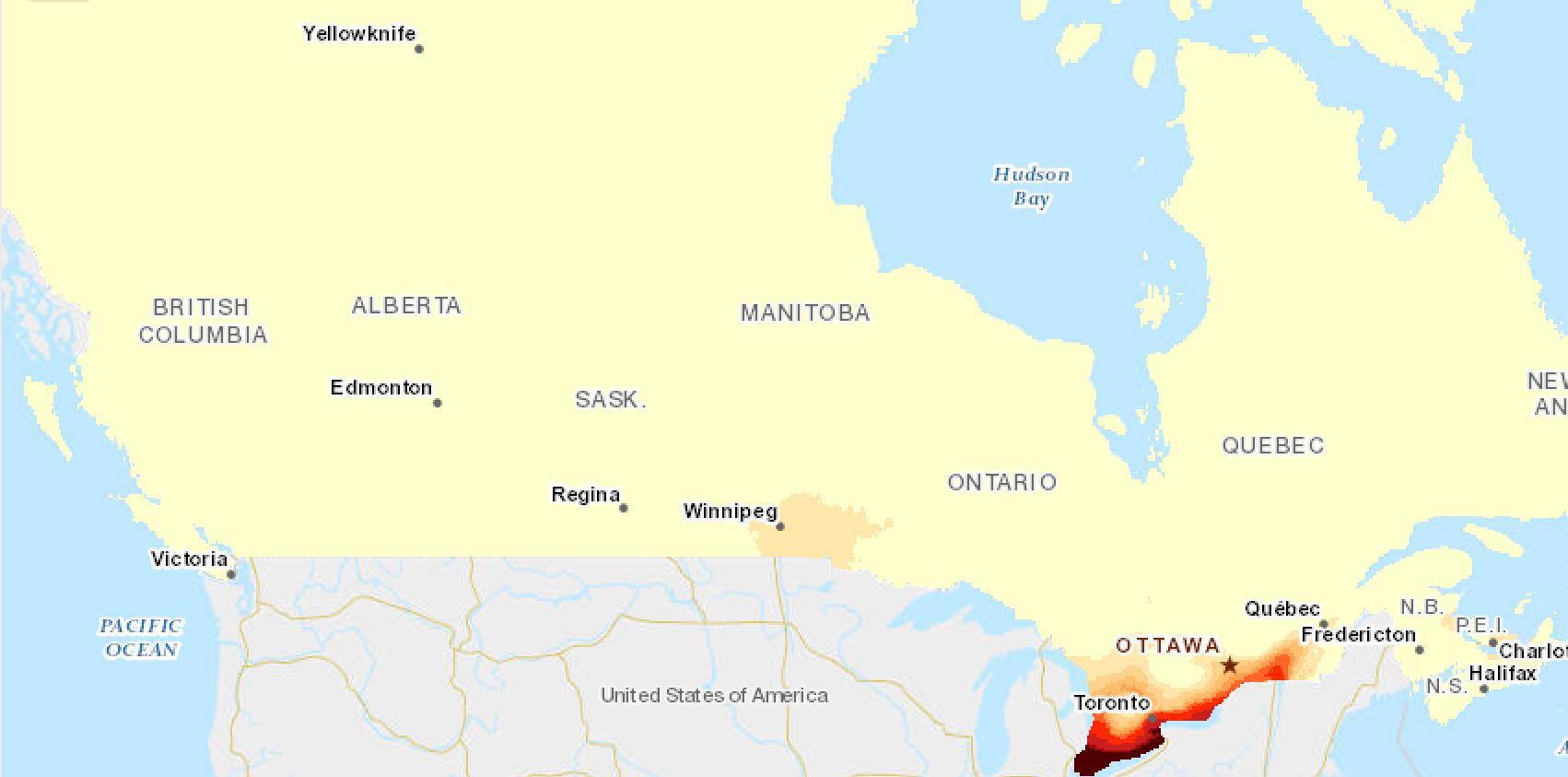
30-year Average Number of Days with Minimum Daily Temperature above 20 °C
30-year Average Number of Days with Minimum Daily Temperature above 20 °C is defined as the count of climate days during the year where the minimum daily temperature was above 20 °C.
These values are calculated across Canada in 10x10 km cells
Simple
- Date ( RI_367 )
- 2021-10-06
- Date ( RI_366 )
- 2021-10-06
- Presentation form
- mapDigital;carteNumérique RI_391
- Status
- completed; complété RI_593
- Maintenance and update frequency
- irregular; irrégulier RI_541
- Keywords ( RI_528 )
-
- Heat Stress
- Government of Canada Core Subject Thesaurus Thésaurus des sujets de base du gouvernement du Canada ( RI_528 )
-
- Agriculture
- Farmlands
- Precipitation
- Temperature
- Crops
- Use limitation
- Open Government Licence - Canada (http://open.canada.ca/en/open-government-licence-canada)
- Access constraints
- license; licence RI_606
- Use constraints
- license; licence RI_606
- Spatial representation type
- grid; grille RI_636
- Metadata language
- eng; CAN
- Topic category
-
- Climatology, meteorology, atmosphere
- Begin date
- 1961-01-01
- End date
- 2010-12-31
))
- Reference system identifier
- http://www.epsg.org/ / EPSG:3857 / 8.3.4
- OnLine resource
-
Data Product Specification (English)
(
HTTPS
)
Supporting Document;PDF;eng
- OnLine resource
-
Using AAFC Climate Services (English)
(
HTTPS
)
Supporting Document;PDF;eng
- OnLine resource
-
Data Product Specification (French)
(
HTTPS
)
Supporting Document;PDF;fra
- OnLine resource
-
Pre-packaged GeoTif files (No linguistic component) annual
(
HTTPS
)
Dataset;GeoTIF;zxx
- OnLine resource
-
Pre-packaged Maps (English)
(
HTTPS
)
Supporting Document;PDF;eng
- OnLine resource
-
Pre-packaged Maps (French)
(
HTTPS
)
Supporting Document;PDF;fra
- OnLine resource
-
Climate normals interactive maps
(
HTTPS
)
Application;Web App;eng
- OnLine resource
-
Climate normals interactive maps
(
HTTPS
)
Application;Web App;fra
- File identifier
- bb8428a1-6757-461e-970c-009837d2d8a7 XML
- Metadata language
- eng; CAN
- Character set
- utf8; utf8 RI_458
- Hierarchy level
- series; série RI_623
- Date stamp
- 2024-06-11T13:54:33
- Metadata standard name
- North American Profile of ISO 19115:2003 - Geographic information - Metadata
- Metadata standard version
- CAN/CGSB-171.100-2009
Overviews
Spatial extent
Provided by
