 Arctic SDI catalogue
Protected Areas 2021 (vector), Europe, 3-yearly, Sep. 2026
Simple
- Date ( Creation )
- 2026-02-17
- Date ( Publication )
- 2026-09-24
- Edition
- 1.0
- Identifier
- copernicus_v_3035_10_k_pa-2021_p_2021_v01_r00
- Unique resource identifier
- 10.2909/bb868019-c125-44d4-a42e-da2b29439d89
- Codespace
- doi.org
Point of contact
Point of contact
- Maintenance and update frequency
- As needed
- GEMET - INSPIRE themes, version 1.0 ( Theme )
- GEMET ( Theme )
- Spatial scope ( Theme )
- Keywords ( Theme )
-
- 2013 2.6.1
- EEA topics ( Theme )
- Keywords
-
- Access constraints
- Other restrictions
- Other constraints
- no limitations to public access
- Use constraints
- Other restrictions
- Other constraints
-
Access to data is based on a principle of full, open and free access as established by the Copernicus data and information policy Regulation (EU) No 1159/2013 of 12 July 2013. This regulation establishes registration and licensing conditions for GMES/Copernicus users.
Free, full and open access to this data set is made on the conditions that:
1. When distributing or communicating Copernicus dedicated data and Copernicus service information to the public, users shall inform the public of the source of that data and information.
2. Users shall make sure not to convey the impression to the public that the user's activities are officially endorsed by the Union.
3. Where that data or information has been adapted or modified, the user shall clearly state this.
4. The data remain the sole property of the European Union. Any information and data produced in the framework of the action shall be the sole property of the European Union. Any communication and publication by the beneficiary shall acknowledge that the data were produced “with funding by the European Union”.
- Spatial representation type
- vector Vector
- Distance
- 10 m
- Metadata language
- en
- Character set
- utf8 UTF8
))
- Begin date
- 2021-01-01
- End date
- 2021-12-31
- Unique resource identifier
- EPSG:3035
- Distribution format
-
-
flatgeobuf
(
)
-
flatgeobuf
(
)
OnLine resource
- OnLine resource
- Product Information & Technical Documentation ( WWW:LINK )
- OnLine resource
-
CLMS Website
(
WWW:DOWNLOAD:
)
Download (requires authentication)
- OnLine resource
- Digital Object Identifier (DOI) ( DOI )
- Hierarchy level
- Dataset
Absolute external positional accuracy
- Name of measure
- Minimum Mapping Unit
Quantitative result
- Value
- 0,5
Absolute external positional accuracy
- Name of measure
- Minimum Mapping Width
Quantitative result
- Value
- 10
Conformance result
- Date ( Publication )
- 2010-12-08
- Explanation
- See the referenced specification
- Statement
-
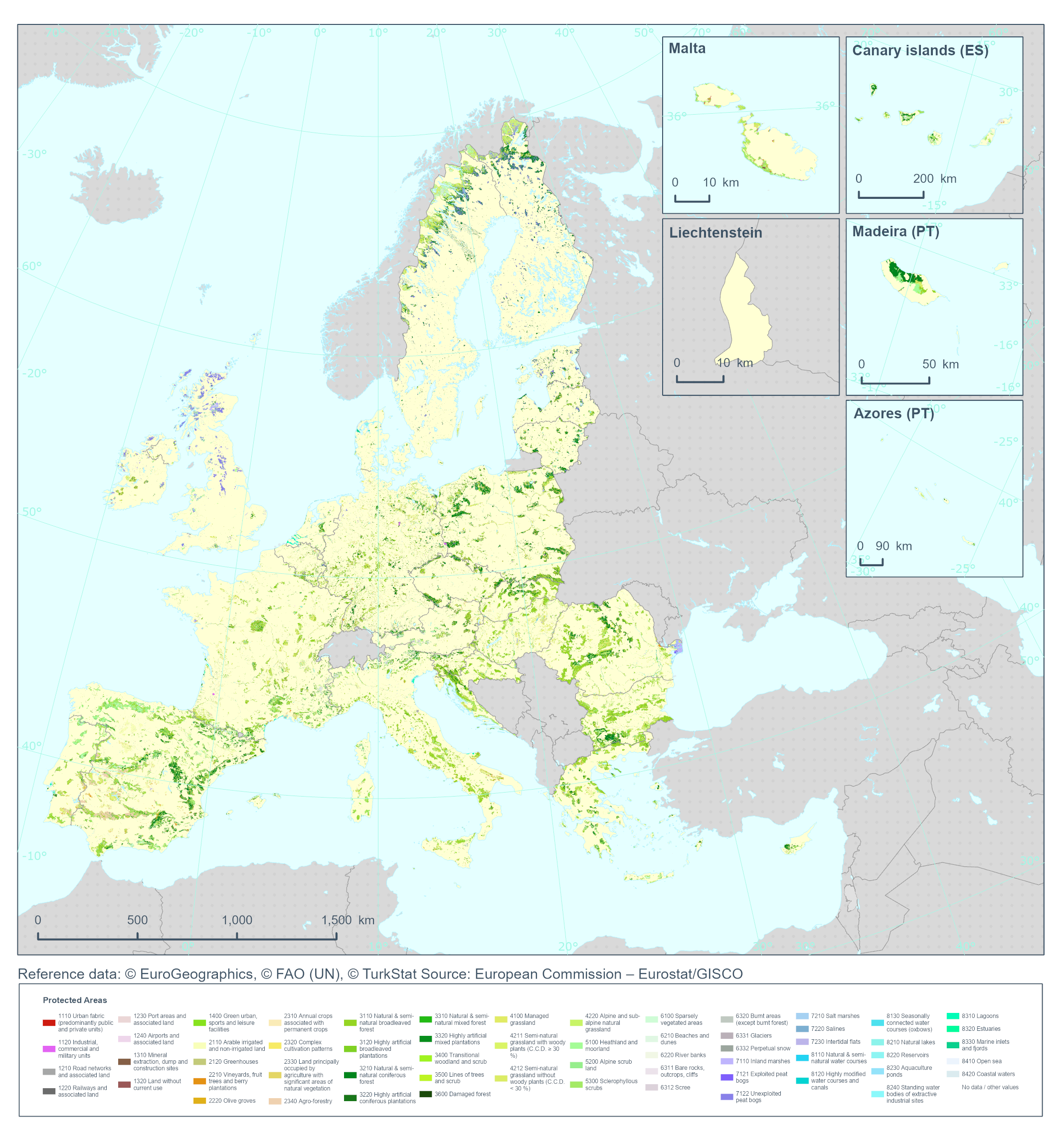
Generation of a Land Cover/Land Use (LC/LU) dataset by applying a semiautomatic workflow based on the use of temporal series of SuperResolved Sentinel-2 imagery, CLMS curated data (mainly N2K18, CZ18, RZ18, CLC+ and HRLs) Deep Learning models, Active Learning, advanced post-processing techniques and manual enhancement through Very High Resolution (VHR) satellite data from 2021 ±1 year. The classification provides 59 distinct thematic classes. The class definitions follow a pre-defined nomenclature based on the Mapping and Assessment of Ecosystems and their Services (MAES) typology of ecosystems (at level 1) and are further harmonised with Corine Land Cover and adapted to the specific characteristics of the different habitats included in N2000 network (levels 2 to 4). The Minimum Mapping Unit (MMU) is 0.5 ha and the Minimum Mapping Width (MMW) is 10 m.
Protected Areas 2021 is an evolution of the previous N2K dataset that only addressed 4790 grassland-rich Natura 2000 sites including a 2 km buffer zone with a six-year update cycle from 2006 onwards.
Additional information:
Typology:
1110 Urban Fabric (predominantly public and private units)
1120 Industrial, commercial and military units
1210 Road networks and associated land
1220 Railways and associated land
1230 Port areas and associated land
1240 Airports and associated land
1310 Mineral extraction sites, dump and construction sites
1320 Land without current use
1400 Green urban, sports and leisure facilities
2110 Arable irrigated and non-irrigated land
2120 Greenhouses
2210 Vineyards, fruit trees and berry plantations
2220 Olive groves
2310 Annual crops associated with permanent crops
2320 Complex cultivation patterns
2330 Land principally occupied by agriculture with significant areas of natural vegetation
2340 Agro-forestry
3110 Natural & semi-natural broadleaved forest
3120 Highly artificial broadleaved plantations
3210 Natural & semi-natural coniferous forest
3220 Highly artificial coniferous plantations
3310 Natural & semi-natural mixed forest
3320 Highly artificial mixed plantations
3400 Transitional woodland and scrub
3500 Lines of trees and scrub
3600 Damaged forest
4100 Managed grassland
4211 Semi-natural grassland with woody plants (C.C.D. ≥30%)
4212 Semi-natural grassland without woody plants (C.C.D. < 30%)
4220 Alpine and sub-alpine natural grassland
5100 Heathland and moorland
5200 Alpine scrub land
5300 Sclerophyllous scrubs
6100 Sparsely vegetated areas
6210 Beaches and dunes
6220 River banks
6311 Bare rocks, outcrops, cliffs
6312 Scree
6320 Burnt areas (except burnt forest)
6331 Glaciers
6332 Perpetual snow
7110 Inland marshes
7121 Exploited peat bogs
7122 Unexploited peat bogs
7210 Salt marshes
7220 Salines
7230 Intertidal flats
8110 Natural & Semi-natural water courses
8120 Highly modified water courses and canals
8130 Seasonally connected water courses (oxbows)
8210 Natural lakes
8220 Reservoirs
8230 Aquaculture ponds
8240 Standing water bodies of extractive industrial sites
8310 Lagoons
8320 Estuaries
8330 Marine inlets and fjords
8410 Open sea
8420 Coastal waters
- File identifier
- bb868019-c125-44d4-a42e-da2b29439d89 XML
- Metadata language
- en
- Character set
- UTF8
- Hierarchy level
- Dataset
- Date stamp
- 2026-09-28T09:18:33.607385Z
- Metadata standard name
- ISO 19115/19139
- Metadata standard version
- 1.0
Overviews
Spatial extent
Provided by
