 Arctic SDI catalogue
Modern treaties
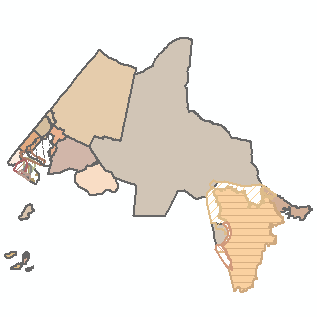
The Modern treaties (formerly known as the Post-1975 treaties) dataset contains geographic boundaries as well as basic attribute data representing signed agreements that were negotiated between Indigenous groups, the Government of Canada, and provincial and territorial governments after 1975. These boundaries represent the areas of Canada where Indigenous land rights and title have not been addressed by treaty or through other legal means. These boundaries represent the final result of a negotiated First Nation’s claimed area. These boundaries are usually not surveyed but help to delineate the geographic extent of the rights of Indigenous beneficiaries defined within the agreement. The Modern treaties dataset includes:
1) Overall Treaty Area (OTA) which is the broad area to which the agreement applies, often composed of the sum of the specific geographies defined within the treaty. 2) Treaty Settlement Lands that is wholly Indigenous-owned and forms part of the “land and cash” settlements that are integral to the treaty. This category belongs to the Department of Natural Resources Canada and can be found on the Open data website as ‘‘Aboriginal Lands’’ classified as ‘‘Land Claim’’. 3) Treaty-Specified Rights Areas which category pertains to areas (lands or waters) where specific rights, activities or responsibilities apply pursuant to the treaty. 4) Other Treaty-related Geography is the catch-all category for any remaining geographies that do not fit within the aforementioned categories but do form part of the OTA, such as lands or marine areas designated for conservation or for specific projects.
For more information about Modern treaties, visit https://www.rcaanc-cirnac.gc.ca/eng/1100100028574/1529354437231#chp4.
The Modern treaties dataset is one of multiple datasets representing treaties and agreements between the Crown and Indigenous peoples. The Crown-Indigenous treaties and agreements geospatial datasets represent the geographic boundaries of the solemn agreements between the Crown and Indigenous peoples that set out promises, obligations and benefits for parties. The following datasets are also available:
1) The Historic treaties (formerly known as the Pre-1975 treaties) dataset, which represents most signed treaties that were negotiated between Indigenous peoples and the Crown between 1725 and 1929.
2) The Indigenous agreements dataset, which represents established protocols in place for consultation processes, self-government agreements, and other signed agreements between Indigenous groups and the Crown which do not fall into the aforementioned categories.
The Modern treaties dataset is Crown-Indigenous Relations and Northern Affairs Canada (CIRNAC) and Indigenous Services Canada (ISC)’s primary source for Modern treaties geographic boundaries on maps.
This dataset can also be viewed in the Aboriginal and Treaty Rights Information System (ATRIS). This web-based system provides access to information to inform governments, industry and other interested parties in determining their consultation obligations and in carrying out their consultation research.
For more information, visit https://www.rcaanc-cirnac.gc.ca/eng/1100100014686/1609421785838.
Simple
- Date ( RI_366 )
- 2012-08-01
- Date ( RI_367 )
- 2012-08-01
- Date ( RI_368 )
- 2023-05-02
1-866-817-3977
- Hours of service
- Monday to Friday 9:00am - 5:00pm
- Credit
- Government of Canada; Aboriginal Affairs and Northern Development Canada
- Status
- completed; complété RI_593
- Maintenance and update frequency
- asNeeded; auBesoin RI_540
- Keywords ( RI_528 )
-
- Comprehensive Land Claim
- Settlement Lands
- Self-Government
- Pre-1975
- Post-1975
- Aboriginal
- Self-determination
- Government of Canada Core Subject Thesaurus Thésaurus des sujets de base du gouvernement du Canada ( RI_528 )
-
- Boundaries
- Indigenous rights
- Indigenous lands
- Indigenous peoples
- Agreements
- Indians
- Use limitation
- Open Government Licence - Canada (http://open.canada.ca/en/open-government-licence-canada)
- Access constraints
- license; licence RI_606
- Use constraints
- license; licence RI_606
- Spatial representation type
- vector; vecteur RI_635
- Metadata language
- fra; CAN
- Metadata language
- eng; CAN
- Character set
- utf8; utf8 RI_458
- Topic category
-
- Boundaries
- Location
- Begin date
- 1976
))
- Reference system identifier
- http://www.epsg-registry.org / EPSG:4617 / 7.11.2
- Distribution format
-
-
WMS
(
1.3.0
)
-
FGDB/GDB
(
unknown
)
-
SHP
(
unknown
)
-
CSV
(
unknown
)
-
WFS
(
1.1.0
)
-
ESRI REST
(
Unknown
)
-
KML
(
Unknown
)
-
WMS
(
1.3.0
)
1-866-817-3977
- Hours of service
- Monday to Friday 9:00am - 5:00pm
- OnLine resource
-
Modern Treaties
(
OGC:WMS
)
Web Service;WMS;eng
- OnLine resource
-
Generate KML file
(
HTTPS
)
Dataset;KML;eng
- OnLine resource
-
Generate KML file
(
HTTPS
)
Dataset;KML;fra
- OnLine resource
-
Web Feature Service (WFS)
(
HTTPS
)
Web Service;WFS;eng
- OnLine resource
-
Web Feature Service (WFS)
(
HTTPS
)
Web Service;WFS;fra
- OnLine resource
-
Modern Treaties
(
OGC:WMS
)
Web Service;WMS;fra
- OnLine resource
-
Pre-packaged FGDB file
(
HTTPS
)
Dataset;FGDB/GDB;eng,fra
- OnLine resource
-
Pre-packaged SHP file
(
HTTPS
)
Dataset;SHP;eng,fra
- OnLine resource
-
Pre-packaged CSV file
(
HTTPS
)
Dataset;CSV;eng,fra
- OnLine resource
-
Data Dictionary - Web Services (in French)
(
HTTPS
)
Supporting Document;CSV;fra
- OnLine resource
-
Data Dictionary - Web Services (in English)
(
HTTPS
)
Supporting Document;CSV;eng
- OnLine resource
-
Data Dictionary - FGDB (in French)
(
HTTPS
)
Supporting Document;CSV;fra
- OnLine resource
-
Data Dictionary - FGDB (in English)
(
HTTPS
)
Supporting Document;CSV;eng
- OnLine resource
-
Data Dictionary - SHP (in French)
(
HTTPS
)
Supporting Document;CSV;fra
- OnLine resource
-
Data Dictionary - SHP (in English)
(
HTTPS
)
Supporting Document;CSV;eng
- OnLine resource
-
Data Dictionary - CSV (in French)
(
HTTPS
)
Supporting Document;CSV;fra
- OnLine resource
-
Data Dictionary - CSV (in English)
(
HTTPS
)
Supporting Document;CSV;eng
- OnLine resource
-
Modern Treaties
(
ESRI REST: Map Service
)
Web Service;ESRI REST;fra
- OnLine resource
-
Modern Treaties
(
ESRI REST: Map Service
)
Web Service;ESRI REST;eng
- File identifier
- be54680b-ea62-46f3-aaa9-7644ed970aef XML
- Metadata language
- eng; CAN
- Character set
- utf8; utf8 RI_458
- Hierarchy level
- dataset; jeuDonnées RI_622
- Date stamp
- 2025-03-25T15:56:41
- Metadata standard name
- North American Profile of ISO 19115:2003 - Geographic information - Metadata
- Metadata standard version
- CAN/CGSB-171.100-2009
1-866-817-3977
- Hours of service
- Monday to Friday 9:00am - 5:00pm
Overviews
Spatial extent
Provided by
