 Arctic SDI catalogue
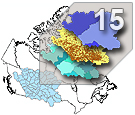
AAFC Watershed Project - 2013
The Agriculture and Agri-Food Canada’s (AAFC) Watersheds Project level series supplies a number of watershed and watershed related datasets for the Prairie Provinces. The levels are greater or smaller assemblages of hydrometric areas, or the components defining them.
The Project is organized by hydrometric gauging stations which are sourced from Environment Canada, the United States, and Canadian provinces. Additional stations were generated to address structural issues, like river confluences or lake inlets. Collectively, they are referred to as the gauging stations, or simply, the stations.
The drainage area that each station monitors, between itself and one or more of its upstream neighbours, is called an ‘incremental gross drainage area’.
The incremental gross drainage areas are collected into larger or smaller groupings based on size or defined interest to generate the various ‘levels ’of the series. They include:
Basins of varying size:
1. Major drainage systems (3): Arctic Ocean, Hudson Bay and Gulf of Mexico;
2. Major basins (23): associated with river or lake reaches;
3. Project sub-basins (47): created specifically for the project;
4. Sub-basins (51): based on specific Environment Canada hydrometric gauging station locations;
5. Sub-sub-basins (311): based on specific Environment Canada hydrometric gauging station locations);
Incremental drainage areas:
6. Incremental gross drainage areas: one per gauging station.
The incremental gross drainage areas are further subdivided into portions that either contribute or do not contribute to drainage to an average runoff event. The portions that do contribute are called ‘effective drainage’ areas, while those that don’t are called ‘non-contributing’. These generate the following levels:
7. Incremental effective drainage areas; and
8. Incremental non-contributing areas.
Total drainage areas:
9. Total gross drainage areas;
10. Total effective drainage areas; and
11. Total non-contributing areas;
And when combined for the entire project, yields the:
12. Effective drainage area.
The series also includes the components:
13. The gauging stations;
14. The collection of boundaries (lines) of the gross incremental drainage areas as well as the boundaries that separate contributing from non-contributing areas for an average runoff event; and
15. A network of downstream-directed lines that connect the gauging stations.
All linework is derived from large scale topographic data.
One additional non-spatial dataset, a table of tallied values by gauging station, is provided:
16. The Project Gauging Station Table.
The Project area, designed for the Prairie Provinces, covers all of Alberta, Saskatchewan and Manitoba, and those portions of British Columbia, Northwest Territories, Nunavut, Ontario, and the United States that are required to complete the trans-border sections of the watersheds.
Since 1975 the AAFC Watersheds Project has systematically collected and refined watershed boundaries for the Prairies. The result is the authoritative source for gross and effective drainage areas in the Prairie Provinces. The initial 1:50,000 analog delineations were moved to their digital form in 1994. Since then, the delineations have increased in accuracy and extent, and the series levels have increased to 16 in number.
Simple
- Date ( RI_367 )
- 2013-04-05
- Date ( RI_366 )
- 2013-04-05
- Presentation form
- mapDigital;carteNumérique RI_391
- Status
- completed; complété RI_593
- Maintenance and update frequency
- unknown; inconnu RI_543
- Government of Canada Core Subject Thesaurus Thésaurus des sujets de base du gouvernement du Canada ( RI_528 )
-
- Drainage
- Western provinces
- Hydrology
- Inland waters
- Water
- Watersheds
- Use limitation
- Open Government Licence - Canada (http://open.canada.ca/en/open-government-licence-canada)
- Access constraints
- license; licence RI_606
- Use constraints
- license; licence RI_606
- Spatial representation type
- vector; vecteur RI_635
- Spatial representation type
- textTable; texteTable RI_637
- Metadata language
- eng; CAN
- Topic category
-
- Inland waters
- Begin date
- 2013-01-01
))
- Reference system identifier
- www.epsg.org / EPSG: 3857 / 8.3.4
- OnLine resource
-
Data Product Specification (English)
(
HTTPS
)
Supporting Document;PDF;eng
- OnLine resource
-
Data Product Specification (French)
(
HTTPS
)
Supporting Document;PDF;fra
- OnLine resource
-
Pre-packaged FGDB files
(
HTTPS
)
Dataset;FGDB/GDB;eng,fra
- OnLine resource
-
Pre-packaged GeoJSON files
(
HTTPS
)
Dataset;GEOJSON;eng,fra
- File identifier
- c20d97e7-60d8-4df8-8611-4d499a796493 XML
- Metadata language
- eng; CAN
- Character set
- utf8; utf8 RI_458
- Hierarchy level
- series; série RI_623
- Date stamp
- 2025-09-03T12:29:04
- Metadata standard name
- North American Profile of ISO 19115:2003 - Geographic information - Metadata
- Metadata standard version
- CAN/CGSB-171.100-2009
Overviews
Spatial extent
Provided by
