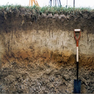
Gridded Soil Landscapes of Canada
This dataset is a rasterized version of the Soil Landscapes of Canada (SLC) dataset. Soil attributes in this dataset have been collated from SLC map polygons and follow the GlobalSoilMap.net standards and specifications at specified depth increments extending over the agricultural portion of Canada.
Weighted averages of soil attribute properties are generated from existing soil horizon information to conform to recognized fixed depth increments. Soil attribute weighted means are calculated by using all the soil components based on their areal extent within each SLC polygon. The weighted mean averages of attributes are spatially represented by the grid along with the lowest and highest attribute values found within each polygon.
Simple
- Date ( RI_367 )
- 2016-03-01
- Date ( RI_366 )
- 2016-03-01
- Presentation form
- mapDigital;carteNumérique RI_391
- Status
- completed; complété RI_593
- Maintenance and update frequency
- notPlanned; nonPlanifié RI_542
- Government of Canada Core Subject Thesaurus Thésaurus des sujets de base du gouvernement du Canada ( RI_528 )
-
- Soil taxonomy
- Agriculture
- Use limitation
- Open Government Licence - Canada (http://open.canada.ca/en/open-government-licence-canada)
- Access constraints
- license; licence RI_606
- Use constraints
- license; licence RI_606
- Spatial representation type
- grid; grille RI_636
- Metadata language
- eng; CAN
- Topic category
-
- Geoscientific information
- Begin date
- 2018-01-01
))
- Reference system identifier
- http://www.epsg-registry.org/ / EPSG:3857 / 8.3.4
- OnLine resource
-
Data Product Specification (English)
(
HTTPS
)
Supporting Document;PDF;eng
- OnLine resource
-
Data Product Specification (French)
(
HTTPS
)
Supporting Document;PDF;fra
- OnLine resource
-
Versioning of GlobalSoilMap.net raster property maps for the North American Node
(
HTTPS
)
Supporting Document;PDF;eng
- OnLine resource
-
Gridded Soil Landscapes of Canada
(
HTTPS
)
Dataset;GeoTIF;zxx
- File identifier
- cb29b370-3639-4645-9ef9-b1ef131837b7 XML
- Metadata language
- eng; CAN
- Character set
- utf8; utf8 RI_458
- Hierarchy level
- dataset; jeuDonnées RI_622
- Date stamp
- 2025-05-27T13:47:29
- Metadata standard name
- North American Profile of ISO 19115:2003 - Geographic information - Metadata
- Metadata standard version
- CAN/CGSB-171.100-2009
Overviews

Spatial extent
))
Provided by

 Arctic SDI catalogue