 Arctic SDI catalogue
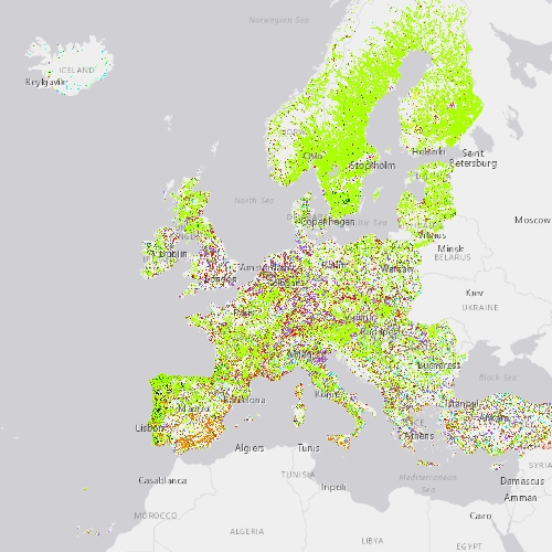
Riparian Zones Land Cover and Land Use Change 2012-2018 (vector), Europe, 6-yearly, Dec. 2021
Riparian zones represent transitional areas occurring between land and freshwater ecosystems, characterised by distinctive hydrology, soil and biotic conditions and strongly influenced by the stream water. They provide a wide range of riparian functions (e.g. chemical filtration, flood control, bank stabilization, aquatic life and riparian wildlife support, etc.) and ecosystem services.
The Riparian Zones products support the objectives of several European legal acts and policy initiatives, such as the EU Biodiversity Strategy to 2020, the Habitats and Birds Directives and the Water Framework Directive.
This metadata refers to the Riparian Zones Land Cover/Land Use (LC/LU) change for 2012-2018. The LC/LU classification is tailored to the needs of biodiversity monitoring in a variable buffer zone of selected rivers (Strahler levels 2-9 derived from EU-Hydro) for the change layer 2012-2018. LC/LU is extracted from Very High Resolution (VHR) satellite data and other available data in a buffer zone of selected rivers for supporting biodiversity monitoring and mapping and assessment of ecosystems and their services. The class definitions follow the pre-defined nomenclature on the basis of Mapping and Assessment of Ecosystems and their Services (MAES) typology of ecosystems (Level 1 to Level 4) and CORINE Land Cover. The classification provides 55 distinct thematic classes with a Minimum Mapping Unit (MMU) of 0.5 ha and a Minimum Mapping Width (MMW) of 10 m.
The production of the Riparian Zones products was coordinated by the European Environment Agency in the frame of the EU Copernicus programme.
Simple
- Date ( Creation )
- 2021-12-14
- Date ( Publication )
- 2021-12-15
- Edition
- 01.00
- Identifier
- copernicus_v_3035_10_m_rz-lclu-cha-2012-2018_p_2010-2018_v01_r00
- Identifier
- DAT-191-en
- Unique resource identifier
- 10.2909/d9aeb892-04d5-42c0-b24a-29b58831316f
- Maintenance and update frequency
- Continual
- GEMET - INSPIRE themes, version 1.0 ( Theme )
- Keywords
-
- Continents, countries, sea regions of the world. ( Place )
-
- EEA38 (from 2020)
- United Kingdom
- Keywords
-
- GEMET ( Theme )
- Spatial scope ( Theme )
- EEA topics ( Theme )
- EEA Management Plan ( Theme )
-
- 2017 3.6.2
- Access constraints
- Other restrictions
- Other constraints
- no limitations to public access
- Use constraints
- Other restrictions
- Other constraints
-
The Copernicus component is governed by Regulation (EU) No 2021/696 of the European Parliament and of the Council of 28 April 2021 establishing the Union Space Programme and the European Union Agency for the Space Programme and repealing Regulations (EU) No 912/2010, (EU) No 1285/2013 and (EU) No 377/2014 and Decision No 541/2014/EU. Within the Copernicus component, a portfolio of land monitoring activities has been delegated by the European Union to the European Environment Agency (EEA) and the DG Joint Research Centre of the European Commission.
The Copernicus land monitoring products and services are made available on a principle of full, open and free access, as established by the Commission Delegated Regulation (EU) No 1159/2013 of 12 July 2013.
Free, full and open access to the products and services of the Copernicus Land Monitoring Service is made on the conditions that:
1. When distributing or communicating Copernicus Land Monitoring Service products and services (data, software scripts, web services, user and methodological documentation and similar) to the public, users shall inform the public of the source of these products and services.
2. Where the Copernicus Land Monitoring Service products and services have been adapted or modified by the user, the user shall clearly state this.
3. Users shall make sure not to convey the impression to the public that the user's activities are officially endorsed by the European Union.
- Aggregate Datasetindentifier
- 393359a7-7ebd-4a52-80ac-1a18d5f3db9c
- Association Type
- Cross reference
- Spatial representation type
- vector Vector
- Distance
- 10 m
- Metadata language
- en
- Character set
- utf8 UTF8
- Topic category
-
- Environment
- Imagery base maps earth cover
- Begin date
- 2010-01-01
- End date
- 2018-12-31
))
- Supplemental Information
- Spatial Resolution information: The Minimum Mapping Width is 10 m
- Unique resource identifier
- EPSG:3035
- Distribution format
-
-
SHP
(
1.1
)
-
SHP
(
1.1
)
- OnLine resource
- Product Information & Technical Documentation ( WWW:LINK )
- OnLine resource
- https://doi.org/10.2909/d9aeb892-04d5-42c0-b24a-29b58831316f ( DOI )
- OnLine resource
-
CLMS Website
(
WWW:DOWNLOAD
)
Download (requires authentication)
- OnLine resource
- https://copernicus.discomap.eea.europa.eu/arcgis/rest/services/RiparianZones/RZ_Change/MapServer ( ESRI:REST )
- Hierarchy level
- Dataset
Conformance result
- Date ( Publication )
- 2010-12-08
- Explanation
- See the referenced specification
- Statement
-
Computer assisted visual interpretation of the status 2018 data compared to the LC/LU product for reference year 2012. The main datasets for visual image interpretation were the DWH_MG2b_CORE_03 dataset (Optical VHR2 coverage over EU 2011-2013 and Riparian zones), mainly consisting of 1.5m VHR2 SPOT-6 and 2.5m VHR2 SPOT-5 HRG and 2m Pleiades satellite data for the 2012 reference year and VHR_IMAGE_2018 dataset (Optical VHR coverage of EEA-39 2017-2019), consisting of 2m Pleiades, Kompsat 3/3A, SuperView-1 and 4m SPOT-6/7, TripleSat, PlanetScope and Deimos satellite data for the 2018 reference year. Subsequently, intersection of classification results with additional data (Urban Atlas 2012/2018) was performed.
The current LC/LU change layer differentiates 55 thematic LC/LU classes covering Strahler levels 2 to 9 storing the changes that happened between the two reference years.
Positional Accuracy: less than 5 m (according to geo-location accuracy of satellite imagery delivered by ESA: less than 5m RMSE). Thematic accuracy (area-corrected Overall Accuracy, internal validation): 98.97% (at CODE_1 level) for change layer 2012-2018. Accuracy Assessment approach: Stratified Random Point Sampling with 1669 sampling points. Interpretation of sampling points has been performed on the best available reference data.
Minimum Mapping Unit (MMU): 0.5 ha
Minimum Mapping Width (MMW): 10 m
- File identifier
- d9aeb892-04d5-42c0-b24a-29b58831316f XML
- Metadata language
- en
- Character set
- UTF8
- Hierarchy level
- Dataset
- Date stamp
- 2025-12-18T14:52:35.665593Z
- Metadata standard name
- ISO 19115/19139
- Metadata standard version
- 1.0
Overviews
Spatial extent
Provided by
