 Arctic SDI catalogue
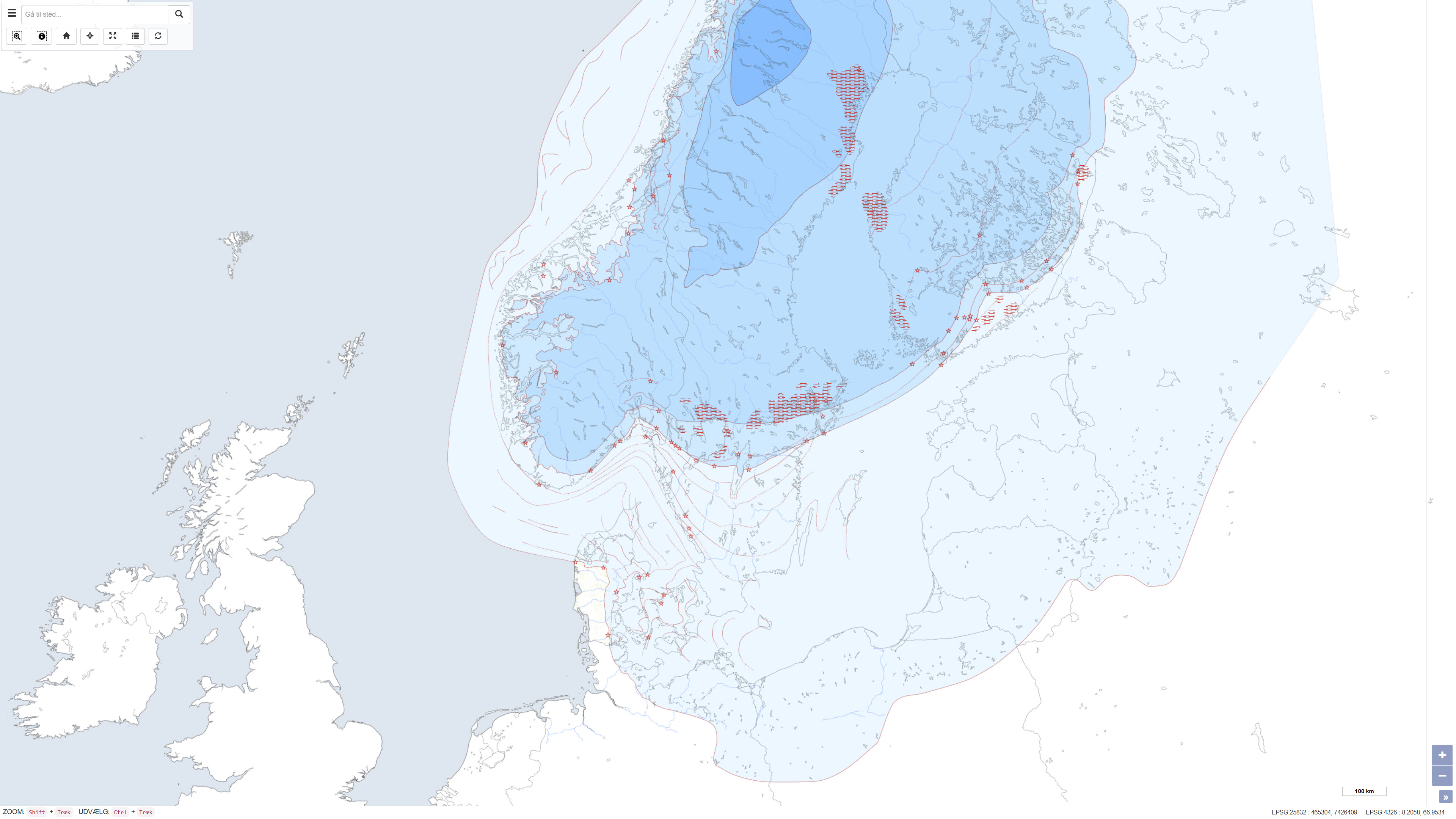
Ice margin lines in Scandinavia
Simple
- Date ( Publication )
- 1998-01-01
- Identifier
- dk.geus / israndslinjer_norden
- Presentation form
- Digital map
- Purpose
- The purpose of the dataset is to provide a regional overview of ice margin development and deglaciation in the Nordic region as a basis for Quaternary geological interpretation, research and education. The dataset supports studies of ice dynamics, landscape evolution and the progression of the last glaciation.
- Status
- Completed
- Maintenance and update frequency
- As needed
- Keywords ( Theme )
-
- Dataset
- Quaternary geology
- Ice margin lines
- Weichsel
- Ice age
- Scandinavia
- ArcGIS
- Forskningsemner Forskningsemner ( Theme )
- Geografisk Geografisk ( Place )
- Access constraints
- Other restrictions
- Use constraints
- Other restrictions
- Other constraints
- CC0 1.0
- Spatial representation type
- Vector
- Denominator
- 1000000
- Metadata language
- Da
- Character set
- UTF8
- Topic category
-
- Geoscientific information
- Climatology, meteorology, atmosphere
- Begin date
- 1995-01-01
- End date
- 1995-12-31
))
- Supplemental Information
- The dataset is a historical, interpretation-based map product reflecting the data availability and level of knowledge at the time of compilation. The map is not subject to continuous updates and is designed for display at a scale of 1:1.000.000. The dataset is primarily used as an overview map in regional and transnational contexts.
- Reference system identifier
- ETRS 89 / UTM 32N (EPSG:25832)
- Distribution format
-
-
WMS
(
)
-
WMTS
(
)
-
REST
(
)
-
WMS
(
)
- OnLine resource
-
Download
(
WWW:DOWNLOAD-1.0-http--download
)
Download dataset from GEUS' Dataverse
- OnLine resource
-
Interactive webmap
(
WWW:LINK-1.0-http--link
)
Interactive map displaying the dataset.
- OnLine resource
-
Ice margin lines in the Nordic countries – TemaNord 1998:584
(
WWW:LINK-1.0-http--link
)
Report published by the Nordic Council of Ministers. The publication is available via Google Books in accordance with publisher viewing rights.
- OnLine resource
-
IskappensUdbredelse
(
OGC:WMS-1.3.0-http-get-capabilities
)
ArcGIS WMS Service
- OnLine resource
-
Israndskort
(
ESRI:REST
)
ArcGIS REST Service
- OnLine resource
-
Denmark_Israndskort
(
OGC:WMTS-1.0.0-http-get-capabilities
)
ArcGIS WMTS Service
- Hierarchy level
- Dataset
- Statement
- The dataset was compiled as part of the project “Ice margin lines in the Nordic countries” and consists of digitised and compiled data contributed by the Nordic countries. The map was produced in 1995 and subsequently published as part of the report Ice margin lines in the Nordic countries, issued by the Nordic Council of Ministers in TemaNord 1998:584. The dataset represents a synthesis of national contributions and interpretations and includes data for Scandinavia only. Data for Iceland are available in a separate dataset.
- File identifier
- daa1a7fd-b1d3-482d-a557-a91e536b2ca8 XML
- Metadata language
- Danskda
- Character set
- UTF8
- Hierarchy level
- Dataset
- Date stamp
- 2026-03-20T10:26:41.721172Z
- Metadata standard name
- ISO 19115:2003/19139
- Metadata standard version
- 1.0
Overviews
Spatial extent
Provided by
