 Arctic SDI catalogue
Geological map of the pre-Quaternary surface in Denmark
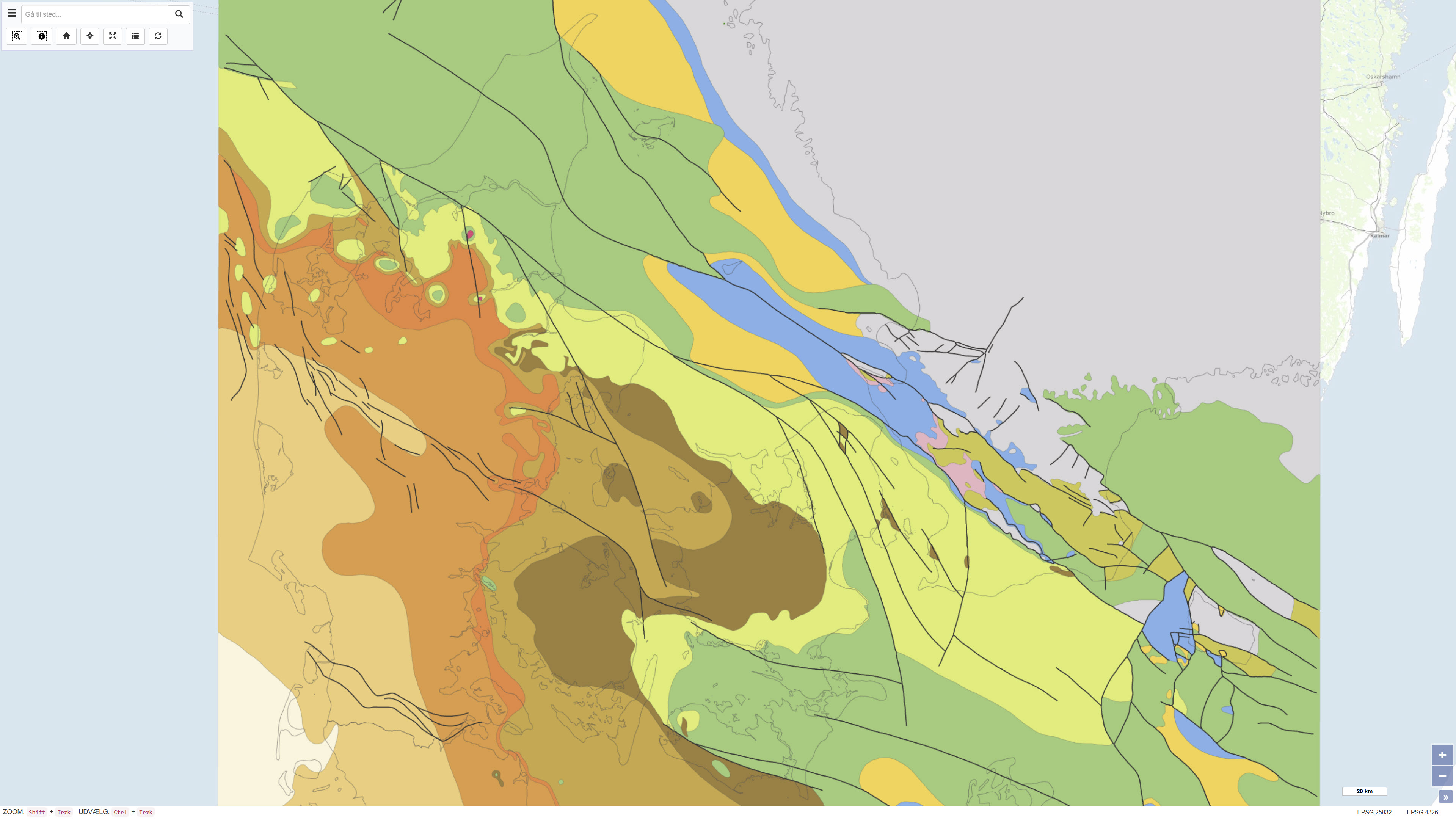
This dataset represents a geological map of the pre-Quaternary surface in Denmark, compiled by Håkansson & Pedersen (1992). The map illustrates the geological delineation and extent of pre-Quaternary formations beneath the Quaternary deposits and is based on geological observations, borehole data and previous interpretations. The dataset provides a regional overview of the pre-Quaternary geological surface and its characteristics as a basis for further geological interpretation.
Reference:
Stenestad, E. 1982: Karst. Varv, 4, pp. 113-119.
Simple
- Date ( Publication )
- 2022-01-01
- Identifier
- dk.geus / praekvartaer_overfladen
- Presentation form
- Digital map
- Purpose
- The purpose of the dataset is to provide an overview map of the pre-Quaternary geological surface in Denmark as a reference for regional geological understanding. The dataset is used for stratigraphic overview, geological interpretation and as background information in Quaternary geological studies.
- Status
- Completed
- Maintenance and update frequency
- As needed
- Keywords ( Theme )
-
- Dataset
- Geology
- Pre-Quaternary
- Subsurface
- Denmark
- Varv
- Forskningsemner Forskningsemner ( Theme )
- Geografisk Geografisk ( Place )
- Access constraints
- Other restrictions
- Use constraints
- Other restrictions
- Other constraints
- This dataset is based on material copyrighted by Varv journal (© 1992). GEUS is not the copyright holder of the original material. Use, redistribution or reproduction may be subject to copyright restrictions and requires permission from the rights holder. Users are responsible for ensuring compliance with applicable copyright legislation.
- Other constraints
- CC0 1.0
- Spatial representation type
- Vector
- Spatial representation type
- Grid
- Denominator
- 500000
- Metadata language
- Da
- Character set
- UTF8
- Topic category
-
- Geoscientific information
- Begin date
- 1982-01-01
- End date
- 1992-01-01
))
- Supplemental Information
- The dataset represents a historical, interpretation-based geological map reflecting the level of knowledge and data availability at the time of compilation in the early 1990s. The map is no longer updated and primarily serves as a reference for regional geological understanding and the development of pre-Quaternary interpretations in Denmark. The dataset should be used in conjunction with more recent borehole data and maps where detailed stratigraphic or geometric information is required.
- Reference system identifier
- ETRS 89 / UTM 32N (EPSG:25832)
- Distribution format
-
-
WMS
(
)
-
REST
(
)
-
WMTS
(
)
-
WMS
(
)
- OnLine resource
-
Interactive webmap
(
WWW:LINK-1.0-http--link
)
Interactive map displaying the dataset.
- OnLine resource
-
Stenestad, E. (1982): Karst. Varv, 4, pp. 113-119.
(
DOI
)
Scientific article by E. Stenestad (1982) presenting early descriptions and references related to mapping of the pre-Quaternary surface and karst phenomena in Denmark.
- OnLine resource
-
Geo-guidance 8
(
WWW:LINK-1.0-http--link
)
GEUS guidance document describing geological maps and datasets used in Denmark. The map of the pre-Quaternary surface is reproduced and referenced as figure 6 on page 21.
- OnLine resource
-
Varv – cover and register (1982)
(
WWW:LINK-1.0-http--link
)
Cover and register from the journal Varv (1982), where the map of the pre-Quaternary surface is presented editorially. The document serves as a supplementary reference to the contemporaneous context of the map.
- OnLine resource
-
Praekvartaer_Varv
(
ESRI:REST
)
ArcGIS REST Service
- OnLine resource
-
Varv_stratigrafi
(
OGC:WMS-1.3.0-http-get-capabilities
)
ArcGIS WMS Service
- OnLine resource
-
Denmark_Praekvartaer_Varv
(
OGC:WMTS-1.0.0-http-get-capabilities
)
ArcGIS WMTS Service
- Hierarchy level
- Dataset
- Statement
- The dataset is based on a geological map of the pre-Quaternary surface compiled by Håkansson & Pedersen (1992). The map is based on geological observations, borehole data and previous interpretations and was originally cited in Stenestad (1982): Karst, Varv, 4, pp. 113-119. The map has subsequently been reproduced and referenced in later publications, including Geo-vejledning 8, where it appears as figure 6. The dataset represents an interpretation-based regional geological overview reflecting the level of knowledge at the time of compilation.
- File identifier
- de4132ca-5102-44fa-af39-eae1f6fe46a1 XML
- Metadata language
- Danskda
- Character set
- UTF8
- Hierarchy level
- Dataset
- Date stamp
- 2026-03-20T10:38:01.708474Z
- Metadata standard name
- ISO 19115:2003/19139
- Metadata standard version
- 1.0
Overviews
Spatial extent
Provided by
