 Arctic SDI catalogue
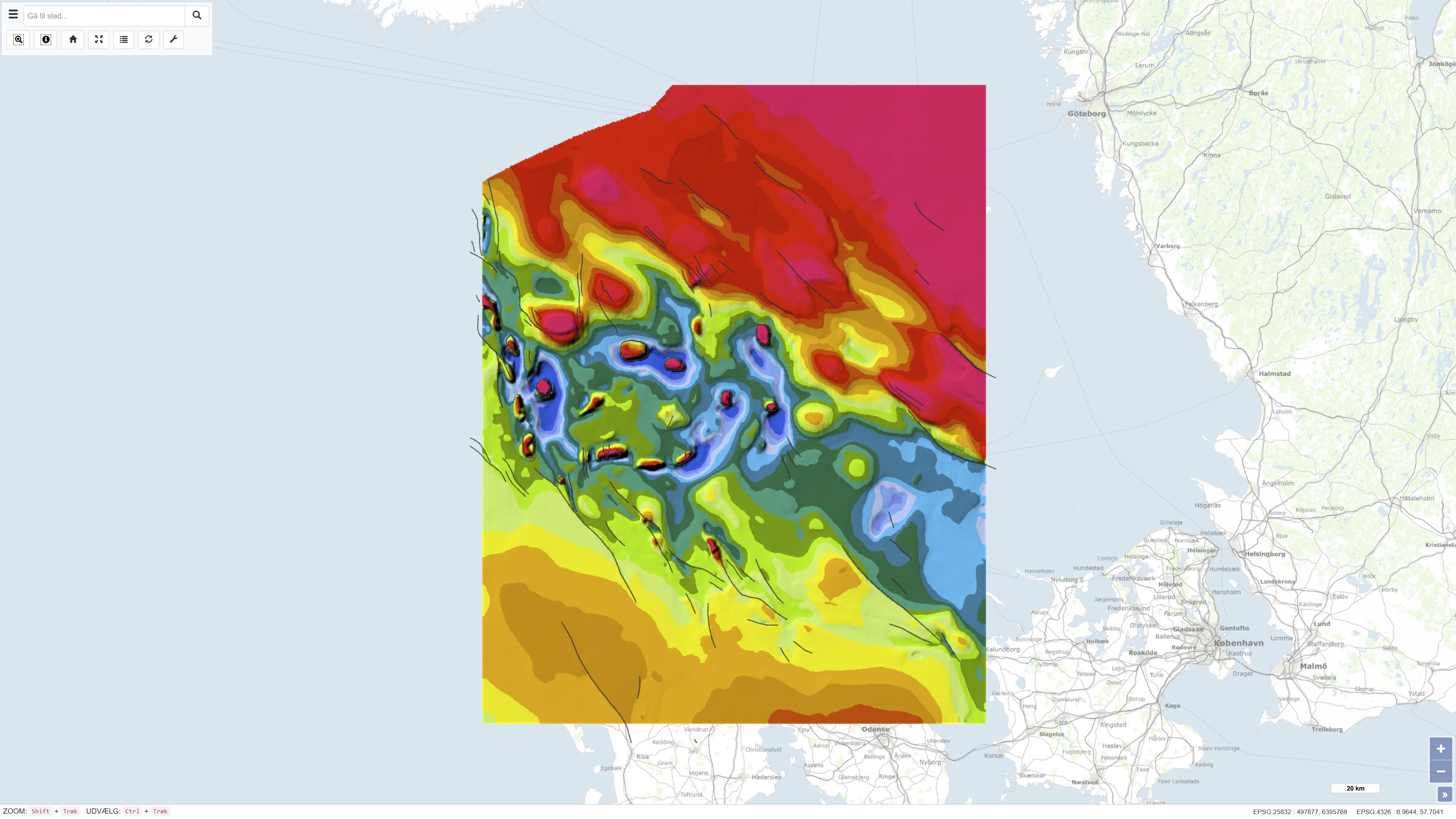
Geological map of Denmark, 1:500,000 – The Danish Basin: Structural map of the Top Chalk
Simple
- Date ( Publication )
- 1990-09-03
- Identifier
- dk.geus / dk_danishbasin_topchalk_structure_500k
- Presentation form
- Digital map
- Purpose
- The purpose of the dataset is to document the regional structure of the chalk surface (Top Chalk) in the Danish Basin, thereby providing a basis for geological and structural interpretation at national and regional scale. The dataset is intended for use in geological analyses, planning purposes and research-related applications.
- Status
- Completed
- Maintenance and update frequency
- As needed
- Keywords ( Theme )
-
- Dataset
- Geology
- Top Chalk
- Danish Basin
- Chalk Group
- Denmark
- Forskningsemner Forskningsemner ( Theme )
- Geografisk Geografisk ( Place )
- Access constraints
- Other restrictions
- Use constraints
- Other restrictions
- Other constraints
- CC BY-SA 4.0
- Other constraints
- Use of the dataset requires acknowledgement of the Geological Survey of Denmark and Greenland (GEUS) as the data source.
- Spatial representation type
- Vector
- Spatial representation type
- Grid
- Denominator
- 500000
- Metadata language
- Da
- Character set
- UTF8
- Topic category
-
- Geoscientific information
- Elevation
- Begin date
- 1980-01-01
- End date
- 1991-01-01
))
- Supplemental Information
- The dataset is a map product at a scale of 1:500,000 and should be used with consideration of the map scale and level of generalisation. The map is part of the DGU map series and reflects the data coverage and geological knowledge available at the time of publication.
- Reference system identifier
- ETRS 89 / UTM 32N (EPSG:25832)
- Distribution format
-
-
WMS
(
)
-
REST
(
)
-
WMS
(
)
- OnLine resource
-
Interactive webmap
(
WWW:LINK-1.0-http--link
)
Interactive map displaying the dataset.
- OnLine resource
-
Geological map of Denmark 1:500,000. The Danish Basin. Structural map of the Top Chalk
(
DOI
)
The publication presents a regional geological structural map of the chalk surface (Top Chalk) in the Danish Basin, based on interpretation of borehole and seismic data acquired over several decades. The map is published as part of the DGU Map Series no. 7.
- OnLine resource
-
DetDanskeBassin
(
ESRI:REST
)
ArcGIS REST Service
- OnLine resource
-
DB_BasisKalk_depth
(
OGC:WMS-1.3.0-http-get-capabilities
)
ArcGIS WMS Service
- Hierarchy level
- Dataset
- Statement
- The map was published as DGU Map Series no. 7 in 1991 and was produced based on interpretation of borehole data and seismic data acquired over a period of approximately 15–20 years prior to publication. The data basis includes around 75 deep onshore boreholes and approximately 4,000 km of seismic profiles from hydrocarbon exploration, supplemented by seismic surveys from the inner Danish waters. Existing geological maps from adjacent areas were also incorporated to ensure regional structural consistency. The dataset represents the geological interpretation available at the time of publication.
- File identifier
- df77efca-6103-45b0-ba93-6e7fe4f1398c XML
- Metadata language
- Danskda
- Character set
- UTF8
- Hierarchy level
- Dataset
- Date stamp
- 2026-03-20T14:15:02.008142Z
- Metadata standard name
- ISO 19115:2003/19139
- Metadata standard version
- 1.0
Overviews
Spatial extent
Provided by
