 Arctic SDI catalogue
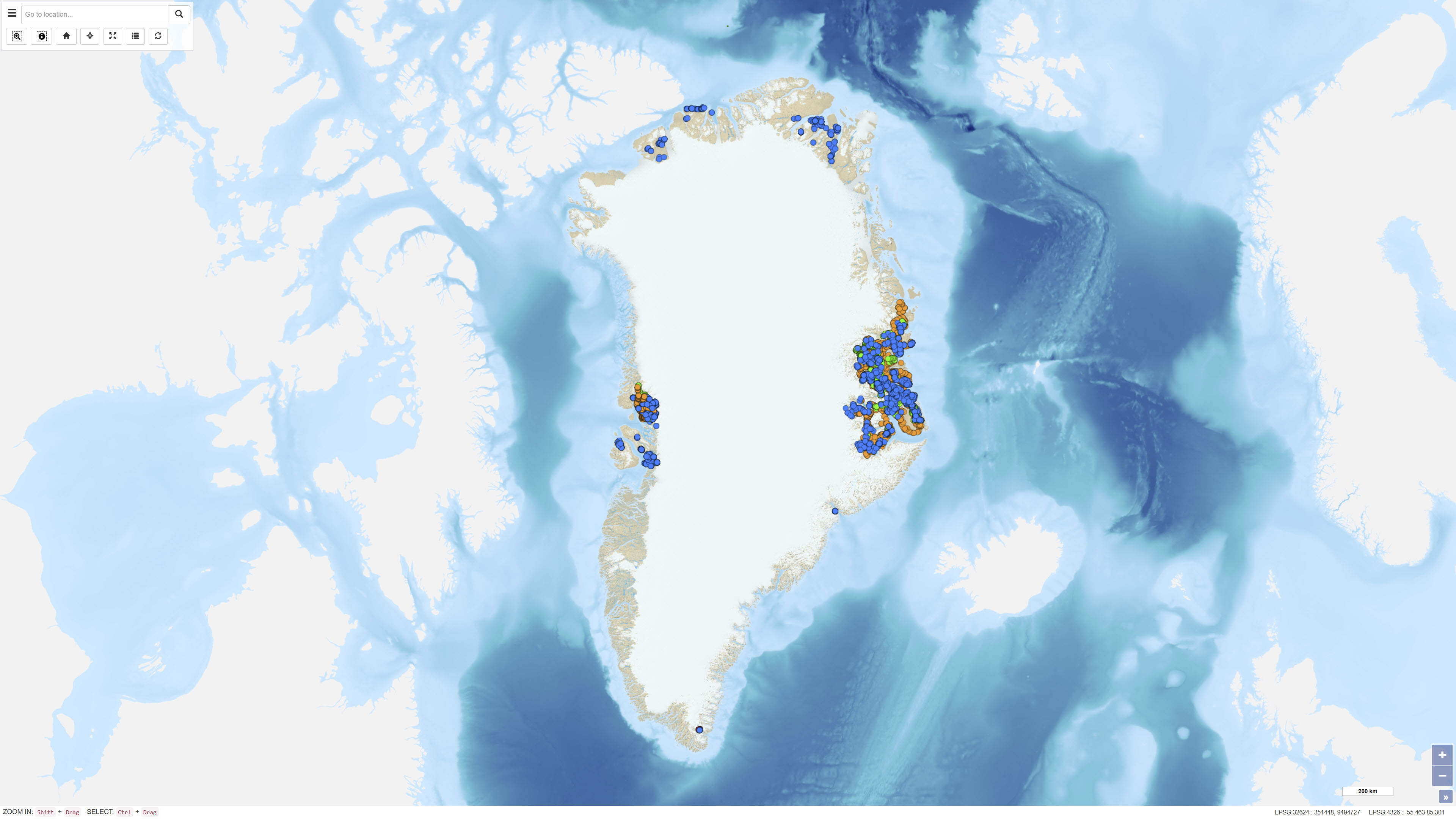
Company samples in Greenland
Simple
- Date ( Publication )
- 2022-01-01
- Identifier
- dk.geus / grl_company_samples
- Presentation form
- Digital map
- Purpose
- The purpose of the dataset is to make historical company-reported geochemical data digitally accessible and searchable through the GEUS sample database. The dataset supports geological and geochemical analyses but must be used with consideration of the documented methodological and analytical limitations.
- Status
- Completed
- Maintenance and update frequency
- As needed
- Keywords ( Theme )
-
- Dataset
- Geochemistry
- Sample data
- Company reports
- Mineral exploration
- Greenland
- Database
- Forskningsemner Forskningsemner ( Theme )
- Geografisk Geografisk ( Place )
- Access constraints
- Other restrictions
- Use constraints
- Other restrictions
- Other constraints
- The dataset is digitally restored from historical company reports (scanned PDFs) using optical character recognition (OCR) and georeferencing of sample locations. Errors may have been introduced during scanning, OCR processing and digitisation. The match between geochemical analyses and geographic coordinates is not unambiguous in all cases, and samples may occur with coordinates but without geochemical results as well as geochemical results without unambiguous coordinates. Information on detection limits, analytical uncertainty, laboratories, methods and grain fractions is generally sparse or not reported in the original sources. During upload to the GEUS sample database, sample names and selected metadata fields were adjusted to comply with the database structure; sample names may therefore differ from those used in the reports. The dataset should be used with these limitations in mind, and the original reports should be consulted for documentation and scientific context.
- Spatial representation type
- Vector
- Denominator
- 500000
- Metadata language
- Da
- Character set
- UTF8
- Topic category
-
- Geoscientific information
))
- Supplemental Information
- The dataset is based on digital restoration of historical company reports. For full traceability, methodological context and any stated limitations, users should consult the original reports. Information about the Review of Greenland activities publication series is available in the attached publication.
- Reference system identifier
- WGS 84 / UTM 24N (EPSG:32624)
- Distribution format
-
-
WMS
(
)
-
WFS
(
)
-
SHP
(
)
-
GeoJSON
(
)
-
WMS
(
)
- OnLine resource
-
Interactive webmap
(
WWW:LINK-1.0-http--link
)
Interactive map displaying the dataset.
- OnLine resource
-
A review of Greenland activities, 1997
(
DOI
)
A review of Greenland activities, 1997. (1998). Geology of Greenland Survey Bulletin, 180, 7-9. https://doi.org/10.34194/ggub.v180.5078
- OnLine resource
-
geochemistry_companies
(
OGC:WMS-1.3.0-http-get-capabilities
)
WMS for Geochemical data packages - Company data
- OnLine resource
-
Download
Download dataset as shapefile
- OnLine resource
-
Karrat Ni Greenland project geology and prospecting assessment report
Pearson, J.G. & Joudrie, M.C. 1995: Karrat Ni Greenland project geology and prospecting assessment report. Latitude: 70°30' - 71°54'N Longitude: 51°3 0' - 51°40'W. Internal report, Cominco Ltd., 17 pp., 8 app., 1 plate. GEUS Report File 21401.
- OnLine resource
-
Karrat concession year end report
Harris, C.J., Swatton, S. & Coppard, J. 1992: Karrat concession year end report. Internal report, RTZ Mining and Exploration Limited, 19 pp., 7 app. GEUS Report File 21085.
- OnLine resource
-
Karrat Group reconnaissance programme, Marmorilik area, West Greenland
Allen, C.R. & Harris, C.J. 1980: Year end report, 1979. Karrat Group reconnaissance programme, Marmorilik area, West Greenland. (Period: May 1979 - May 1980). Internal report, Cominco Ltd. & Greenex A/S, 34 pp., [analytical results], 11 plates, 14 photos. GEUS Report File 20435.
- OnLine resource
-
ms:geochemistry_companies
(
OGC:WFS-1.0.0-http-get-capabilities
)
WFS for Geochemical data packages - Company data
- OnLine resource
-
Download
Download dataset as GeoJSON
- Hierarchy level
- Dataset
- Statement
- The dataset is based on four historical company reports (Allen & Harris, 1980; Coppard et al., 1992; Harris et al., 1992; Pearson & Joudrie, 1995). The reports were originally submitted in paper format and later scanned. The geochemical data were digitally restored through optical character recognition (OCR) of text and numerical values and through georeferencing of sample locations. Errors may have been introduced during scanning, OCR processing and digitisation. The matching between geochemical analyses and geographic coordinates is not unambiguous in all cases. Information on analytical methods, detection limits and measurement uncertainty is generally sparse or not reported in the original sources. During upload to the GEUS sample database, sample names and certain metadata fields were adjusted to comply with the database structure.
- File identifier
- e8673f44-bfce-4f5f-873b-9567280e16fc XML
- Metadata language
- Danskda
- Character set
- UTF8
- Hierarchy level
- Dataset
- Date stamp
- 2026-03-01T12:39:15.069461Z
- Metadata standard name
- ISO 19115:2003/19139
- Metadata standard version
- 1.0
Overviews
Spatial extent
Provided by
