 Arctic SDI catalogue
Intrusions and Magmatic Complexes in Greenland
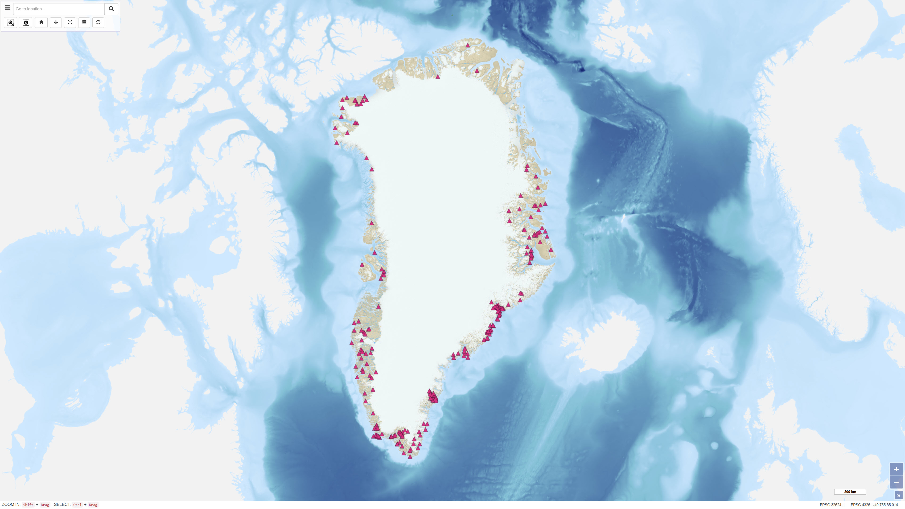
This dataset describes the intrusions and magmatic complexes of Greenland, forming a dedicated information layer within the GEUS GMOMDB2 database, displayed via the Greenland Mineral Occurrence Map (GMOM2). It includes 194 registered intrusions and complexes grouped into 23 magmatic provinces. The data are compiled from GEUS geological maps, published sources, and company reports.
The Palaeogene intrusions and complexes of East Greenland (66–75°N) are related to the opening of the North Atlantic and the influence of the ancestral Icelandic mantle plume. The magmatic evolution includes flood basalts, dyke swarms, and intrusive activity from 61 to 13 Ma.
Economic mineralisation is documented in several complexes, including the Skaergaard palladium deposit and the Malmbjerg porphyry molybdenum deposit, representing classic examples of rift- and post-rift-related mineral systems.
The dataset provides harmonised, quality-controlled geological information to support exploration and research activities in Greenland.
Simple
- Date ( Publication )
- 2011-12-31
- Identifier
- dk.geus / magmatic_intrusion
- Presentation form
- Digital map
- Purpose
-
The purpose of this dataset is to provide a comprehensive, standardised overview of Greenland’s magmatic intrusions and complexes, highlighting their geological characteristics, ages, and potential mineralisation.
It supports scientific research, mineral exploration, and resource assessment, as well as interoperability between GEUS geological databases and web services.
- Status
- Completed
- Maintenance and update frequency
- As needed
- Keywords ( Theme )
-
- Dataset
- Geology
- Intrusions
- Mineral resources
- Magmatic
- Forskningsemner Forskningsemner ( Theme )
- Geografisk Geografisk ( Place )
- Access constraints
- Other restrictions
- Use constraints
- Other restrictions
- Other constraints
- CC BY 4.0
- Spatial representation type
- Vector
- Denominator
- 25000
- Metadata language
- en
- Character set
- UTF8
- Topic category
-
- Geoscientific information
- Begin date
- 2008-01-01
- End date
- 2010-12-31
))
- Supplemental Information
- None specified
- Reference system identifier
- WGS 84 / UTM 24N (EPSG:32624)
- Distribution format
-
-
SHP
(
)
-
WMS
(
)
-
WFS
(
)
-
GeoJSON
(
)
-
SHP
(
)
- OnLine resource
-
Report
(
WWW:LINK-1.0-http--link
)
Palaeogene intrusions and magmatic complexes in East Greenland, 66 to 75 degree North
- OnLine resource
-
Interactive webmap
(
WWW:LINK-1.0-http--link
)
Viewing the dataset on the web portal
- OnLine resource
-
Report
(
WWW:LINK-1.0-http--link
)
Updating of Greenland Mineral Occurrence Map (GMOM) on the web
- OnLine resource
-
intrusions
(
OGC:WMS-1.3.0-http-get-capabilities
)
WMS for Intrusion points
- OnLine resource
-
ms:intrusions
(
OGC:WFS-1.0.0-http-get-capabilities
)
WFS for Intrusion points
- OnLine resource
-
Download
Download dataset as shapefile
- OnLine resource
-
Download
Download dataset as GeoJSON
- Hierarchy level
- Dataset
- Statement
-
The data were compiled by the Geological Survey of Denmark and Greenland (GEUS) during the GMOMDB2 upgrade. Information originates from GEUS databases, geological maps, published studies, and exploration reports. Each entry includes location, lithology, age, type, and references.
Data management follows the GeoSciML model and GEUS data quality principles.
Quality assurance includes:
- Controlled vocabulary and data model conformity.
- Role-based data management and approval workflows.
- Public access limited to released, non-confidential records.
- Continuous updates as new data become available.
- File identifier
- e95226cb-a66e-49a9-ade3-5ff03c7e5f86 XML
- Metadata language
- Danskda
- Character set
- UTF8
- Hierarchy level
- Dataset
- Date stamp
- 2026-03-02T08:30:22.359863Z
- Metadata standard name
- ISO 19115:2003/19139
- Metadata standard version
- 1.0
Overviews
Spatial extent
Provided by
