 Arctic SDI catalogue
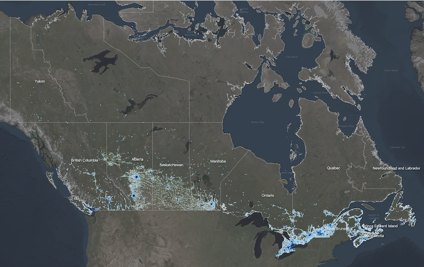
Human Settlement and Natural Hazards in Canada
The National Human Settlement Layer (NHSL) is a collection of thematic datasets that describe the physical, social and economic characteristics of urban centres and rural/remote communities across Canada, and their vulnerability to natural hazards of concern. Detailed information on land use, buildings, people and capital assets are provided at the Census Dissemination Area administrative level for more than 454,000 settled areas across Canada.
The Physical Exposure Layer includes a delineation of human settlement areas and related functional land use classes across Canada, and provides detailed information on construction type, occupancy and design level of more than 9.1 million buildings; population dynamics at different times of day for 35.1 million people, and; capital asset valuation of buildings and contents totaling more than 8.3 trillion CAD$.
The Social Fabric Layer utilizes Census demographic data to evaluate broad spatial patterns of vulnerability, and neighbourhood-level capacities to withstand and recover from disaster events based on intrinsic characteristics of housing, family structure, individual autonomy and financial agency.
Although developed to support quantitative risk assessments and implementation of the Sendai Framework for Disaster Risk Reduction at local and regional scales in Canada, the NHSL is also suitable for use in other integrated landscape modeling applications, including climate change adaptation and sustainable land use planning.
Simple
- Date ( RI_366 )
- 2020-06-15
- Date ( RI_367 )
- 2020-11-15
- Status
- onGoing; enContinue RI_596
- Maintenance and update frequency
- asNeeded; auBesoin RI_540
- Government of Canada Core Subject Thesaurus Thésaurus des sujets de base du gouvernement du Canada ( RI_528 )
-
- Planning
- Land management
- Sustainable development
- Natural disasters
- Use limitation
- Open Government Licence - Canada (http://open.canada.ca/en/open-government-licence-canada)
- Access constraints
- license; licence RI_606
- Use constraints
- license; licence RI_606
- Spatial representation type
- vector; vecteur RI_635
- Metadata language
- eng; CAN
- Topic category
-
- Society
- Begin date
- 2016
- End date
- 2021
))
- Reference system identifier
- http://www.epsg-registry.org / EPSG:4326 /
- OnLine resource
-
GitHub Repository
(
HTTPS
)
Supporting Document;HTML;eng
- File identifier
- e9905001-6a39-43ca-a02d-4ab5144df0f8 XML
- Metadata language
- eng; CAN
- Character set
- utf8; utf8 RI_458
- Hierarchy level
- series; série RI_623
- Date stamp
- 2022-08-19T18:16:01
- Metadata standard name
- North American Profile of ISO 19115:2003 - Geographic information - Metadata
- Metadata standard version
- CAN/CGSB-171.100-2009
Overviews
Spatial extent
Provided by
