 Arctic SDI catalogue
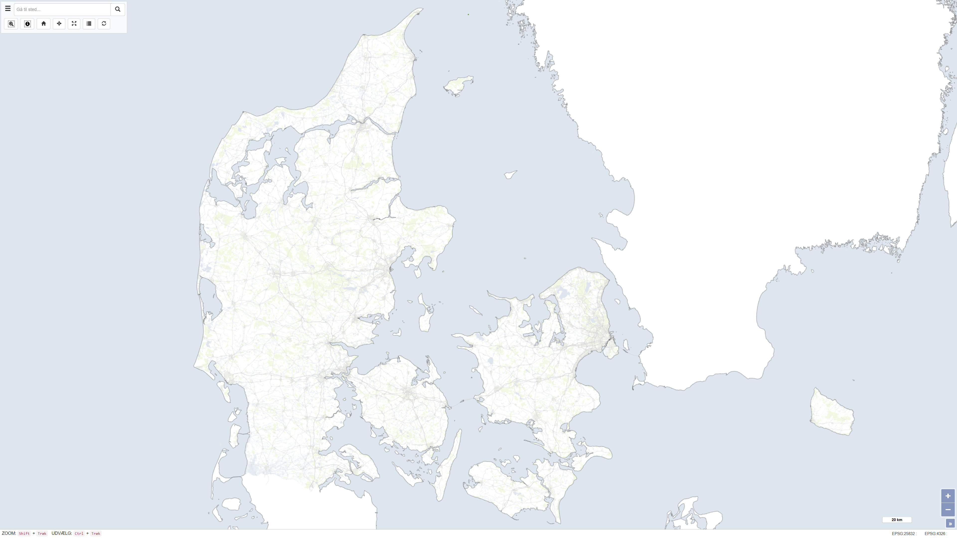
OpenStreetMap baggrundskort over Danmark
The dataset is based on OpenStreetMap (OSM) data downloaded from the official OpenStreetMap distribution platform. The data have subsequently been processed and published as a customised web service.
OpenStreetMap is an open, crowdsourced geospatial dataset that is continuously maintained and updated by a global community of contributors. The dataset contains vector-based geographic features, including transport networks, buildings, land use, hydrography, natural features, and points of interest.
The data are used as a background map and reference dataset for map visualisation and spatial analysis at local, regional, and national scales. Data content and quality vary geographically and depend on contributor activity.
Simple
- Date ( Publication )
- 2023-10-09
- Identifier
- dk.geus / openstreetmap_dk
- Presentation form
- Digital map
- Purpose
-
The purpose of the background map is to provide a simplified yet geographically informative OpenStreetMap-based background map with primary focus on Denmark. The map also provides a general geographic overview of Northern and Central Europe to support contextual map visualisation.
The dataset is published as a web map and is used as the central background map in GEUS’ Danish WebGIS portals.
- Status
- Completed
- Maintenance and update frequency
- As needed
- Keywords ( Theme )
-
- Dataset
- OpenStreetMap
- Denmark
- Basemap
- Topography
- Forskningsemner Forskningsemner ( Theme )
- Geografisk Geografisk ( Place )
- Access constraints
- Other restrictions
- Use constraints
- Other restrictions
- Other constraints
- Open Database License (ODbL) 1.0
- Other constraints
- The dataset is based on OpenStreetMap data licensed under the Open Database License (ODbL) 1.0. Users must provide appropriate attribution to © OpenStreetMap contributors. Any redistribution or derivative use must comply with the terms of the ODbL license, including share-alike requirements. The dataset represents a processed visualisation and does not constitute the original OpenStreetMap data. GEUS assumes no responsibility for data quality or completeness.
- Spatial representation type
- Vector
- Denominator
- 1000
- Metadata language
- Da
- Character set
- UTF8
- Topic category
-
- Imagery base maps earth cover
- Inland waters
- Location
- Society
- Structure
- Transportation
))
- Supplemental Information
- None specified
- Reference system identifier
- ETRS 89 / UTM 32N (EPSG:25832)
- Distribution format
-
-
WMTS
(
)
-
REST
(
)
-
WMTS
(
)
- OnLine resource
-
Interactive webmap
(
WWW:LINK-1.0-http--link
)
Interactive map displaying the dataset.
- OnLine resource
-
Denmark_OpenStreetMap_DK
(
OGC:WMTS-1.0.0-http-get-capabilities
)
ArcGIS WMTS Service
- OnLine resource
-
OpenStreetMap_DK
(
ESRI:REST
)
ArcGIS REST Service
- Hierarchy level
- Dataset
- Statement
- The dataset is based on OpenStreetMap (OSM) data. The data have been geographically clipped to Northern and Central Europe. Subsequently, the dataset has been generalised and filtered to include selected relevant geographic feature types. The cartographic representation has been adapted using a muted colour scheme for use as a background map.
- File identifier
- f252e709-aee8-45a0-9338-e0fedf6d3d83 XML
- Metadata language
- Danskda
- Character set
- UTF8
- Hierarchy level
- Dataset
- Date stamp
- 2026-03-20T10:11:09.567865Z
- Metadata standard name
- ISO 19115:2003/19139
- Metadata standard version
- 1.0
Overviews
Spatial extent
Provided by
