 Arctic SDI catalogue
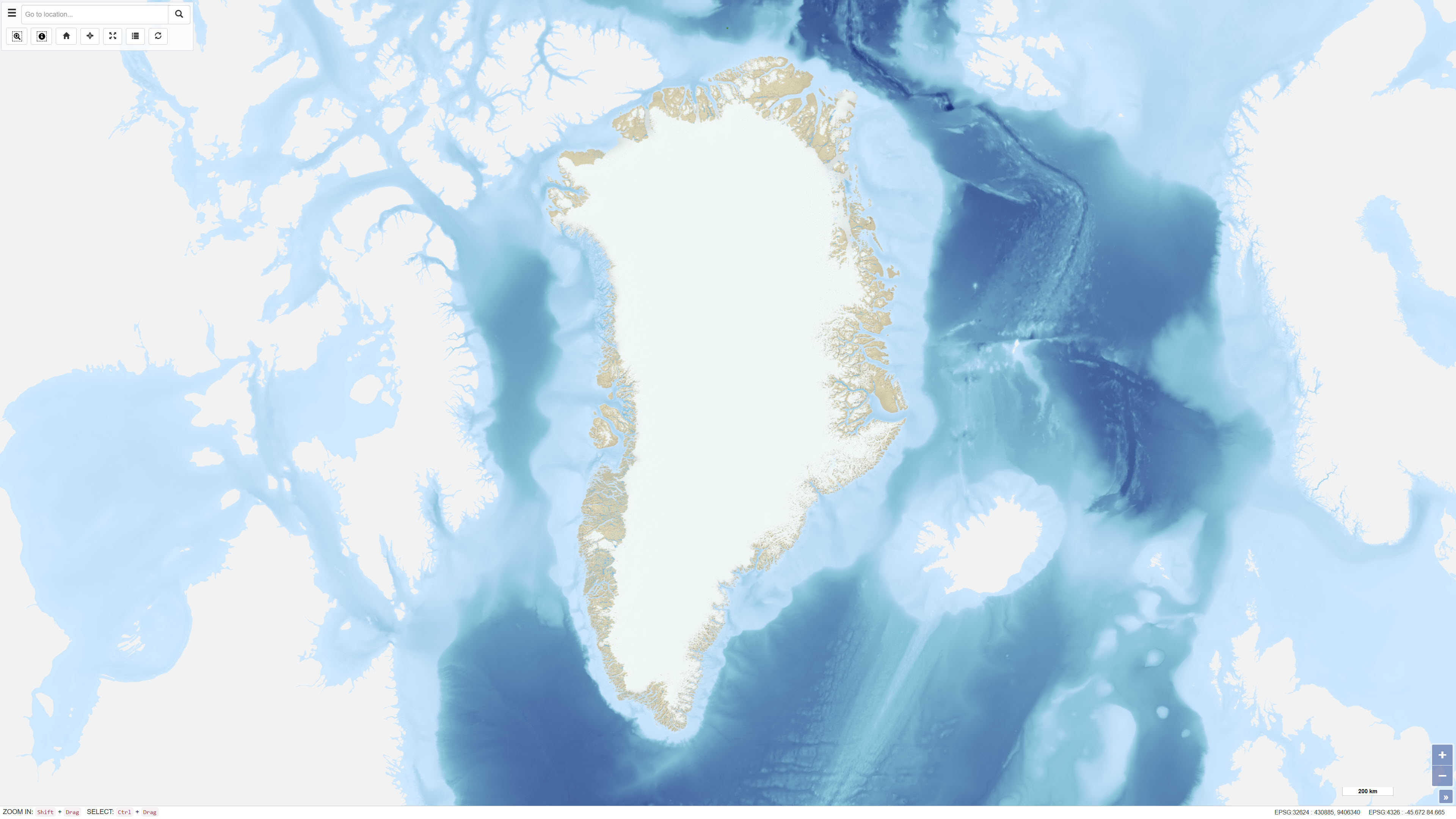
Topographic map of Greenland 1:250.000
The topographic map of Greenland at a scale of 1:250.000 is based on data collected from the 1930s through the 1970s and 1980s. These data formed the basis for the production of a series of 1:250.000 scale topographic map sheets, which continue to serve as the primary topographic reference for large parts of Greenland.
Mapping of areas prior to 1970 was based on several historical map series, including 18 map sheets at a scale of 1:300.000 covering North Greenland produced by Lauge Koch between 1932 and 1940, 1:250,000 scale mapping of parts of Northeast Greenland conducted by the Geodetic Institute in the 1930s, and complete national coverage at 1:250.000 produced by the American Army Map Service in the 1950s.
The digital topographic map of North and Northeast Greenland has been produced by the Geological Survey of Denmark and Greenland (GEUS) since 1977, based on high-precision digital photogrammetry using aerial photographs. The dataset has primarily been used as a topographic reference for geological mapping at scales of 1:100.000 and 1:500.000.
Simple
- Date ( Publication )
- 2023-03-24
- Identifier
- dk.geus / g250_topographic_map
- Presentation form
- Digital map
- Purpose
- The purpose of the dataset is to provide a consistent and comprehensive topographic reference for Greenland at a scale of 1:250,000. The dataset is primarily used as a base map and reference for geological mapping, planning activities, scientific research, and the dissemination of geoscientific information.
- Status
- Completed
- Maintenance and update frequency
- As needed
- Keywords ( Theme )
-
- Dataset
- Topography
- Grønland
- Basemap
- ArcGIS
- Forskningsemner Forskningsemner ( Theme )
- Geografisk Geografisk ( Place )
- Access constraints
- Other restrictions
- Use constraints
- Other restrictions
- Other constraints
- CC BY 4.0
- Spatial representation type
- Vector
- Spatial representation type
- Grid
- Denominator
- 250000
- Metadata language
- Da
- Character set
- UTF8
- Topic category
-
- Geoscientific information
- Imagery base maps earth cover
- Elevation
- Location
))
- Supplemental Information
-
The dataset has been reprojected to WGS 1984 / UTM zone 24 North to conform with the standard projection used for datasets hosted on the Greenland Mineral Resources Portal (www.greenmin.gl
). A hillshade has been added based on the Greenland Ice Sheet Mapping Project (GIMP) Digital Elevation Model. Bathymetry has been assigned using data from the General Bathymetric Chart of the Oceans (GEBCO) 2019/2021 grid.
- Reference system identifier
- WGS 84 / UTM 24N (EPSG:32624)
- Distribution format
-
-
WMTS
(
)
-
REST
(
)
-
WMS
(
)
-
WMTS
(
)
- OnLine resource
-
Interactive webmap
(
WWW:LINK-1.0-http--link
)
Interactive map displaying the dataset.
- OnLine resource
-
Digital Topographic Map of North and Northeast Greenland (1 CD-Rom included)
(
WWW:LINK-1.0-http--link
)
Hans F. Jepsen, Naja Elisabeth Mikkelsen, Frants von Platen-Hallermund, Frands Otto Schjøth, Willy Lehmann Weng
- OnLine resource
-
Greenland_G250_Topographic_Map_UTM24N
(
OGC:WMTS-1.0.0-http-get-capabilities
)
ArcGIS WMTS Service
- OnLine resource
-
G250_Topographic_Map_UTM24N
(
ESRI:REST
)
ArcGIS REST Service
- OnLine resource
-
Area
(
OGC:WMS-1.3.0-http-get-capabilities
)
ArcGIS WMS Service
- OnLine resource
-
Digitalt topografisk kort
(
WWW:LINK-1.0-http--link
)
Hans F. Jepsen, Willy L. Weng
- Hierarchy level
- Dataset
- Statement
-
Systematic topographic surveying of the inhabited coastal areas of Greenland was initiated by the Geodetic Institute of Denmark in 1927 and resulted in the production of a series of 1:250,000 scale topographic map sheets, which continue to form the basis for the overall topographic mapping of Greenland. A primary geodetic network was established based on an astronomical station at Qoornoq. Initially, map detail was obtained through plane table surveys; however, between 1932 and 1938 extensive aerial photography of the coastal regions was carried out, forming the basis for subsequent photogrammetric compilation.
By 1964, all ice-free areas of Greenland had been photographed, and map sheets were completed for nearly the entire country. Early map sheets depicted relief using hillshading and contour lines, while later editions were produced without relief shading but retained color differentiation between lowland and upland areas. Contours are shown at 50 m intervals. The maps were originally produced using Lambert conformal conic projection or UTM based on the international ellipsoid, and the datum was changed from the Qoornoq Datum to the North American Datum 1984. Place names are provided in Greenlandic (Inuit) and Danish. Revisions of the map sheets have been limited to significant corrections.
- File identifier
- f3c6c2e4-f161-4c42-83a4-b7acbd127980 XML
- Metadata language
- Danskda
- Character set
- UTF8
- Hierarchy level
- Dataset
- Date stamp
- 2026-01-23T09:52:42.61106Z
- Metadata standard name
- ISO 19115:2003/19139
- Metadata standard version
- 1.0
Overviews
%20-%20datas%C3%A6t.jpg)
Spatial extent
Provided by
