 Arctic SDI catalogue
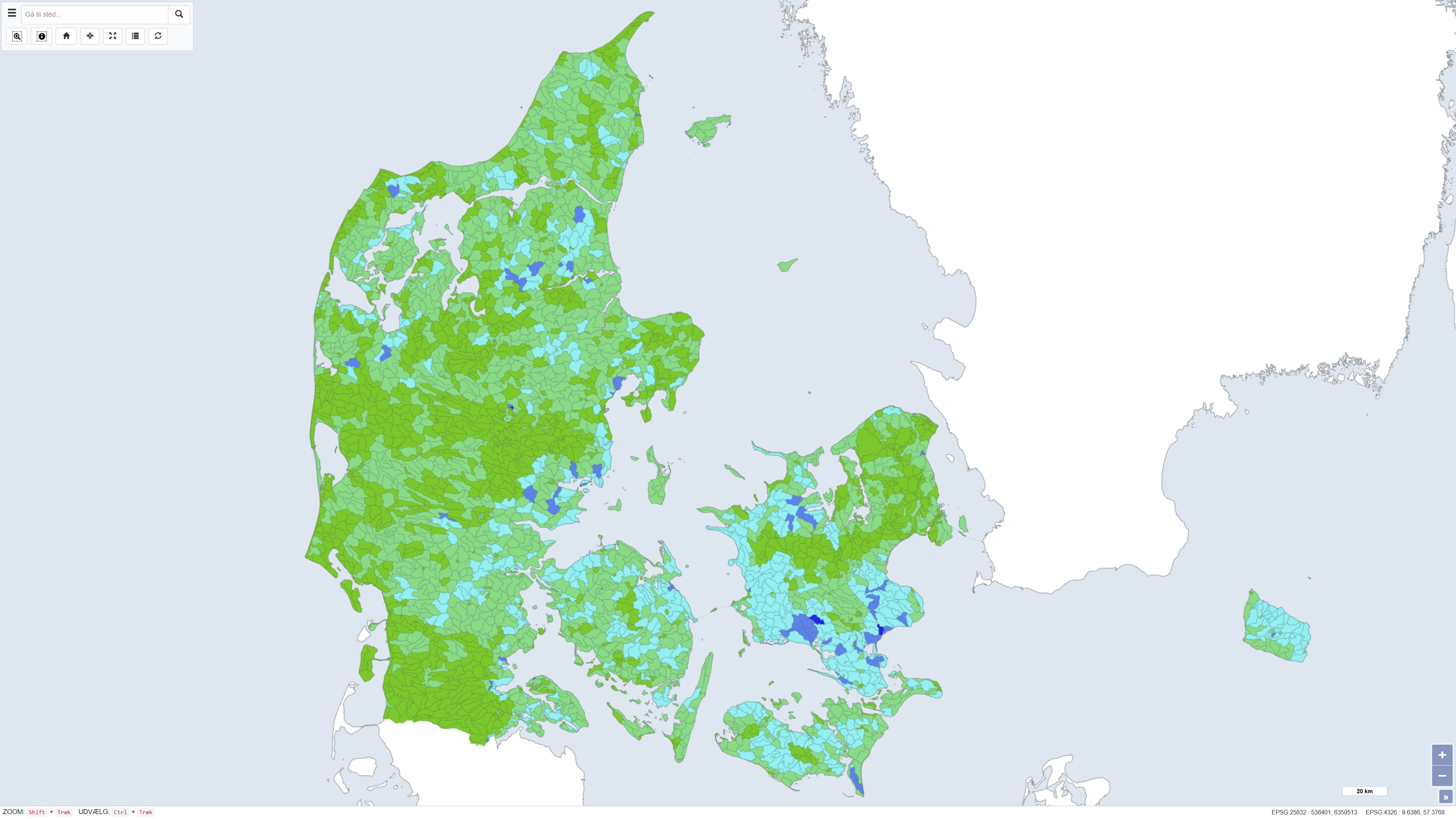
Nitrogen retention from the National Nitrogen Model
This dataset shows the percentage nitrogen retention in Denmark, i.e. the proportion of nitrogen leached from the root zone that is transformed or retained in the subsurface and surface waters before reaching the coast. Nitrogen retention is calculated using the National Nitrogen Model and represents an average retention for the period 1990–2010. The dataset provides nationwide coverage of spatial variations in nitrogen retention and is used as a basis for assessing nitrogen transport and coastal nutrient loading.
The National Nitrogen Model version 2020 is documented in National Nitrogen Model – version 2020, a GEUS special report, including a method report (ISBN 978-87-7871-551-7) and an appendix (ISBN 978-87-7871-552-4), both available from GEUS (in danish).
Simple
- Date ( Publication )
- 2020-12-15
- Identifier
- dk.geus / kvælstofretention
- Presentation form
- Digital map
- Purpose
- The purpose of the dataset is to support environmental management, planning and research related to nitrogen loading of the aquatic environment. The dataset is used in water management planning, assessment of mitigation measures, scenario analyses and modelling of nitrogen transport from land to sea.
- Status
- Completed
- Maintenance and update frequency
- As needed
- Keywords ( Theme )
-
- Dataset
- Nitrogen retention
- Aquatic environment
- Nutrients
- Denmark
- Forskningsemner Forskningsemner ( Theme )
- Geografisk Geografisk ( Place )
- Access constraints
- Other restrictions
- Use constraints
- Other restrictions
- Other constraints
- CC0 1.0
- Spatial representation type
- Vector
- Denominator
- 100000
- Metadata language
- Da
- Character set
- UTF8
- Topic category
-
- Geoscientific information
- Environment
- Inland waters
- Begin date
- 1990-01-01
- End date
- 2010-12-15
))
- Supplemental Information
- The dataset includes attributes describing calculated nitrogen retention at the ID15 catchment level. Key attributes include total nitrogen retention from the root zone to the coast, retention in surface waters and groundwater, as well as associated uncertainty estimates. The dataset also contains information on whether a catchment is included as a measured catchment in the model or represents an unmeasured catchment for which retention is estimated based on average values.
- Reference system identifier
- ETRS 89 / UTM 32N (EPSG:25832)
- Distribution format
-
-
WMS
(
)
-
REST
(
)
-
WMTS
(
)
-
WMS
(
)
- OnLine resource
-
Download
(
WWW:DOWNLOAD-1.0-http--download
)
Download dataset from GEUS' Dataverse
- OnLine resource
-
Interactive webmap
(
WWW:LINK-1.0-http--link
)
Interactive map displaying the dataset.
- OnLine resource
-
National Nitrogen Model 2025 – Method report
(
DOI
)
Method report documenting the calculation framework and model structure of the National Nitrogen Model.
- OnLine resource
-
The National Nitrogen Model
(
WWW:LINK-1.0-http--link
)
Overordnet beskrivelse af Den Nationale Kvælstofmodel, dens anvendelser og datagrundlag.
- OnLine resource
-
Kvaelstofretention
(
ESRI:REST
)
ArcGIS REST Service
- OnLine resource
-
Kvaelstofretention
(
OGC:WMS-1.3.0-http-get-capabilities
)
ArcGIS WMS Service
- OnLine resource
-
Denmark_Kvaelstofretention
(
OGC:WMTS-1.0.0-http-get-capabilities
)
ArcGIS WMTS Service
- Hierarchy level
- Dataset
- Statement
- The dataset was developed during the period mid-2013 to early 2015 by GEUS in collaboration with Aarhus University (DCE and DCA) as part of the work on the National Nitrogen Model. The map was subsequently revised in August 2015. Nitrogen retention is calculated using the National Nitrogen Model and represents model-based estimates of nitrogen transport and reduction from the root zone through groundwater and surface waters to the coast. The dataset is based on a subdivision into ID15 catchments and reflects the assumptions and data basis applied in the model at the time of calculation.
- File identifier
- f92f9e5c-ab8d-40ae-8f53-158f7b441ca1 XML
- Metadata language
- Danskda
- Character set
- UTF8
- Hierarchy level
- Dataset
- Date stamp
- 2026-03-19T15:10:48.074502Z
- Metadata standard name
- ISO 19115:2003/19139
- Metadata standard version
- 1.0
Overviews
Spatial extent
Provided by
