 Arctic SDI catalogue
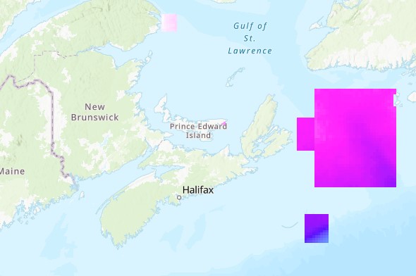
High-resolution climate projection data for Marine Protected Areas in the Maritimes
This dataset provides refined monthly climatological projections for six key ocean variables: surface and bottom temperature, surface and bottom salinity, mixed layer depth, and bottom current speed. The projections are provided for six Maritime Marine Protected Areas: the Gully, the Laurentian Channel, St. Anns Bank, Musquash Estuary, Banc-des-Américains, and Basin Head. These projections are based on downscaled outputs from 22 CMIP6 models under four emissions scenarios (SSP1-2.6, SSP2-4.5, SSP3-7.0, and SSP5-8.5) for four 20-year periods spanning 2020 to 2099 (2020–2039, 2040–2059, 2060–2079, and 2080–2099).
For each model and scenario, 20-year climatological means were computed for each future period. These climatologies were then aggregated to produce ensemble means and ensemble standard deviations for all variables. The released dataset includes only these ensemble summary fields and is provided as gridded data with dimensions longitude × latitude × scenario × time.
Cite this data as: Wang., Z. Data of High-resolution climate projection data for Marine Protected Areas in the Maritimes. Published: May 2026. Ocean Ecosystems Science Division, Maritimes Region, Fisheries and Oceans Canada, Dartmouth NS. https://open.canada.ca/data/en/dataset/fb4b3212-bca3-4192-8401-687faccc534b
Simple
- Date ( RI_367 )
- 2026-05-06
- Date ( RI_366 )
- 2025-10-17
- Status
- completed; complété RI_593
- Maintenance and update frequency
- notPlanned; nonPlanifié RI_542
- Keywords ( RI_528 )
-
- Oceans
- Marine Protected Areas
- Maritimes Region
- Government of Canada Core Subject Thesaurus Thésaurus des sujets de base du gouvernement du Canada ( RI_528 )
-
- Oceans
- Use limitation
- Open Government Licence - Canada (http://open.canada.ca/en/open-government-licence-canada)
- Access constraints
- license; licence RI_606
- Use constraints
- license; licence RI_606
- Classification
- unclassified; nonClassifié RI_484
- Spatial representation type
- grid; grille RI_636
- Metadata language
- eng; CAN
- Character set
- utf8; utf8 RI_458
- Topic category
-
- Oceans
- Environment
- Begin date
- 2020-01-01
- End date
- 2100-12-31
))
- Reference system identifier
- https://epsg.io / EPSG:4326 / 8.2.6
- Distribution format
-
-
ESRI REST
(
2.9.8
)
-
CSV
(
N/A
)
-
NetCDF
(
N/A
)
-
ESRI REST
(
2.9.8
)
- OnLine resource
-
High-resolution climate projection data for Marine Protected Areas in the Maritimes
(
HTTPS
)
Dataset;NetCDF;zxx
- OnLine resource
-
NetCDF Data Dictionary
(
HTTPS
)
Supporting Document;CSV;eng,fra
- OnLine resource
-
Raster Data Dictionary
(
HTTPS
)
Supporting Document;PDF;eng,fra
- OnLine resource
-
High-resolution climate projection data for Marine Protected Areas in the Maritimes
(
HTTPS
)
Dataset;TIFF;zxx
- OnLine resource
-
High-resolution climate projection data for Marine Protected Areas in the Maritimes
(
ESRI REST: Map Service
)
Web Service;ESRI REST;eng
- OnLine resource
-
High-resolution climate projection data for Marine Protected Areas in the Maritimes
(
ESRI REST: Map Service
)
Web Service;ESRI REST;fra
- File identifier
- fb4b3212-bca3-4192-8401-687faccc534b XML
- Metadata language
- eng; CAN
- Character set
- utf8; utf8 RI_458
- Hierarchy level
- dataset; jeuDonnées RI_622
- Date stamp
- 2026-05-07T10:47:09.077045Z
- Metadata standard name
- North American Profile of ISO 19115:2003 - Geographic information - Metadata
- Metadata standard version
- CAN/CGSB-171.100-2009
Overviews
Spatial extent
Provided by
